Tornadoes, damaging wind, hail possible with storms Wednesday in North Texas
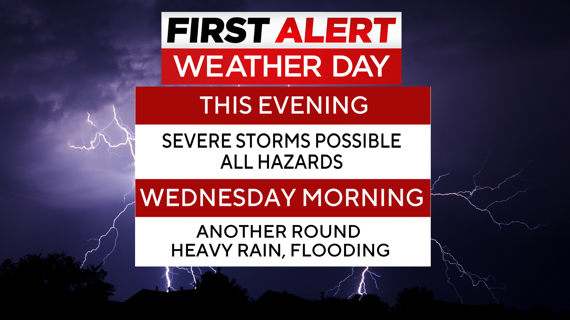
A strong fall cold front is moving into North Texas, bringing the threat of hail, damaging winds, and localized flooding. The tornado threat is low, but not zero.
A First Alert Weather Day is in effect Wednesday morning, as an area of low pressure and trailing cold front moves through the central and southern Plains. The cold front started to move through North Texas Tuesday evening.
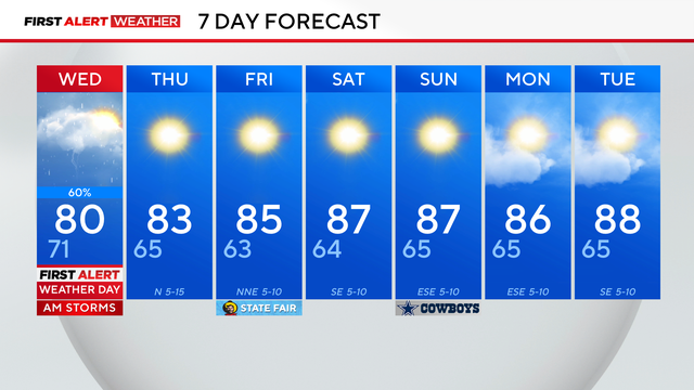
Shower and storm activity will arrive during Wednesday's morning drive. Expect the greatest coverage and heaviest rain on Wednesday morning to be along and south of I-20.
This shower activity looks to clear the North Texas region by about midday Wednesday, then the forecast clears up for the rest of the week.
There is a 20% chance of isolated rainfall totals near 4-5" in parts of East Texas through Wednesday afternoon. Heavy rainfall may cause flash flooding.
Temperatures will cool off a bit and settle back close to average for this point in the year.