Morning showers roll in across South Florida, afternoon heats up
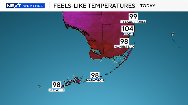
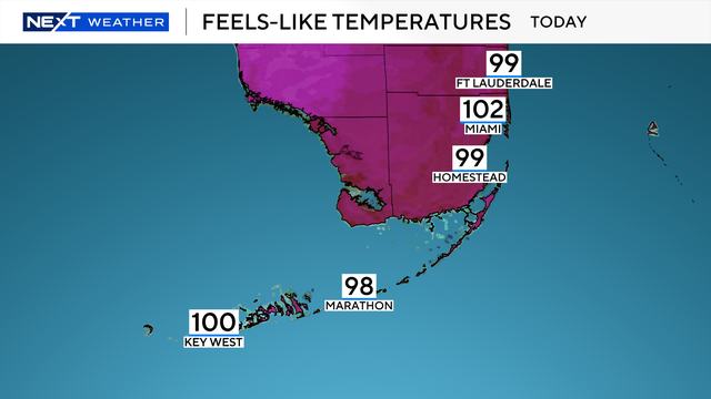
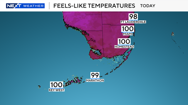
A warm morning will lead to another hot and humid day.
Watch CBS News

A warm morning will lead to another hot and humid day.
There is a 20% chance for afternoon storms, but these will mostly remain inland and over the Everglades.
The rain won't be nearly as widespread as what happened over the holiday weekend.
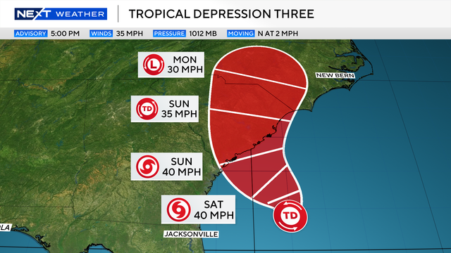
Tropical Depression 3 formed off the Southeast coast and could become Tropical Storm Chantal by Saturday.
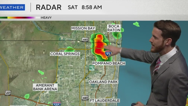
Scattered storms are expected to ease before Fourth of July fireworks in South Florida, but a lingering flood risk and weekend rain chances remain.
Despite this being near-average, it will still feel like summer with "feels like" temperatures in the mid to upper 90s.
The combination of rain and clouds should help to keep temperatures in the mid to upper 80s.
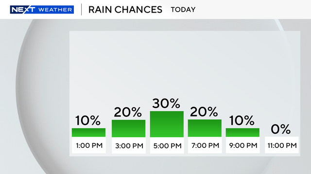
The highest chance of rain will be on Wednesday.
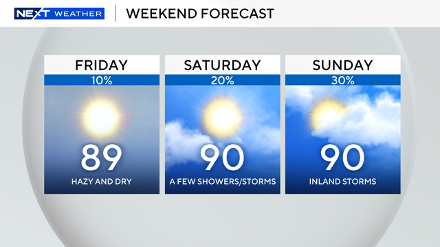
There is a 10% isolated inland afternoon shower chance on Saturday.
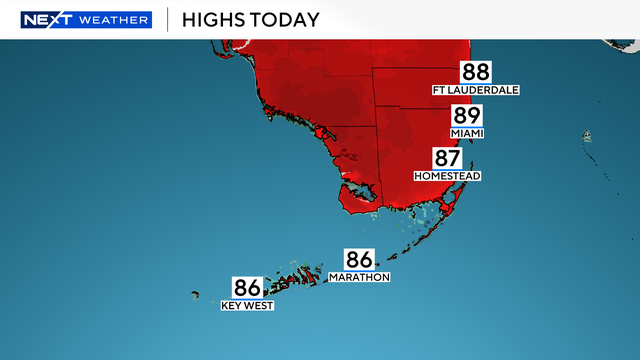
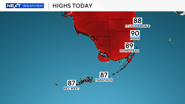
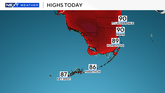
Afternoon highs will be seasonable, in the upper 80s to lower 90s.
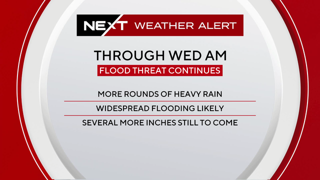
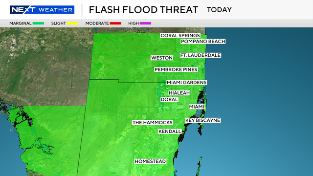
Miami-Dade, Broward and Monroe counties are under a flood watch through Wednesday morning.
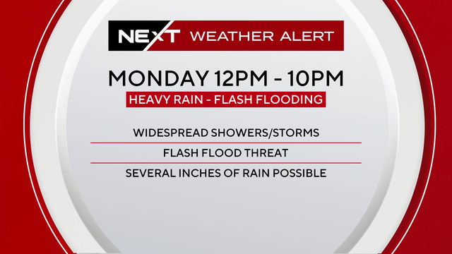
Monday and Tuesday are NEXT Weather Alert Days for South Florida as a weather pattern of storms drops heavy rainfall in the afternoons.
All forecast models have some kind of bias, so AI is being used to help correct them to give forecasters a more accurate idea of where a tropical system might go.
"Storm surge" is defined as the abnormal water level that rises above the typical tide during a tropical event.
The NEXT Weather Team is tracking another hot and humid day across South Florida with the potential for a few scattered afternoon storms to end the workweek.