
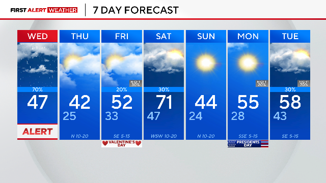
Valentine's Day brings cool temps, spotty showers to North Texas
With highs Saturday in the low 70s to then highs Sunday in the mid 40s, North Texas is getting another weekend with a tale of two seasons.
Watch CBS News

With highs Saturday in the low 70s to then highs Sunday in the mid 40s, North Texas is getting another weekend with a tale of two seasons.
Dangerous wind chills dropped "feels-like" temperatures to the teens and single digits in DFW.
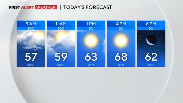
Rain will taper out by the end of the morning commute.
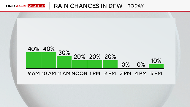
Grab an umbrella and be cautious on the roadways across North Texas.

First Alert Weather Days are in place on Tuesday and Wednesday for disruptive rain in the forecast.

A First Alert Weather Day is in place for Sunday as temperatures in North Texas are set to drop by nearly 30 degrees.

North Texas is seeing muggy conditions this morning, with a stalled front causing varied temperatures.

Near-record heat is in the forecast through mid-week, then a cold front arrives Saturday into Sunday, bringing back average temperatures.
Thunderstorms produced heavy rain across North Texas Wednesday night and into Thursday.

First Alert Weather Days were issued for Wednesday and Thursday due to widespread rain on the way and some stronger storms.

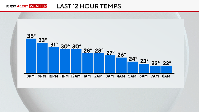
While temperatures started in the teens, sunny skies will warm North Texas to the upper 50s by afternoon.

We do have another cold morning expected on Friday, with temperatures dropping to freezing or below.

The forecast for Sunday has a 50% chance of scattered showers.
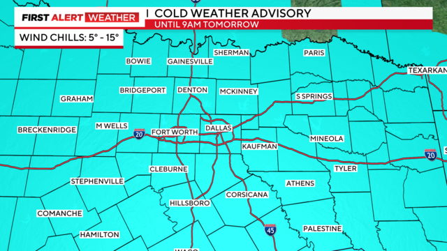
First Alert Weather Days remain in effect through Wednesday morning due to "feels-like" temperatures in the single digits.
A First Alert Weather Day remains in effect Monday and Tuesday for the dangerous "feels-like" temperatures.