
Warming trend continues, pollen count high
It will be a good zoo or botanical garden weekend because our high temps warm into the mid-70s to the mid-80s.
Watch CBS News

It will be a good zoo or botanical garden weekend because our high temps warm into the mid-70s to the mid-80s.

More clouds are on the way Thursday and Friday ahead of a strong cold front.

Love is in the air. From chocolates to stuffed animals, love birds around the world are searching for that perfect gift to signify their love.
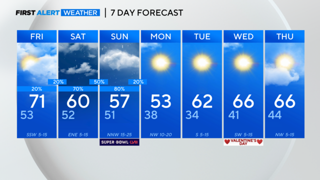
Rain chances for the metroplex on both Saturday and Sunday and cooler temps return this weekend.

Mild weather continues through Wednesday and Thursday with highs in the lower to mid-70s.

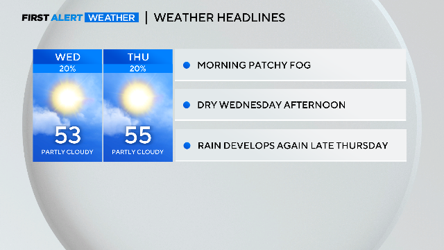
The First Alert Meteorologists have issued a First Alert as another foggy night and Wednesday morning is ahead.
With more sunshine on the way, our temperatures will warm into the lower 50s compared to our 49° high Tuesday.

While temperatures are in the 30s to 40s this AM, we see abundant sunshine and high temperatures today close to 70°!
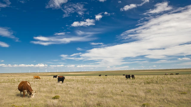
The region's once-vast prairies, essential for maintaining ecological balance, have diminished to less than 1% of their original 20 million acres.
Sunday won't be a washout but we will see scattered showers increase in the morning hours toward midday.

The First Alert Weather team issued another weather alert for Monday due to the excessive heat. Most of North Texas is included in the excessive heat warning, aside from our Red River counties.
Isolated strong-to-severe storms are possible Tuesday.

From Saturday, June 10 through Thursday, June 15, there were 249 hail reports from the National Weather Service in Fort Worth.

Between 2 a.m. and 8 a.m., we have the potential of another round of strong to severe storms with large hail and damaging winds being the biggest concern.
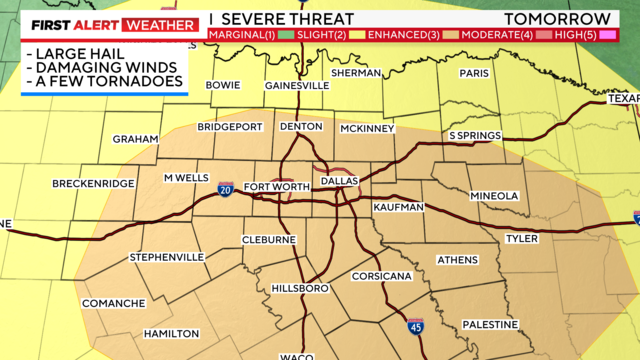
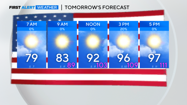
Stay aware of your plans for late afternoon – all modes of severe weather are possible including large hail and damaging winds.