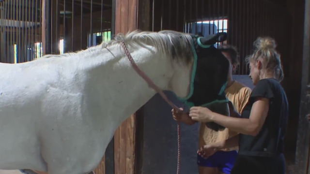
Deadly tornado hits Celina equestrian pasture
Three of the horses made it to safety, five weren't so lucky as winds up to nearly 165 mph tore through the countryside.
Watch CBS News

Three of the horses made it to safety, five weren't so lucky as winds up to nearly 165 mph tore through the countryside.
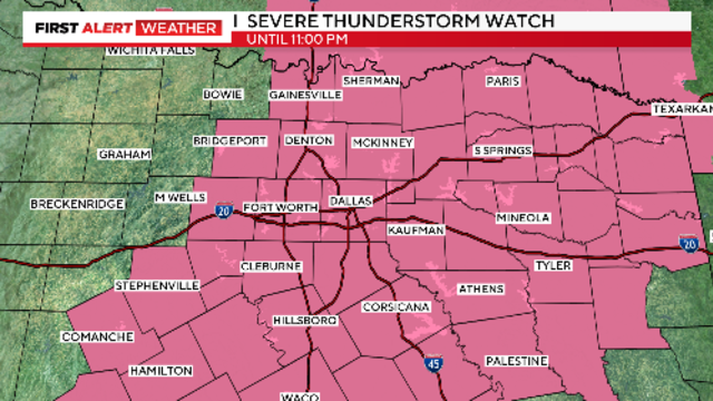
The severe threat has shifted to the southeast.

There is a slight chance of a few isolated storms overnight.

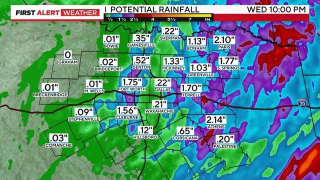
The severe weather threat continues Wednesday night with the potential for isolated strong to severe storms.

Large hail, damaging winds with localized flooding are the main threats but there is a low tornado threat.

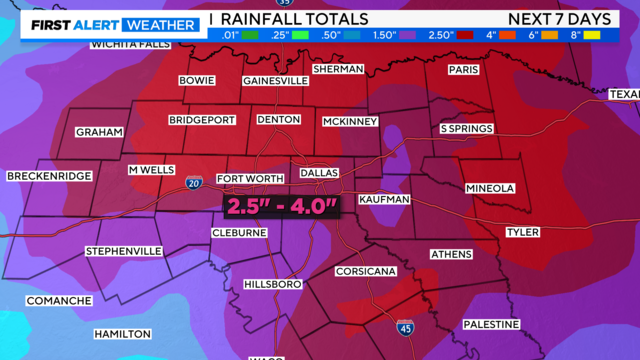
A drier and warmer weekend is ahead as the rain coverage and intensity has mostly come to an end Thursday.

Put the sunscreen on today because the UV index will climb to the 'very high' category.

A cold front moves through later today which will sweep out the moisture, leading to a sunny Tuesday and Wednesday.

High temps are forecast to warm near 90° both Tuesday and Wednesday ahead of a cold front.
Tuesday, temperatures will warm above average into the mid-80s.
The alert continues Tuesday night for the potential of some isolated strong to severe storms.

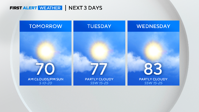
It is perfect baseball weather with afternoon temperatures climbing into the lower 70s with barely a cloud in the sky.
Our spring pattern continues with a mid-week warmup ahead of the next strong cold front.

Cold front on Friday to bring a big cool down into the weekend.

Temperatures will have dropped to the 30s to 40s when you wake up on Wednesday morning.