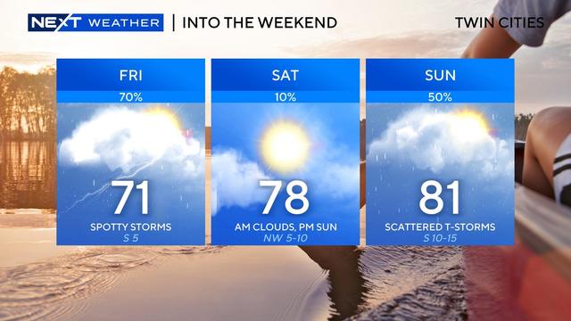
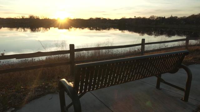
More dry time than rain this weekend in Twin Cities; severe storms possible
Showers return to the Twin Cities on Friday afternoon and evening, bringing some locally heavy rain and some thunder.
Watch CBS News

Showers return to the Twin Cities on Friday afternoon and evening, bringing some locally heavy rain and some thunder.
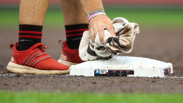
During Minnesota Twins games, the duties of the grounds crew are evident, like when they are dragging the infield. But there is much more to the work that takes place when the cameras are off.
Showers and storms are possible this Memorial Day, though it won't be a total washout.
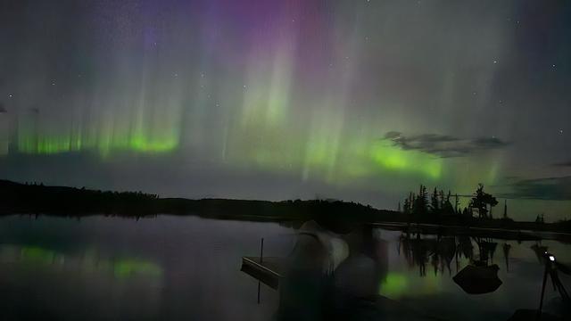
Minnesotans may be treated to more northern lights this weekend from the strongest solar storm our planet has experienced in 20 years.
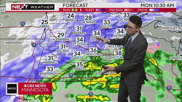
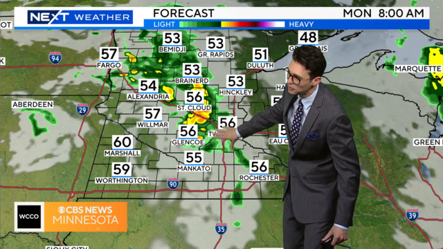
WCCO meteorologist Chris Shaffer says a Winter Weather Advisory has been added including the metro area until Tuesday morning. The wind will pick up and the raindrops many have seen Monday will change back to snow.

A major storm is making its way through Minnesota, and by the time it wraps up, much of the state will see half a foot of snow or more.
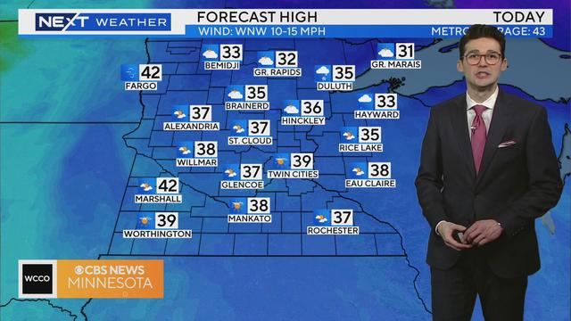
After a cold and breezy weekend, Monday will be slightly warmer.
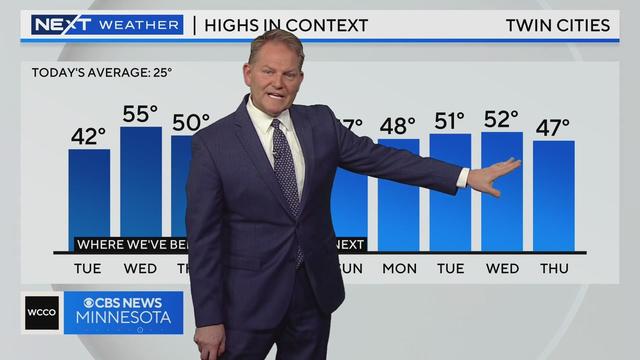
Temps will continue to climb into the weekend, perhaps even back into the 50s by next week.
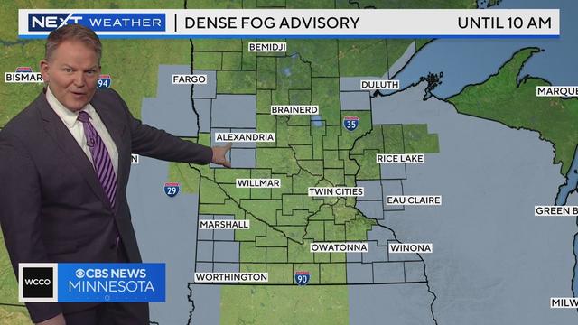
Dense fog advisories across central and southern Minnesota expire at 10 a.m.
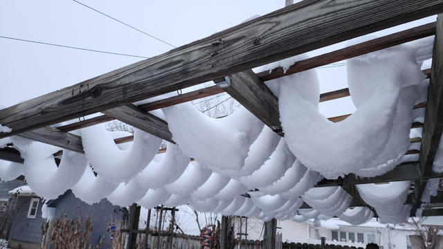
After a WCCO viewer sent in a striking photo of drooping snow formations, our NEXT Weather team came up with a possible explanation.
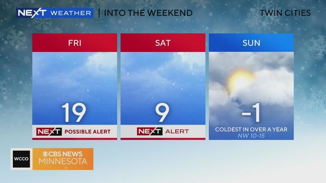
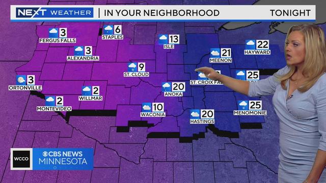
Friday will be a NEXT Weather Alert day due to possible heavy snowfall, as will Saturday due to frigid temperatures the likes Minnesota hasn't seen in quite some time.
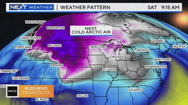
After a historically mild December, Minnesota is about to be served up an arctic blast.
The forecast high in the Twin Cities on Wednesday is 27 degrees, but it will feel like the upper teens due to wind chill.
With northerly and northwesterly winds, this shouldn't be a mild stretch of weather for us, yet temperatures are running 10 degrees above average due to lack of snow cover.
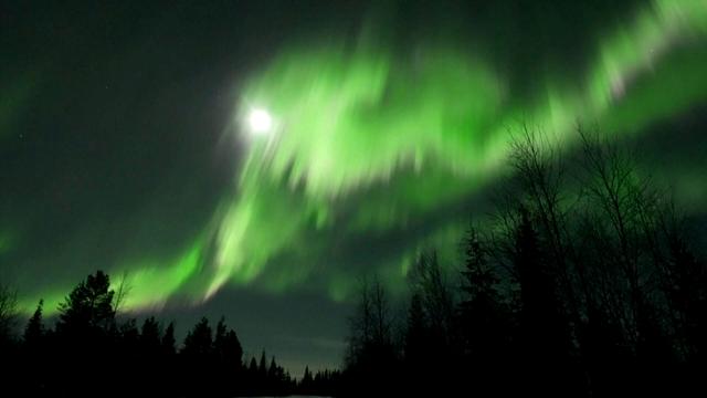
NOAA space-weather forecasters track coronal holes in an effort to forecast the solar wind, but those holes can interact in unpredictable ways. To make things even more complicated, the sun rotates every 27 days, turning the solar wind into a complex spiral of high and low speeds.