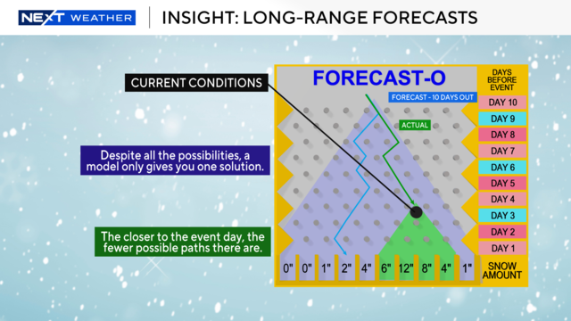
How long-range snowstorm forecasting is like a Plinko board
A system headed for the Twin Cities next week could bring snow, but it's a tricky forecast this far out. Think of it like a giant game of Plinko, with many different outcomes.
Watch CBS News

A system headed for the Twin Cities next week could bring snow, but it's a tricky forecast this far out. Think of it like a giant game of Plinko, with many different outcomes.
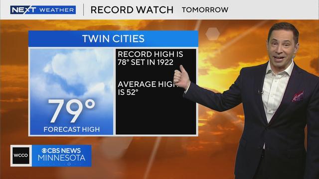
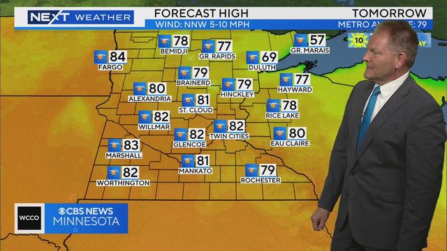
Highs will approach 80 on Tuesday as the next system positions itself far enough north to pull in some warm air.
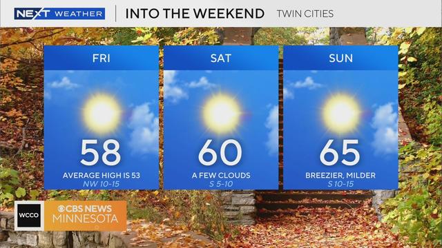
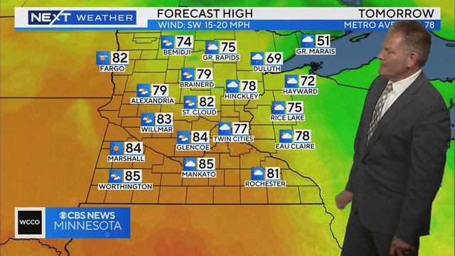
The Twin Cities will enjoy a typical fall day on Friday, with a pleasant weekend to follow.
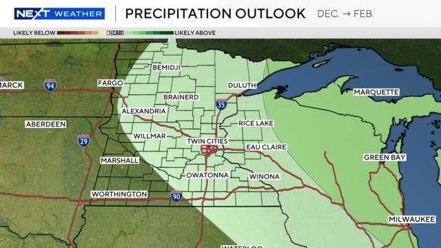
The odds slightly favor colder-than-average temperatures, especially in western Minnesota.
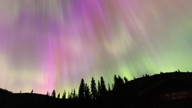
Minnesotans might have a chance to see the northern lights this week. Thursday looks to be the greatest chance in the latest forecast.
WCCO meteorologist Mike Augustyniak says the strongest part of the storm is moving to the east, quickly exiting Minnesota.
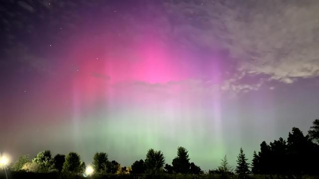
Minnesotans, consider this your aurora borealis alert. The northern lights could potentially light up the sky early this week, but there's still uncertainty in the forecast.
It's no secret that Minnesota has been lacking in sunshine as of late. In fact, it's been one of the dreariest first halves of meteorological summer on record in the Twin Cities.
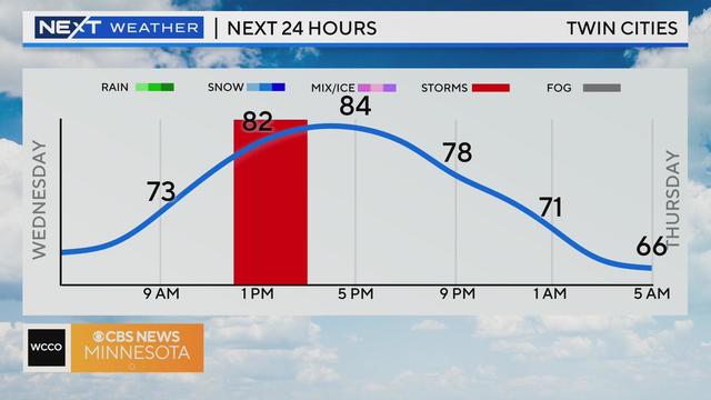
Wednesday will be another day of isolated storms in the Twin Cities before we dry out and heat up this weekend.
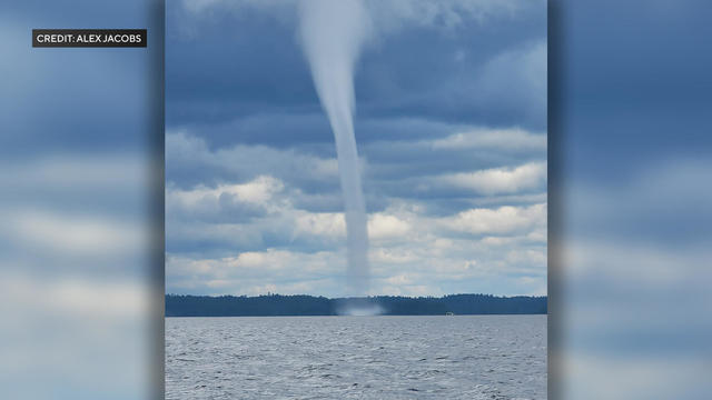
The National Weather Service says a 90-foot-wide waterspout, a tornado that forms over water, took a dazzling and distressing ride across Minnesota's Lake Vermillion on Sunday afternoon.
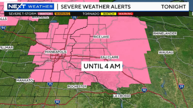
Monday will be hot and humid before potentially damaging severe weather moves in during the evening hours.
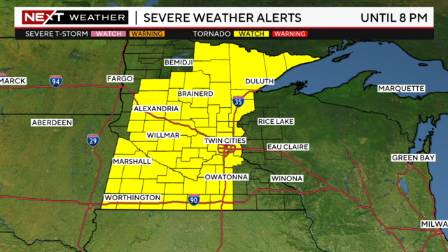
Now that morning storms have passed in northern Minnesota, the state is prepping for a second round that could bring widespread severe weather.
After this week's storms and mugginess, the workweek will end with a #Top10WxDay!
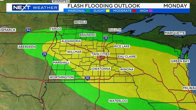
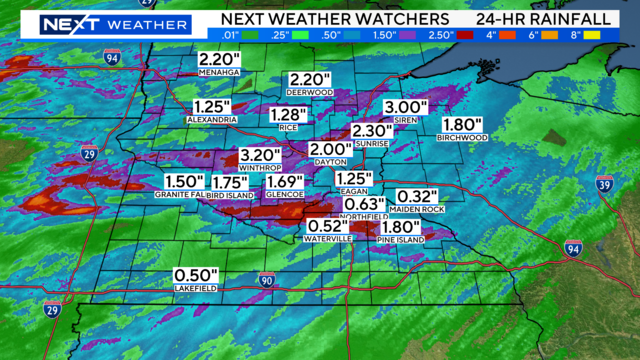
Clouds increase over the Twin Cities on Monday night, rain showers will roll in overnight, and severe weather is possible on Tuesday and Wednesday.
May will go down as one of the wettest in Twin Cities history, and June is also off to a soggy start.