
Cold weather advisory in Twin Cities through early Thursday
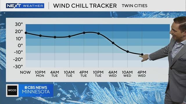
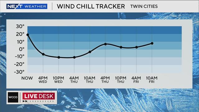
A cold weather advisory is in effect from Wednesday night until 9 a.m. Thursday in the Twin Cities.
Watch CBS News

A cold weather advisory is in effect from Wednesday night until 9 a.m. Thursday in the Twin Cities.

Highs in the Twin Cities on Tuesday will be in the single digits, and some spots around the state won't get above zero.

Monday marked the seventh consecutive day of below-average weather in the Twin Cities, and the trend will continue for around 11 more days.

Cold will take over the Twin Cities on Monday, and there's a slight chance for some light snow.

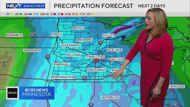
A storm bringing accumulating snow is anticipated to arrive Friday night into Saturday morning.

The Twin Cities are enjoying record-breaking warmth on Thursday, but a cooldown is right around the corner.
Tuesday will be breezy and warm with clearing clouds in the Twin Cities.

Highs across the state will be in the single digits, and even colder in spots.

Frazil ice has been spotted in Minnesota following Thursday's winter storm. But what is frazil ice?
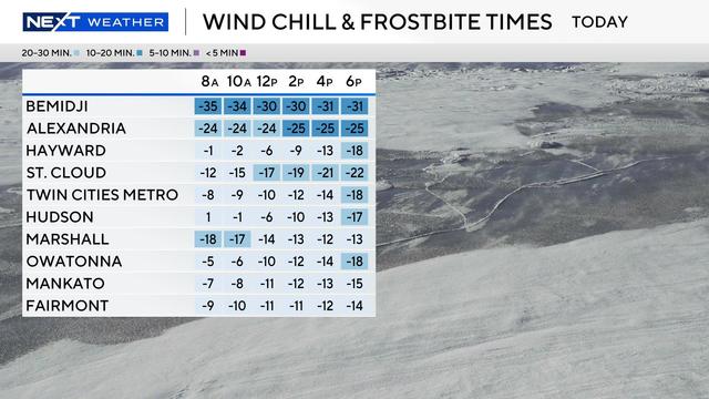
Cold weather advisories are in effect for northern Minnesota from Wednesday evening through Thursday morning for dangerous wind chills around minus 35 degrees.

Twin Cities-area strength coach Carl Champion offers expert advice for setting and sticking to fitness goals next year.
The Twin Cities will be mostly cloudy and windy on Monday evening, with temperatures falling back to around 20 degrees.

States across the northern United States have a high chance for a white Christmas this year, according to weather experts.
An arctic cold front is pushing into Minnesota on Wednesday, along with wind speeds of up to 50 mph.
After a slow slog through the rain on Monday night and early Tuesday, a big storm will bring 1-3 inches of snow to the Red River Valley by Wednesday.