
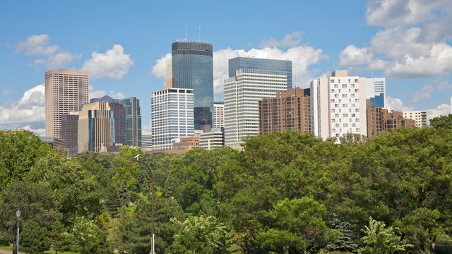
Record warmth in Twin Cities through the weekend; cooldown ahead
Highs will get near 90 degrees on Friday in the Twin Cities, with warm overnight lows near 70.
Watch CBS News

Highs will get near 90 degrees on Friday in the Twin Cities, with warm overnight lows near 70.

Summer heat will start to make a comeback on Friday in the Twin Cities, and last through the weekend.

A Next Weather Alert is in effect until Saturday at 4 a.m. as storms roll across Minnesota.
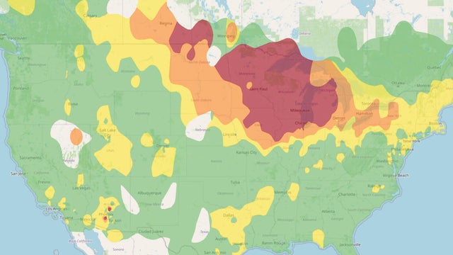
An air quality alert covering the entire state of Minnesota continues on Thursday, marring otherwise fairly ideal weather conditions.

Minnesota is headed for a much-needed break from the intense heat and humidity, but air quality concerns will linger over the state through the weekend.

Parts of Minnesota will once again be under a heat advisory on Wednesday, and more storms are in the pipeline, too.

Heat and humidity return to Minnesota on Tuesday, and parts of the state are in for scattered thunderstorms.
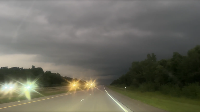
Severe storms moved through parts of western and southern Minnesota on Friday night.
An air quality alert is in effect for all of Minnesota from Saturday through 9 a.m. Monday because of Canadian wildfire smoke.
Minnesota will see a drier, calmer end to week before spotty storms return for the weekend.

The work week will wrap with the return of rain to parts of Minnesota, then the first pop of summer heat and humidity will arrive over the weekend.

Wednesday will be warm and mostly dry in Minnesota, though isolated storms are possible down south.

Thursday will feature a few peeks of sunshine in the Twin Cities, along with a chance of an isolated afternoon shower.

The warmth is here to stay through Memorial Day, with the next chance for showers being Tuesday.

Rain will taper off slowly on Wednesday in the Twin Cities, then several dry, warmer days follow.