Temps stay mild in Twin Cities; wintry mix possible Thursday
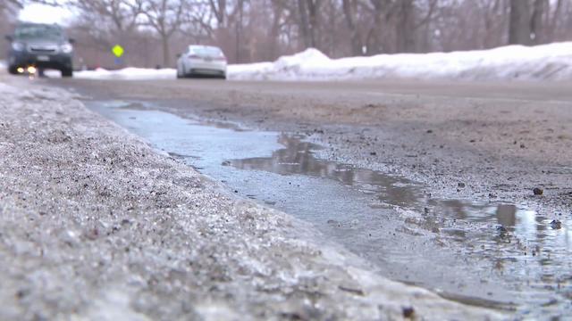
The Twin Cities is in for another mild night on Wednesday. Temperatures will fall below freezing overnight, with another icy morning possible on the roads.
Watch CBS News

The Twin Cities is in for another mild night on Wednesday. Temperatures will fall below freezing overnight, with another icy morning possible on the roads.
It stays mild into Monday night in the Twin Cities, which means rain could turn to freezing rain and drizzle overnight.
Snow showers are expected to move through central Minnesota on Friday night as temperatures across the state rise.
A NEXT Weather Alert is in effect Thursday for a little snow but a lot of wind and cold that could cause roads to freeze up across the Twin Cities.

The Twin Cities will have another mild day Wednesday before things turn wet and colder.
Dangerous cold is the big story all weekend as the Twin Cities as temperatures are expected to plummet overnight Saturday.
If temperatures remain below zero all day Saturday, it will be the coldest day in the metro since Feb. 17, the earliest zero-or-lower high since Dec. 12, 2000 and the 15th earliest zero-or-lower high on record.

Clear skies are nice, but they will allow overnight temperatures to fall to a low of minus 6 degrees in the Twin Cities on Wednesday night. Feels-like temps will be closer to minus 15 to minus 20.
A cold pattern settles in across Minnesota Tuesday, with spotty light snow possible.

The work week will get off to a cold start in Minnesota before a steady warm-up in the coming days.

Wednesday's breezy, sunny conditions will close out the work week in the Twin Cities, but a major chill-down is on the way.

Friday night football games should be dry with temperatures in the 40s.

Thursday and Friday mornings will be cold with frost and freeze likely, but the next several days warm up.
Minnesota stands a greater-than-average chance for more snow and colder temperatures this winter, pertaining to the three months that make up the meteorological season: December, January and February.

After some northern Minnesota communities dealt with a patchy freeze early Tuesday, freezing temps will be widespread north of Interstate 94 on Tuesday night.