
Dangerously cold weather persists in Chicago area through Sunday
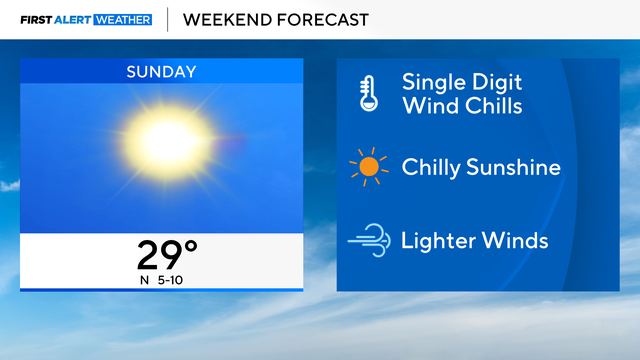
In the midday hours on Sunday, wind chills still ranged between 0 degrees and -10 in some parts of the area.
Watch CBS News

In the midday hours on Sunday, wind chills still ranged between 0 degrees and -10 in some parts of the area.
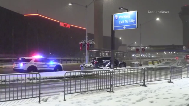
A winter weather system dropped 6 inches of fresh snow in some parts of the greater Chicago area Sunday morning, and prompted a ground stop at O'Hare International Airport.
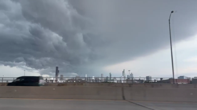
Multiple rounds of storms pounded the Chicago area Monday afternoon, evening, and late night — prompting tornado and flash flood warnings, and causing flight and commuter train delays, power outages, and other problems.
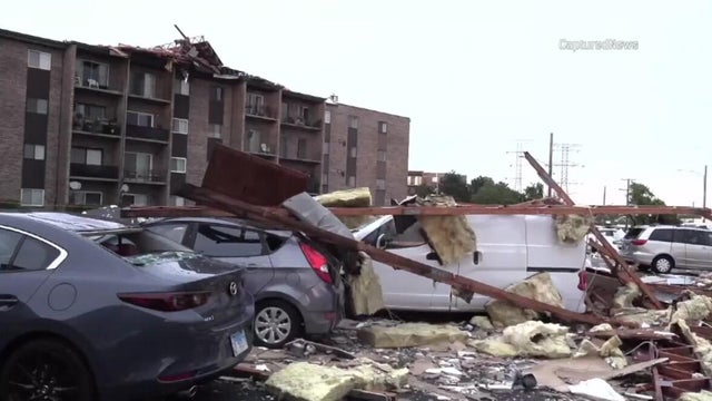
Strong storms swept through the Chicago area Saturday evening, bringing torrential rain, hail, and damaging winds, causing significant damage in several suburbs.
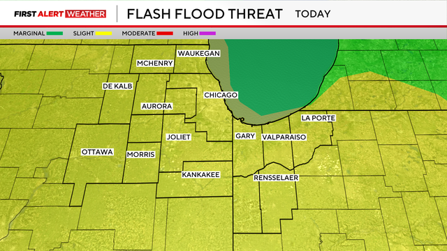
Torrential downpours could bring rain rates of one to two inches per hour.
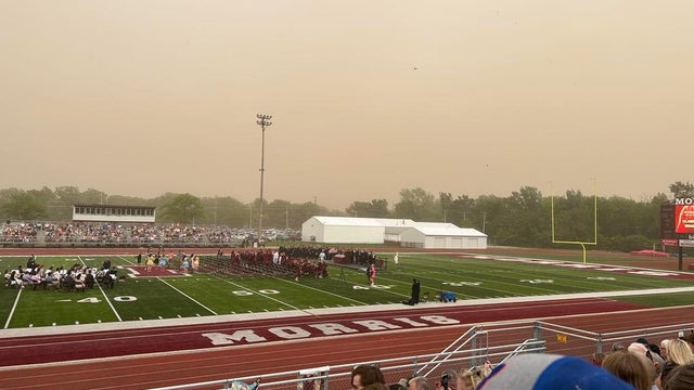
The National Weather Service said it was only the second time its Chicago office ever issued a dust storm warning.
We are gearing up for a much warmer-than-average week ahead with a big push of warm air into Chicago.
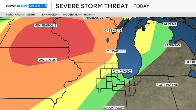
The chance of severe storms hitting the Chicago area Monday night has lessened.
Weather alerts have been posted after dark Monday and into Tuesday morning as scattered showers and possibly severe storms roll through the area.
Brisk winds will make it cooler in the 40s near Lake Michigan on Wednesday.
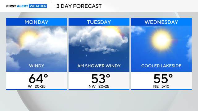
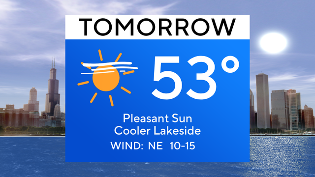
Gusty winds are expected on Monday with highs near 64 degrees.
Both days of the weekend will feature a cool lake breeze.
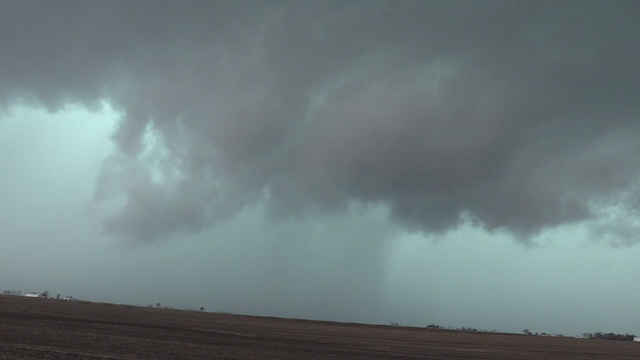
In Iroquois County, crews on the ground said an apparent tornado blew apart barns and brought down power lines.
We will be in alert mode on Wednesday, with all modes of severe hazards are possible.
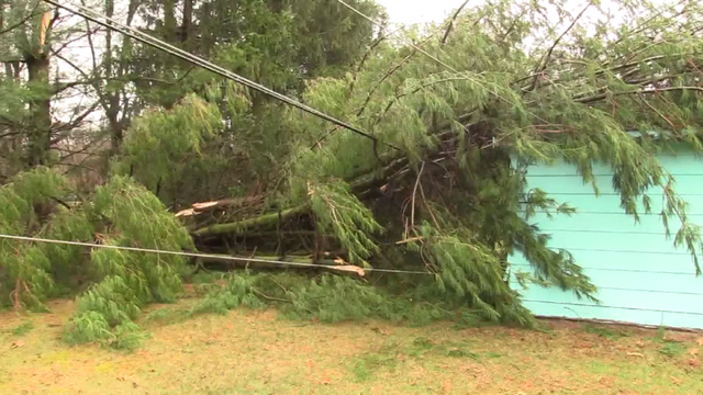
Wind gusts of 81 mph were reported in Valparaiso, Indiana.