
Gov. Walz traveling to Bemidji area to survey storm damage
Gov. Tim Walz traveled to northern Minnesota on Tuesday to assess damage in Beltrami County after a weekend of damaging storms that brought hurricane-force winds.
Watch CBS News

Gov. Tim Walz traveled to northern Minnesota on Tuesday to assess damage in Beltrami County after a weekend of damaging storms that brought hurricane-force winds.
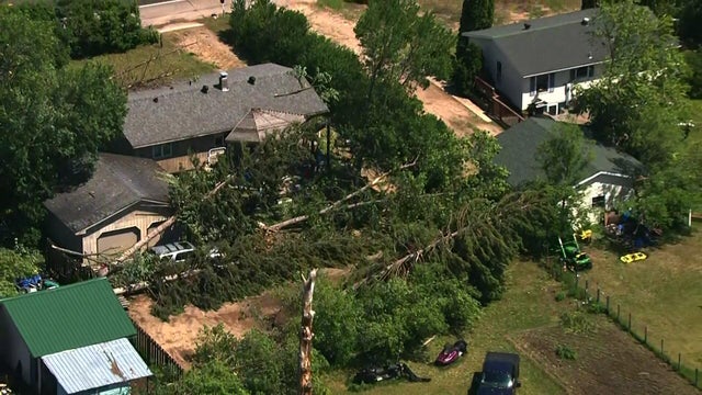
A straight-line windstorm carved a damage path 10 miles wide through downtown Bemidji and in the southern Lake Bemidji area.

Expect more uncomfortable heat and humidity to continue on Sunday, with highs back in the mid-90s and heat index values reaching up to 110 degrees.

Rain returns to the Twin Cities on Wednesday, with light showers starting early and building in the evening.

The sun will return to the Twin Cities on Tuesday with highs in the low 80s.

Sunday will start off sunny but end rainy and windy. The wind will pull down wildfire smoke from the northwest, placing Minnesota under an air quality alert until 11 p.m.

Winds from the northwest will pull wildfire smoke back into Minnesota skies over the weekend, as well a chance for rain Saturday afternoon.

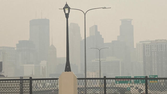
An air quality alert remains in effect through Wednesday at noon for most of Minnesota, though conditions should improve in the overnight hours.

The Minnesota Pollution Control Agency extended its air quality alert on Monday for another couple days due to lingering Canadian wildfire smoke.
Sunday is the first day of meteorological summer in Minnesota, and it will certainly feel like it.
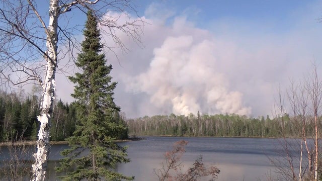
WCCO has been reporting for weeks about the impacts of the northeastern Minnesota wildfires on the ground and in the air, but new research shows it could also impact the state's waterways.

Passing showers are possible over the next couple of days in parts of Minnesota, but most areas should stay dry.

Friday brings sunshine, light winds and highs in the upper 60s in the Twin Cities.
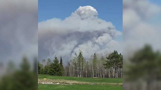
Heat from the recent wildfires raging in northern Minnesota is so intense, that under the right circumstances, they can actually create storms in the atmosphere.

The heat cranks up this Mother's Day with record-challenging highs near 90 with gusty winds. A red flag warning is issued across the state.