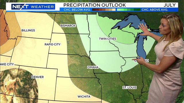
After a rainy June in Minnesota, July also expected to be wetter than average
NEXT Weather meteorologist Lisa Meadows has the data from last month and what to expect next month.
Watch CBS News

NEXT Weather meteorologist Lisa Meadows has the data from last month and what to expect next month.
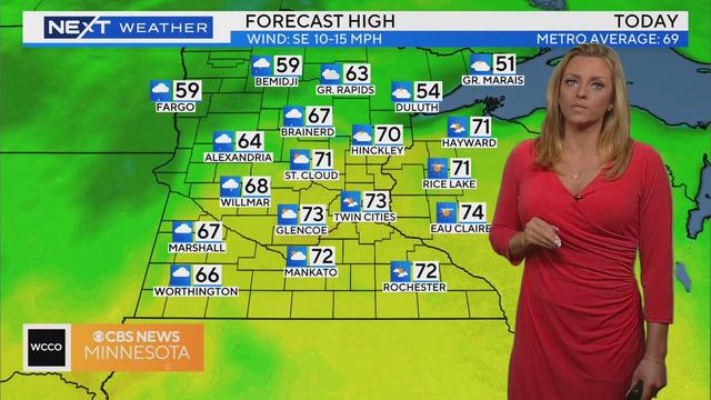
For the first time since June 14, we have no rain to worry about in the Twin Cities and most of Minnesota.
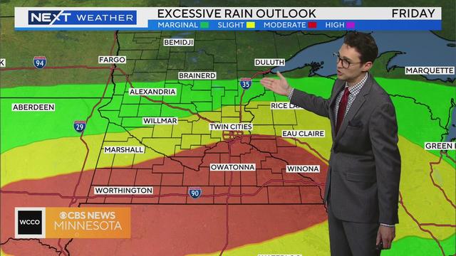
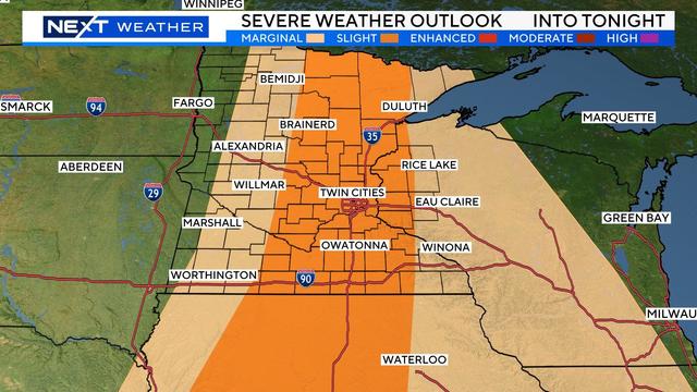
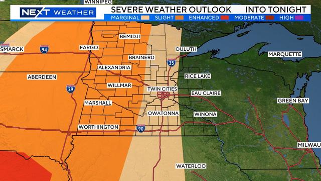
A flood watch is in effect from Friday afternoon through Saturday evening with 2-4 inches of rain expected to fall from two more rounds of storms.
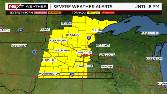
Now that morning storms have passed in northern Minnesota, the state is prepping for a second round that could bring widespread severe weather.
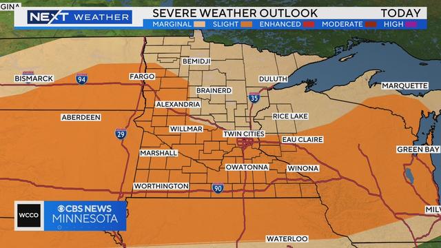
The workweek starts with the first of several storms expected over the next several days.
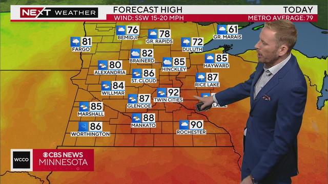
Sunday is a NEXT Weather Alert day due to excessive heat and humidity in the Twin Cities.
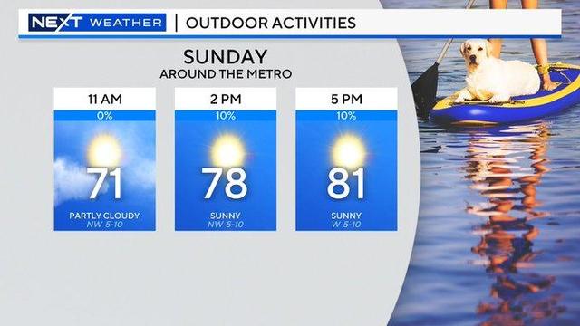
Our dry, comfortable stretch continues Sunday, with more sunshine and pleasant temps in the 70s in the Twin Cities. Monday will continue the trend, with a bit less wind.

Despite some rain overnight, we can expect to have beautiful weather this weekend.
Severe weather alerts have been issued in parts of Minnesota on Tuesday afternoon as a storm system rolls through the state.
May will go down as one of the wettest in Twin Cities history, and June is also off to a soggy start.
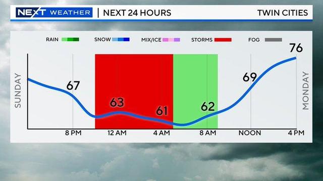
After a quiet start, storms are pushing into the Twin Cities metro late Sunday afternoon.
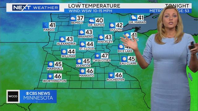
Friday night will be breezy with temperatures falling to the 40s overnight.
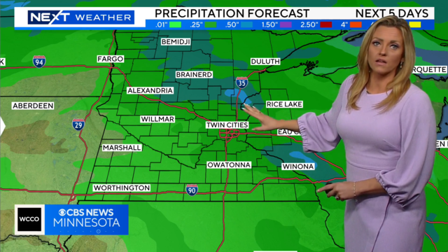
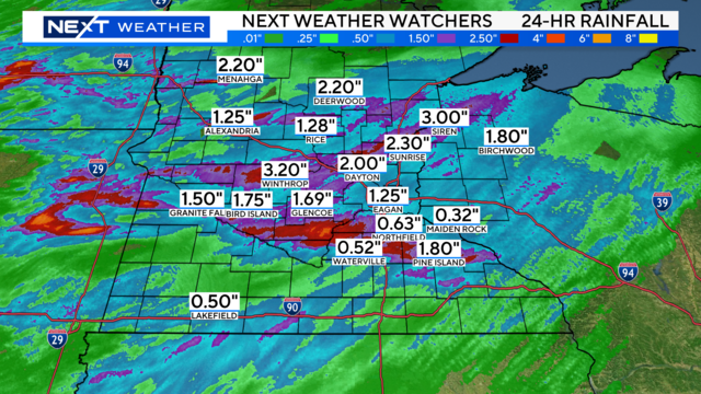
Minnesota will see plenty of rainfall over the next three days.
Wednesday will be similar to Tuesday but with more clouds building in the afternoon, and eventually some evening storms.
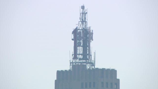
A hazy city skyline and quiet sidewalk strip tell part of the story up north in Canada, where dozens of wildfires rage.