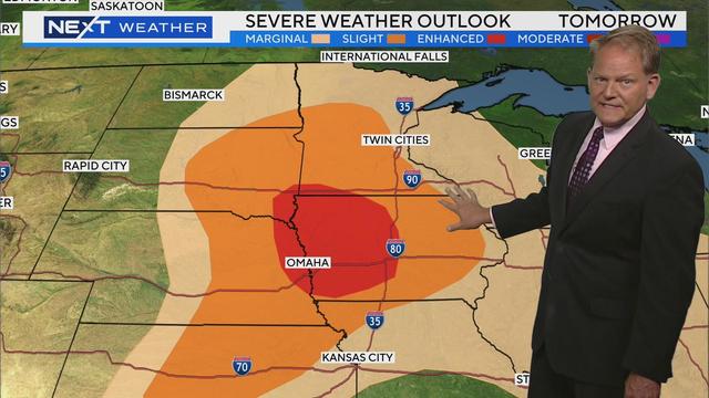
Severe storms, tornadoes reported in southern Minnesota before sunny Tuesday
WCCO meteorologist Mike Augustyniak says the strongest part of the storm is moving to the east, quickly exiting Minnesota.
Watch CBS News

WCCO meteorologist Mike Augustyniak says the strongest part of the storm is moving to the east, quickly exiting Minnesota.
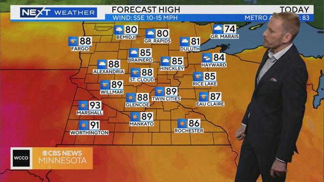
Sunday will be a touch cooler across Minnesota, and mainly dry until late in the evening when more storms could move in.
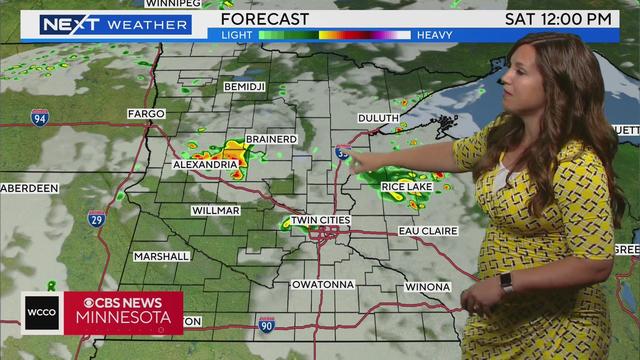
It'll be another hot and humid day on Saturday, though some showers and storms could move in during the evening.
Tuesday continues a now familiar pattern of scattered storms and summer heat in Minnesota.
Most of the day will be dry, but storms become likely late in the evening and into the night.
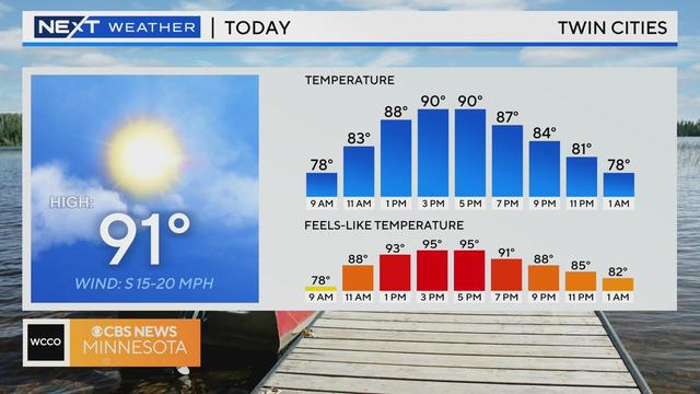
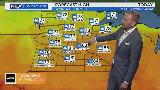
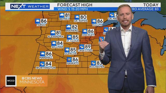
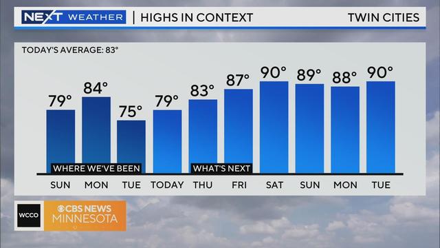
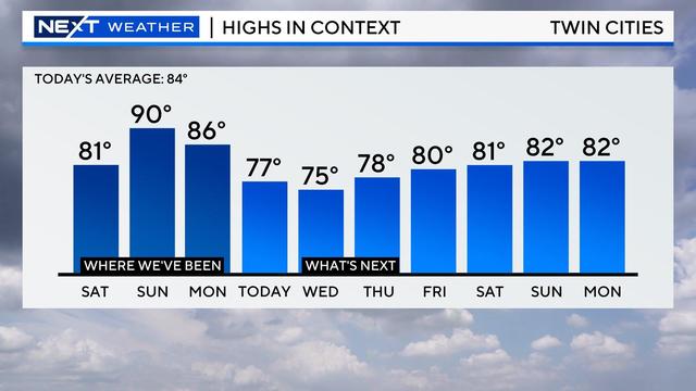
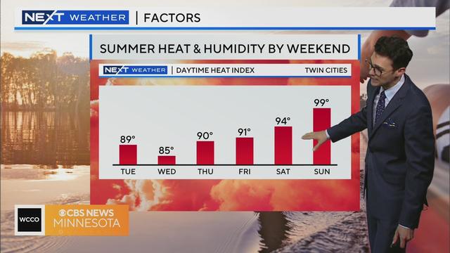
For just the second time this year, the high hit 90 degrees on Saturday in the Twin Cities, and it feels even hotter due to heavy humidity.
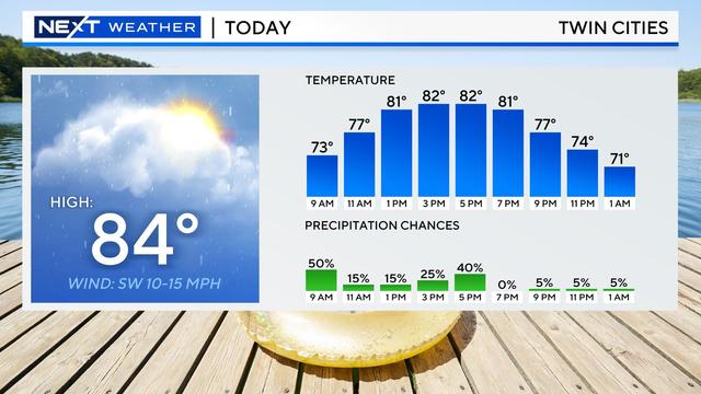
A really nice Wednesday in the works with high pressure and a gentle wind coming in out of the east.
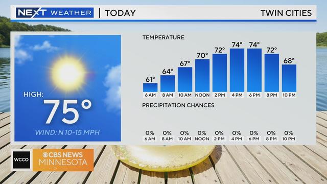
Wednesday kicks off a stretch of lovely summer weather in the Twin Cities.
Aside from a slight chance of isolated showers on Tuesday, the next few days of the forecast look dry.
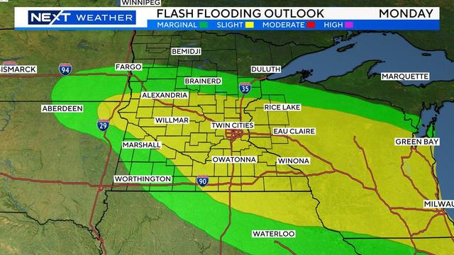
Brace for more rain and storms on Monday in parts of Minnesota, including the Twin Cities.
Parts of Minnesota are still assessing damage after storms late Saturday and overnight left some with large hail, and others with high winds that knocked down trees and led to power outages for tens of thousands.
Saturday is a NEXT Weather Alert day because of the heat and humidity, as well as the chance for storms.
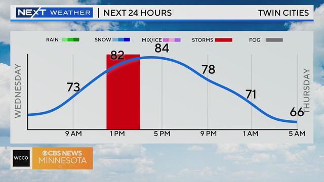
Wednesday will be another day of isolated storms in the Twin Cities before we dry out and heat up this weekend.
Tuesday will continue the recent trend of isolated showers in the Twin Cities.
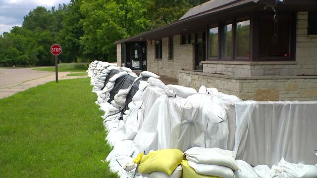
This year's flooding closed Fort Snelling State Park, which is still waiting to be cleaned up.