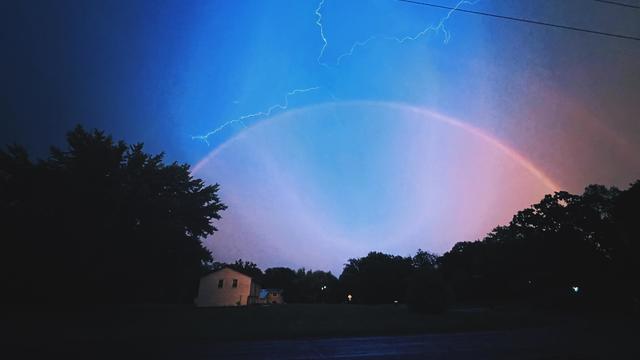
Overnight showers in Twin Cities before possible severe Thursday storms
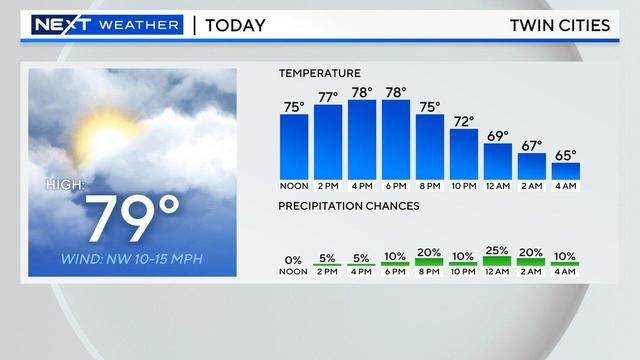
After some scattered overnight showers in the Twin Cities, a NEXT Weather Alert has been issued for Thursday due to the possibility of severe storms.
Watch CBS News

After some scattered overnight showers in the Twin Cities, a NEXT Weather Alert has been issued for Thursday due to the possibility of severe storms.

September has been a very dry month in Minnesota. Here's how it compares to the driest on record.
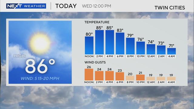
Summer heat returns to Minnesota this week, with humidity and high temperatures in store.
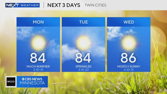
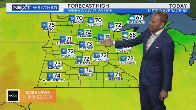
Minnesota will get a break from the rain on Wednesday, but the quiet weather won't last long.
A system of severe weather pushed east through the metro in the morning hours, bringing heavy rain and strong winds.
A severe thunderstorm ripped through southern Minnesota on Monday night, leaving tens of thousands without power.
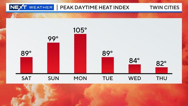
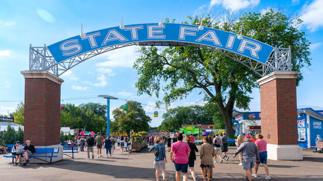
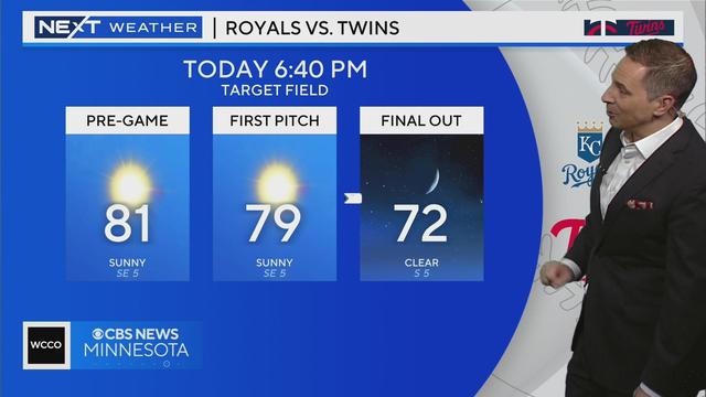
Saturday kicks off a hot and steamy first weekend for the Minnesota State Fair, with Sunday and Monday both declared NEXT Weather Alert days.
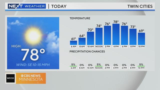
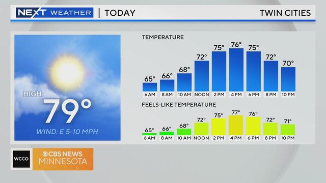
The clouds and rain from Tuesday night's disturbance will clear out early Wednesday, bringing back some sunshine and highs in the upper 70s.

Minnesotans haven't had to worry too much about beating the heat. We've only had six 90-plus degree temperature days — a stark contrast to last year's 27 through August.
Some people jokingly call it the "Great Minnesota Sweat Together" because it can be so hot. So, what is the latest with the forecast?
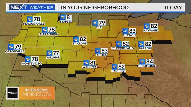
Tuesday will be another pleasant day in Minnesota.
Tuesday will be a carbon copy day of Monday in the Twin Cities, with highs around 80, lots of sunshine and low humidity.
A high-pressure system will bring more sunshine to Minnesota as the weekend wraps up.
High pressure continues to move in on Saturday, which will help calm the winds and begin a warming trend.
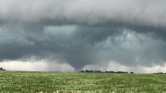
As of Thursday evening, crews confirmed five tornadoes: near St. James, Janesville, Wells, Otisco and Twin Lakes/Emmons.