Record highs in the 80s on Tuesday in Chicago
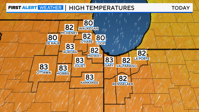
The forecast high today is 82, with the current high-temperature record being 78 degrees, set back in 1999.
Watch CBS News

The forecast high today is 82, with the current high-temperature record being 78 degrees, set back in 1999.
Jackets will still be needed throughout the day and evening.

Once the sun is up, temperatures will start warming towards the upper 50s.
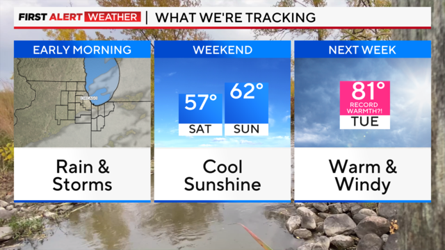
After the early morning rain and storms, the rain showers are tapering off.

Starting this fall, the National Weather Service is changing the naming conventions for cold weather alerts.
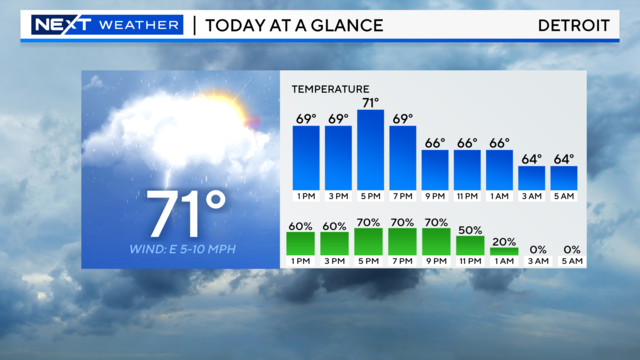
There is a chance for stronger storms to impact Southeast Michigan from 3 p.m. until 10 p.m. Tuesday.
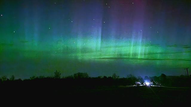
The Aurora Borealis will be possible across Michigan on Tuesday night.
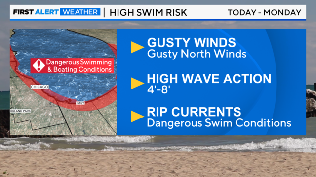
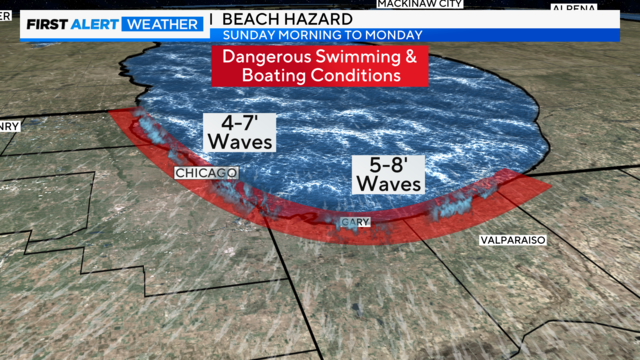
The winds will gust around 25 to 30 mph from the north and northeast, creating choppy Lake Michigan waters.
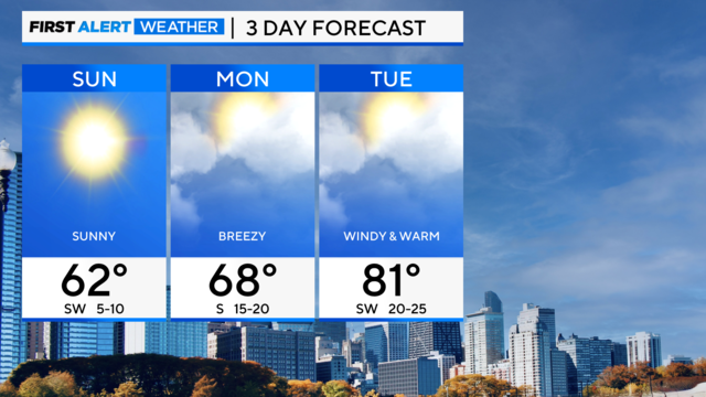
Mostly sunny and less humid for Saturday. Highs will be in the low to mid-80s.
Late Tuesday, there will be a storm risk in the Chicago area, with scattered storms forecast for the evening and parts of the overnight hours.
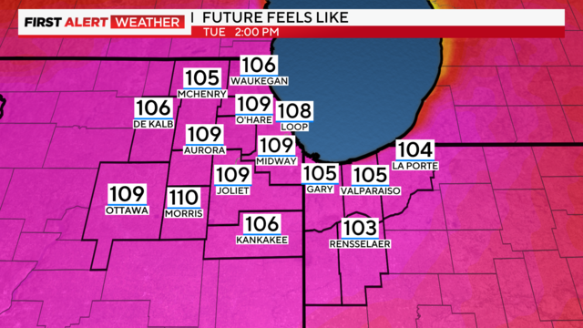
a mostly sunny sky in the afternoon will boost highs to the mid-90s. A very humid environment will make it feel like 100 to 105 degrees in most locations.
Air quality alerts have been issued from midnight Saturday until Sunday night.
With those stronger winds, wave heights for the lakeshore of Lake Michigan will be 5 to 10 feet, creating dangerous swimming conditions and possible rip currents.
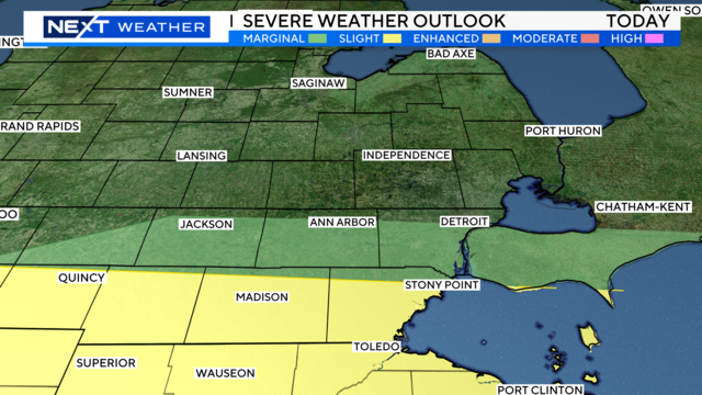
Your NEXT Weather team is tracking strong storms for Tuesday.
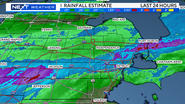
The severe storm threat is over across lower Michigan, but flooded areas remain after we experienced heavy rainfall in the last 48 hours.