Increasing clouds with flurries for Chicago Saturday
Expect a few snow flurries today before snow showers arrive after midnight tonight due to a clipper system.
Watch CBS News

Expect a few snow flurries today before snow showers arrive after midnight tonight due to a clipper system.
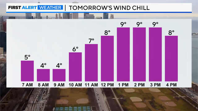
Even though the wind won't be very strong, it will still feel like the single digits stepping outside for wind chills Wednesday night into Thursday morning.
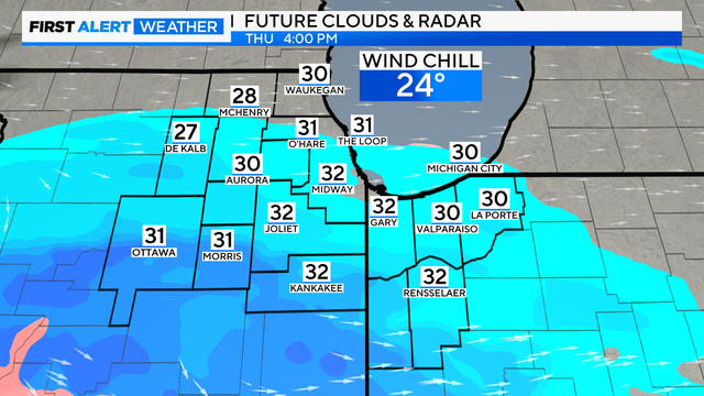
Wednesday will be the coldest day this week with highs only topping out in the lower 20s at best.
Everyone is still advised to be careful of slick area roads and sidewalks with ice patches.
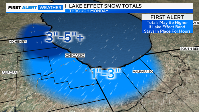
The most significant lake-effect snow is expected in Lake County, Illinois, with generally 3 to 5 inches of snow possible.

Have you ever looked up in the sky and noticed colored spots on either one or both sides of the sun? If so, you probably saw a sun dog, also known as parhelia or mock sun.
Models still favor a southerly track to the winter storm from Sunday into Monday.
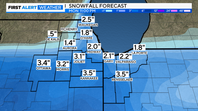
Snow totals range from a dusting to 2 inches farther south of Chicago.
The snow is expected to favor areas south of I-80, with a dusting up to 2" being possible for the higher end.
Fog will also create low visibility through Monday morning as well, so if you are traveling anywhere, make sure to use your low-beam headlights if you encounter the locally dense fog.

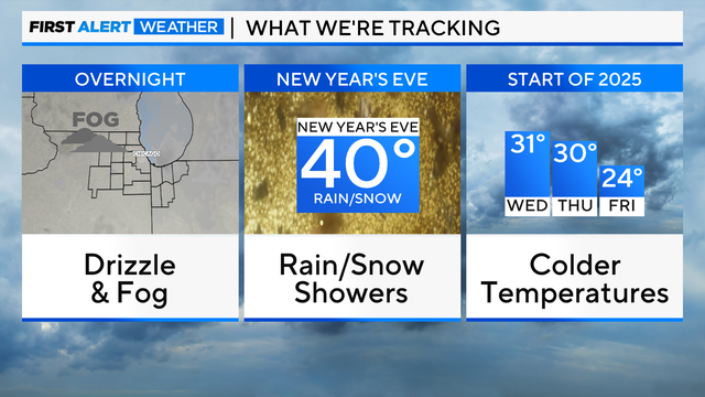
The average temperature in Chicago for 2024 will end up being between 54.8 degrees and 55 degrees Fahrenheit.
In total, about 1" to 1.5" of rainfall will be possible for areas east of Interstate 55 by Sunday evening.
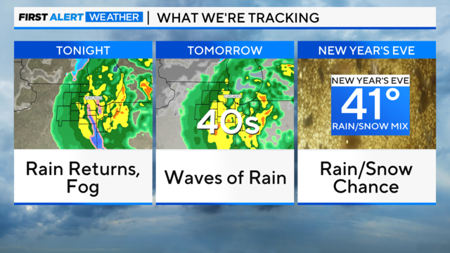
After a rainy end to the week, Chicago is finally in for a break from the rain.
Untreated roads and surfaces could ice up rather quickly as the pockets of drizzle and rain freeze on contact with cold surfaces.
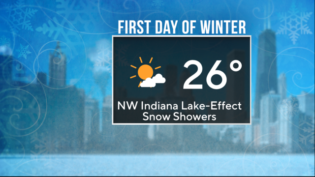
Partly cloudy skies are on tap with some lake-effect snow showers, favoring Northwest Indiana.