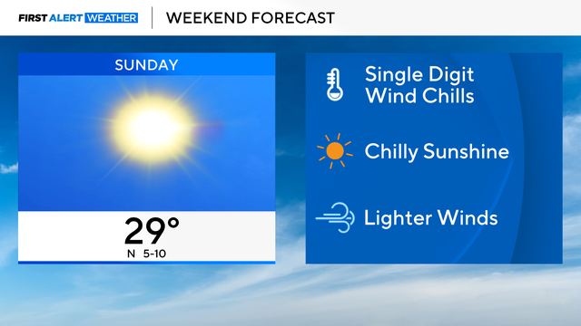
Chicago weather: Sunny, highs near 30 for Sunday
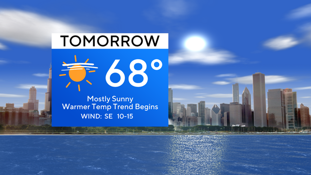
We are gearing up for a much warmer-than-average week ahead with a big push of warm air into Chicago.
Watch CBS News

We are gearing up for a much warmer-than-average week ahead with a big push of warm air into Chicago.
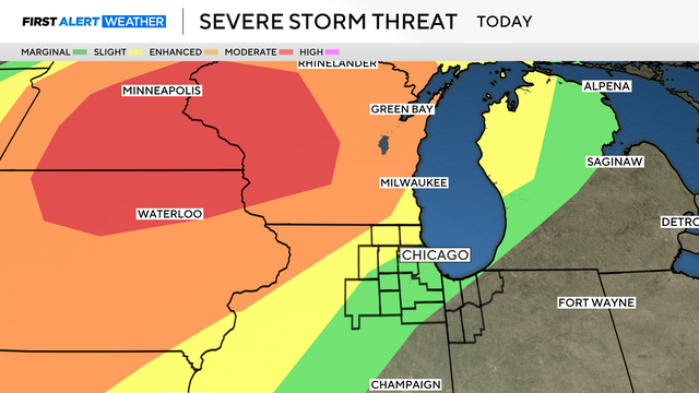
The chance of severe storms hitting the Chicago area Monday night has lessened.
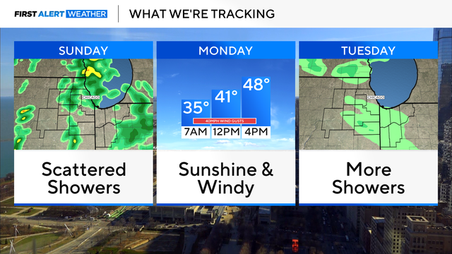
Weather alerts have been posted after dark Monday and into Tuesday morning as scattered showers and possibly severe storms roll through the area.
Patchy frost will start to develop overnight in parts of northwest Indiana, with La Porte County under a Frost Advisory until 7 a.m.
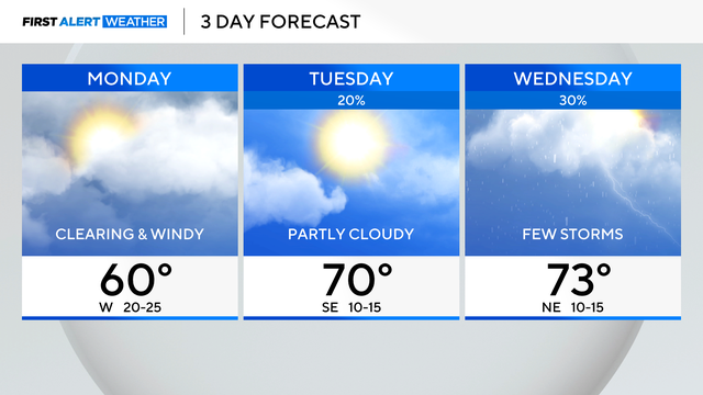
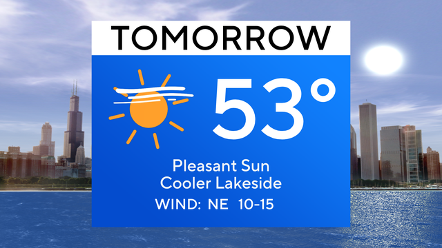
Monday's temperatures will be in the 50s.
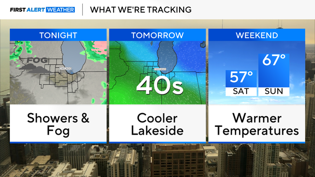
Brisk winds will make it cooler in the 40s near Lake Michigan on Wednesday.
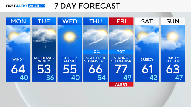
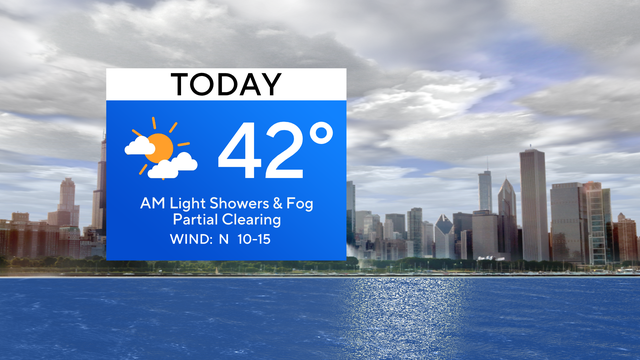
We are tracking a cold front slated to move through Tuesday morning with a few quick rain showers, then cooler breezes to follow through midweek.
Cooler-than-average temperatures continue in the 40s Thursday
A cold front will activate sporadic snow showers and gusty winds. Visibility may be low at times throughout the morning and afternoon.
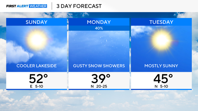
Highs are in the 50s, but cooler lakeside temperatures are in the 40s.
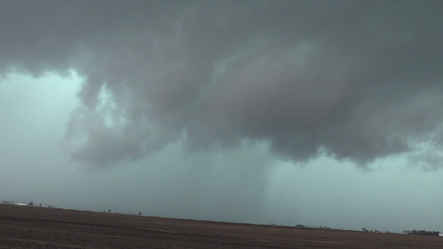
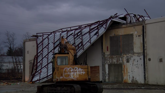
In Iroquois County, crews on the ground said an apparent tornado blew apart barns and brought down power lines.
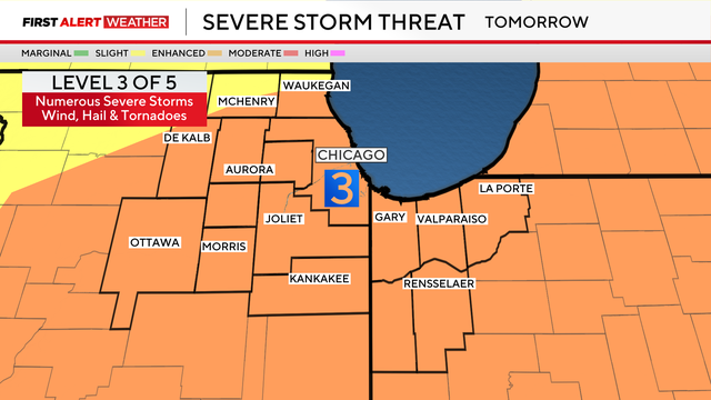
A warm front may spark numerous severe thunderstorms Wednesday afternoon into the evening hours.
Stronger storms are possible Tuesday night, and more rounds of showers and storms move into the area Wednesday.
Rain showers arrive by dawn Sunday, with a few rumbles of thunder being possible in the afternoon.
A line of severe storms triggered multiple tornado warnings in the Chicago area Wednesday afternoon.