
Summer warmth for Thursday's start to Minnesota State Fair
Expect a beautiful start to the Minnesota State Fair on Thursday, with sunshine and seasonable temperatures topping off in the low 80s.
Watch CBS News

Expect a beautiful start to the Minnesota State Fair on Thursday, with sunshine and seasonable temperatures topping off in the low 80s.
Wednesday will be warm and slightly humid in the Twin Cities, but things will cool down for the first weekend of the Minnesota State Fair.
After some lingering rain moves out Monday morning, the Twin Cities will see partly sunny skies ahead of a cooler, drier week.

A NEXT Weather Alert remains in effect Friday due to possible severe storms across Minnesota, though concerns about extreme heat have abated.
As the southerly flow picks up, expect a hotter and more humid Thursday in the Twin Cities, with highs into the upper 80s.

After the morning round, the Twin Cities will get some dry time before the rain returns in the evening.

Though the hazy skies will continue to clear in the Twin Cities on Tuesday, northeastern Minnesota is still dealing with air quality concerns.

The air quality in Minnesota will continue to improve on Monday as wildfire smoke moves out of the state.
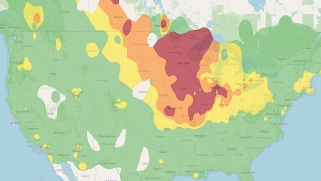
The state of Minnesota is entering another in a long string of summer days marred by air quality alerts. Poor air quality will continue through Saturday with lingering wildfire smoke from Canada.
An air quality alert covering the entire state of Minnesota continues on Thursday, marring otherwise fairly ideal weather conditions.

The entire state of Minnesota is under an air quality alert for the next few days, coinciding with a stretch of cooler, quieter weather.

Minnesota is headed for a much-needed break from the intense heat and humidity, but air quality concerns will linger over the state through the weekend.
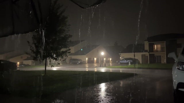
Strong to severe storms moved through the bottom half of Minnesota on Monday evening.

Parts of Minnesota will once again be under a heat advisory on Wednesday, and more storms are in the pipeline, too.

Heat and humidity return to Minnesota on Tuesday, and parts of the state are in for scattered thunderstorms.