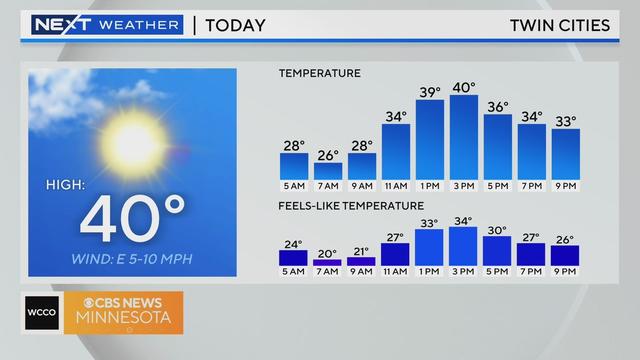
Mild December continues with sunshine and 40 degrees Wednesday
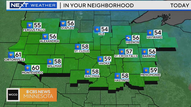
Just like most days this December, we are on track for another above-average day.
Watch CBS News

Just like most days this December, we are on track for another above-average day.
Wednesday will be our best chance of sunshine for the next several days.
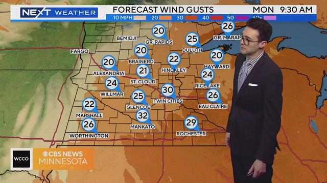
Monday's going to be cool and breezy, but temperatures will jump right back up above average on Tuesday.
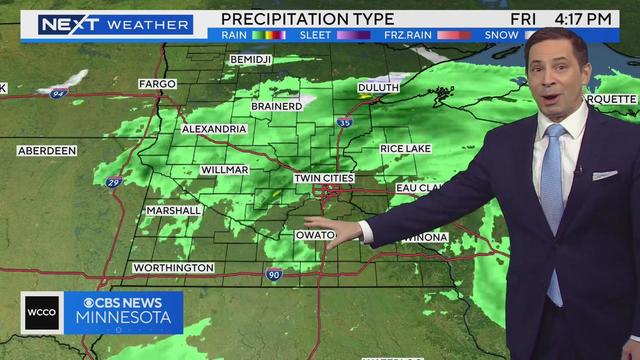
Expect spotty showers Friday morning, with a steady rain coming in the afternoon.
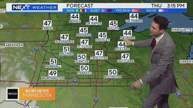
Warm air moves in quickly Thursday, as temperatures across Minnesota build to 15-20 degrees above the average.
After the coldest day of the week, we are now building the temperatures back up.
Tuesday is going to be cool and breezy, but much warmer temperatures are ahead this week.
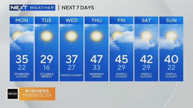
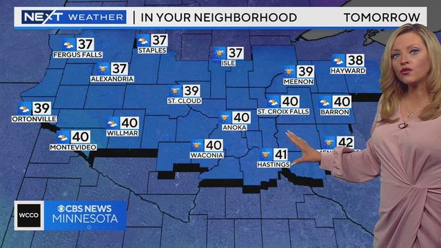
Monday will bring some sunshine and highs slightly above average, but a weak cold front will arrive in the afternoon, dropping temps back below freezing.

The Twin Cities will see temperatures in the mid-30s on Monday, and snow flurries are possible in the evening hours.

Northwest flow will prevent us from that same type of warming from Wednesday.

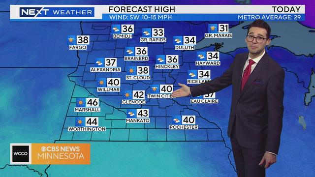
Wednesday will be the warmest day of the week, with plenty of sunshine to enjoy.
Wednesday will feature above-average warmth, before a cooldown arrives in time for Thanksgiving.
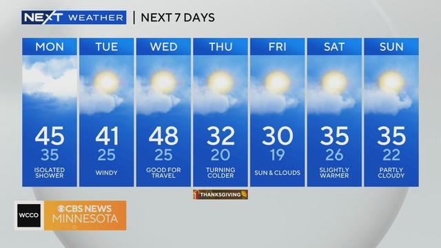
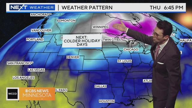
Thanksgiving week has plans to turn cold and dry, but it won't happen just yet on Tuesday.
Enjoy the last few hours of warmth Thursday before we're back to autumnal reality.
A #Top10WXDay is coming at you Wednesday as the forecast leans warm and sunny.