
Double-digit temps Wednesday, but subzero feel remains
The forecast high in the Twin Cities Wednesday will be 10 degrees, but the feels-like temp will be closer to minus-5.
Watch CBS News

The forecast high in the Twin Cities Wednesday will be 10 degrees, but the feels-like temp will be closer to minus-5.
Frigid conditions continue on Tuesday, though temperatures will at least climb above zero.
Monday will bring dangerous temperatures and wind chills across the state.
We're going straight into the cold side of winter. Expect flurries Saturday with a biting wind, temps will drop below zero late.
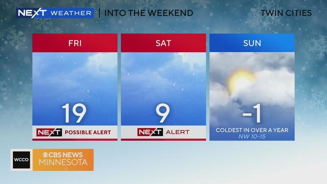
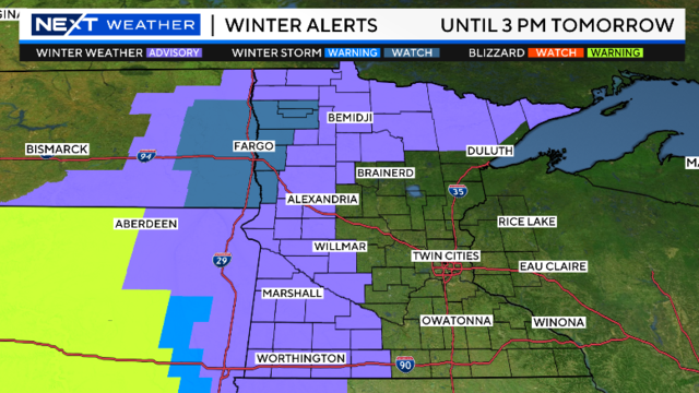
Friday will be a NEXT Weather Alert day due to possible heavy snowfall, as will Saturday due to frigid temperatures the likes Minnesota hasn't seen in quite some time.
The forecast high in the Twin Cities on Wednesday is 27 degrees, but it will feel like the upper teens due to wind chill.
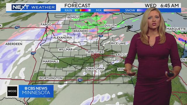
It's going to be an active weather week in Minnesota, starting with a system moving through Monday that should bring multiple inches of snow to parts of the state.
A band of snow will fall mostly in northern Minnesota, and it'll stay mild over the weekend.
The new year will start off cloudy before the sun breaks through in the afternoon, with temperatures expected to top out above and around freezing.
Pleasant Friday evening with temps in the mid 30s overnight with flurries possible Saturday.
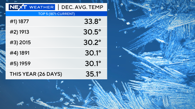
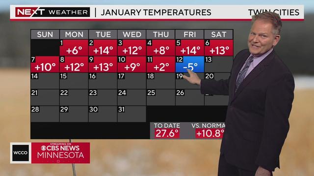
Temperatures are cooling down, but they'll remain above average for a while. In fact, December may break a record for warmth.
After multiple warm air records were broken over Christmas Eve and Christmas Day, cooler air moved through the state Tuesday.
Next on the docket is rain for much of the state, and snow for some.
We're experiencing out-of-character weather as we enter the holiday weekend.
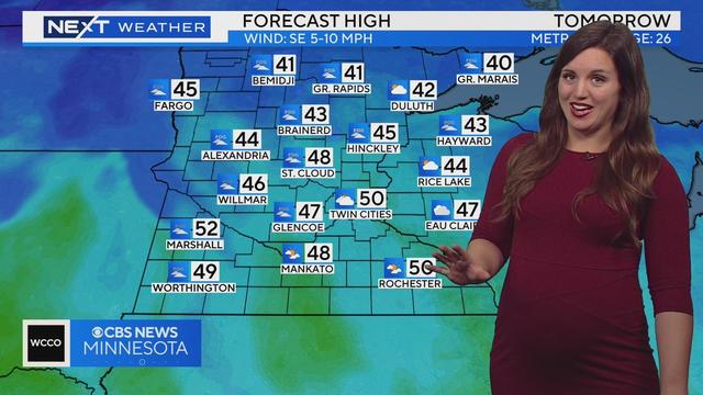
Mild winter days continue as we warm back to the lower 40s.