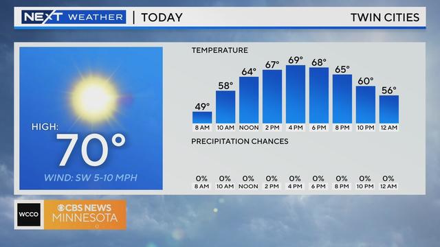
Mostly dry, sunny, cooler Thursday in the Twin Cities
Thursday will be the coolest day this week, with a few morning pop-up showers possible.
Watch CBS News

Thursday will be the coolest day this week, with a few morning pop-up showers possible.
Wednesday will bring more warmth and sunshine, plus a chance of evening storms.
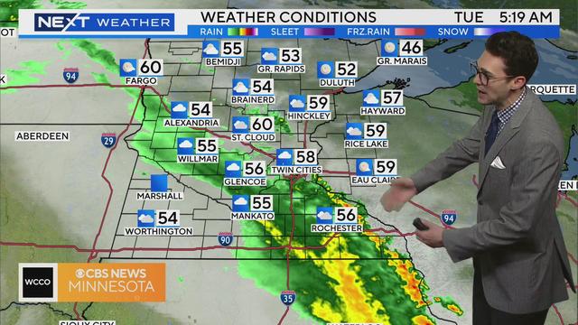
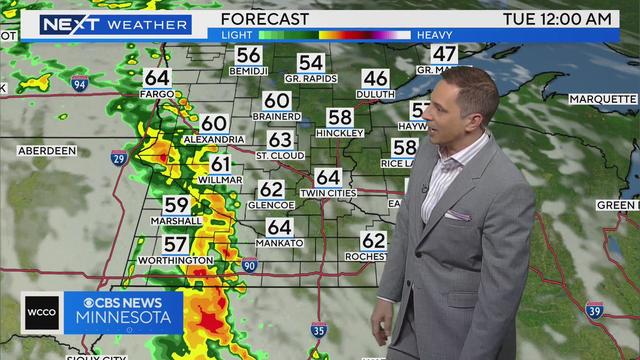
Grab your umbrella if you're headed out the door early Tuesday, and keep it handy for later in the day, too.
Monday will be warm and windy, and more rain is on the way this week.
We're closing out the weekend with a #Top10WxDay in the Twin Cities.

The Twin Cities are in for a lovely Friday, but more rain is on the way.

Rain crept into the Twin Cities overnight Thursday and will become more steady throughout the day.

Make way for some nice weather in the Twin Cities on the first day of May.

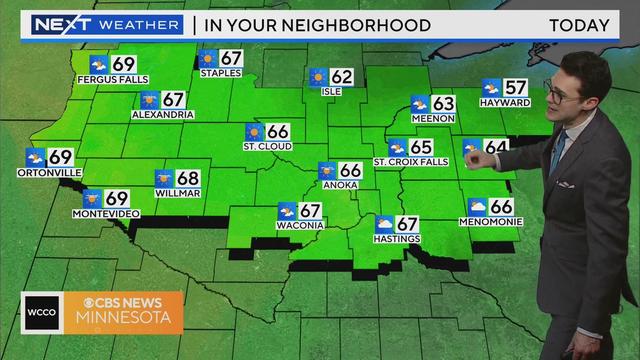
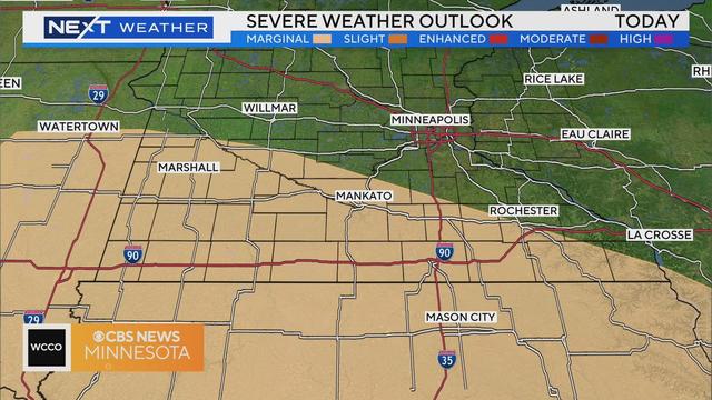
After a sunny and warm start to Tuesday, storms will roll across southern Minnesota.

The Twin Cities are about to be treated to some proper April showers.

Strong southerly winds, along with some sunshine, will help temperatures climb close to 70 Thursday afternoon in the Twin Cities.

After a frosty morning in the Twin Cities, the sun will shine, wind speeds will decrease and highs will reach the low 60s

After a sunny start to Tuesday, more clouds and showers will arrive in the Twin Cities by midday.

After a dry morning in the Twin Cities, wind and warmth will increase as the day goes on, with a forecasted high of 68 degrees.

Thursday will be mostly dry with a high of 55 degrees. The sun will return by the afternoon, along with the wind.