Sunshine, mild temps to melt more snow Wednesday
The forecast high in the Twin Cities is 50 degrees amid a large ridge sequencing that will cause states to the south to break into the 60s and 70s.
Watch CBS News
Joseph Dames joined the WCCO team during the winter of 2022. He is currently the weekday morning meteorologist. You can also catch him putting together weather, science, and other environmental stories during the week.
Born and raised in Illinois, just outside of Chicago, Joseph grew up in the small community of Plainfield. Plainfield is notorious for the 1990 F5 tornado, which started Joseph's interest in weather. Joseph stayed in the state of Illinois for his education and attended Eastern Illinois University with a concentration in broadcast meteorology.
Joseph spent seven years covering wildfires, ice storms, and atmospheric rivers in Portland, Oregon. As a fan of snow, he is excited to trade those in for winter forecasting.
You better believe he has a love for Chicago sports and, of course, that deep dish pizza. In his down time, Joseph spends his days and nights hitting the outdoors, enjoying live music, and trying all the different restaurants around the area.
Feel free to send in weather questions, photos, or weather and environmental story ideas to Joseph.
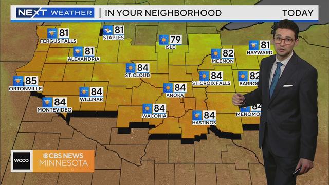
The forecast high in the Twin Cities is 50 degrees amid a large ridge sequencing that will cause states to the south to break into the 60s and 70s.
Twin Cities residents can look forward to sunshine and highs in the 40s on Tuesday, and the next few days will look very similar.
Another week of above average temperatures will kick off on Monday.
With the latest snowfall across parts of Minnesota during the latter part of Wednesday and into the overnight hours, we've now officially moved up a notch from our previous position of being on track for the least-snowy winter on the record books.
The Twin Cities were in the snow zone Wednesday, with snow-covered trees and roads making for an icy-yet-picturesque Thursday.
A winter weather advisory is in effect from 3 p.m. Wednesday to 3 a.m. Thursday.
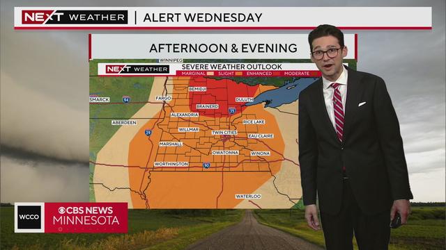
A weak incoming system will cause increased clouds and cooler air in the Twin Cities going into Wednesday. There's some light snow in the forecast on Valentine's Day.
Temperatures will remain above average Monday, but later in the week, the Twin Cities will get cooler air and a couple of chances for snow.
After three days of record-setting warmth this week, Friday and Saturday will not follow suit.
Showers are passing through the Twin Cities Thursday morning, and another daily heat record will likely be broken.
Tuesday's high temperature broke a 99-year-old daily heat record, kicking off a possible multi-day streak of record-breaking warmth.
Temperatures in the Twin Cities will top out in the 40s on Monday, a mere prelude to the record warmth expected in the coming days.
We keep the warm winter days going with highs in the upper 40s on Thursday.
Wednesday morning's fog cleared early, setting us up for lots of sun to help temperatures soar to record levels in the 50s.
Temperatures will technically cool down on Tuesday, but they'll still be well above average.