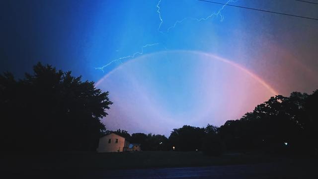
Severe storms rock Twin Cities Monday night; tens of thousands without power
A severe thunderstorm ripped through southern Minnesota on Monday night, leaving tens of thousands without power.
Watch CBS News

A severe thunderstorm ripped through southern Minnesota on Monday night, leaving tens of thousands without power.
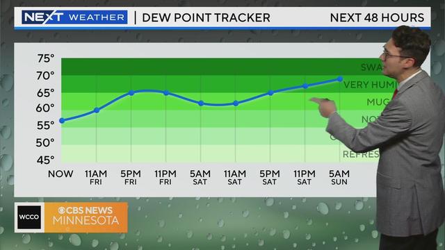
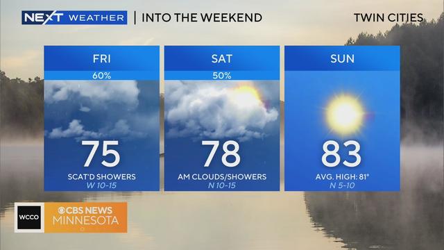
Humidity is on the rise Friday, with things expected to heat up for the first weekend of the Minnesota State Fair.
The Minnesota State Fair's first day will be a lovely one ahead of a very sweaty weekend
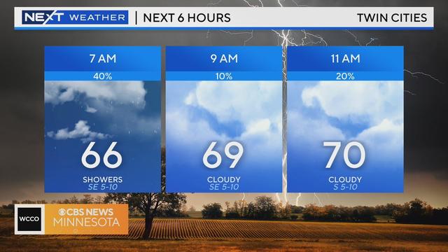
The clouds and rain from Tuesday night's disturbance will clear out early Wednesday, bringing back some sunshine and highs in the upper 70s.
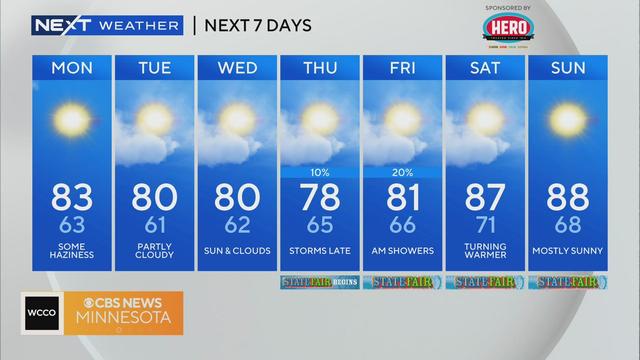
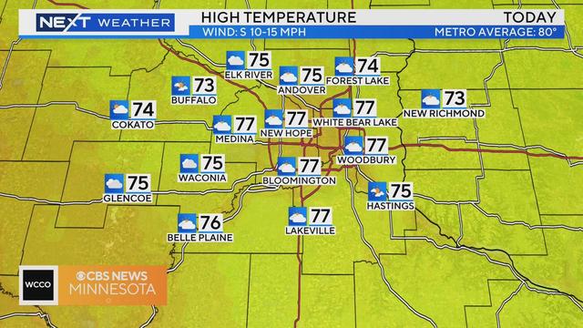
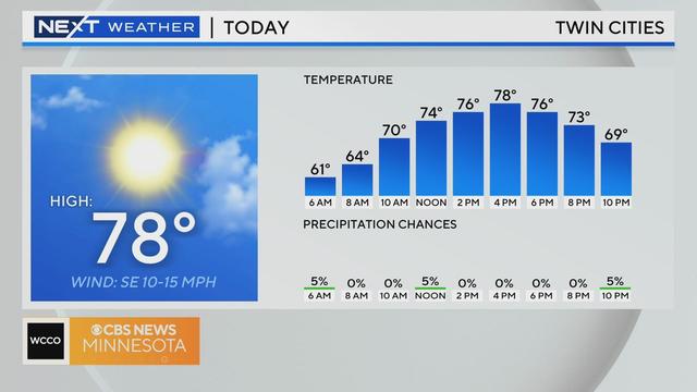
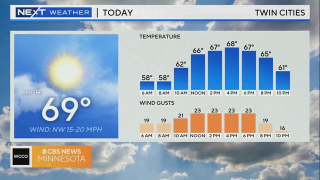
The work week will kick off with a pleasant August day in the Twin Cities.
An area of low pressure pushes across Minnesota on Friday, keeping things cloudy with a chance for isolated showers and thundershowers all day.
The metro is in for two days of scattered showers and storms ahead of a stellar weekend.
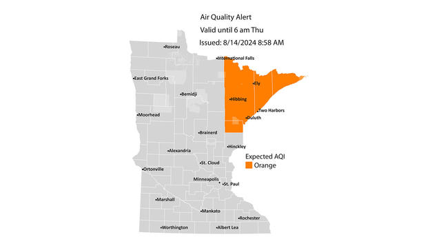
Showers are expected to move into the Twin Cities Wednesday, while up north, officials issued an air quality alert due to wildfire smoke from Canada.
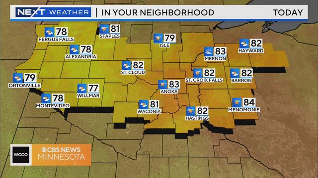
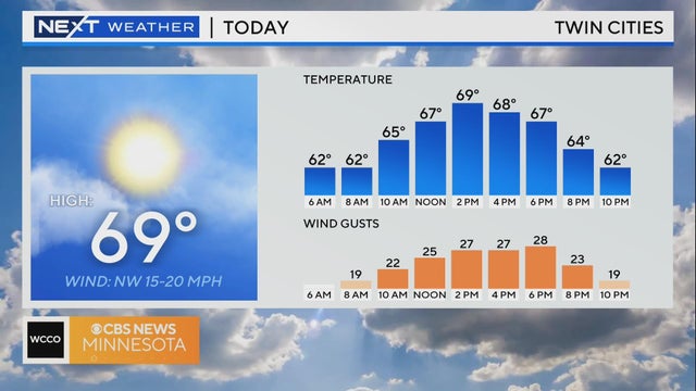
Tuesday will be another pleasant day in Minnesota.
Outside of a stray sprinkle on Friday afternoon, the Twin Cities can expect another quiet day with a mix of sun and clouds.
A cold front brings a touch of autumn to the end of the week.
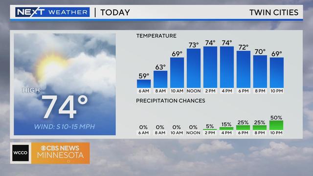
Wednesday will be dry for the most part in the Twin Cities, until the evening hours.
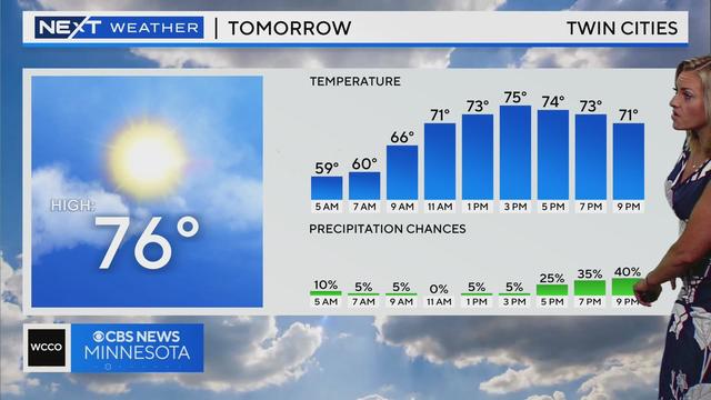
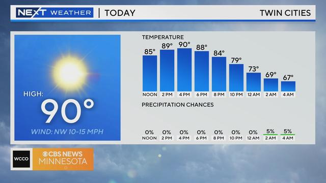
After Monday's severe storms, Tuesday's stable weather will be a welcome change.
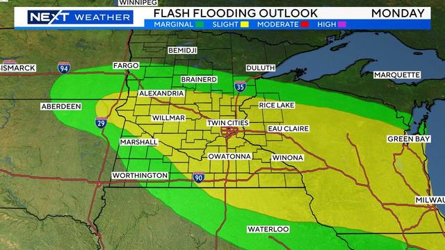
WCCO meteorologist Mike Augustyniak says the strongest part of the storm is moving to the east, quickly exiting Minnesota.
High pressure is moving in on Friday, bringing back sunshine to wrap up the week in the Twin Cities.