Warm, windy Thursday as temps boost to finish out the week
It'll be a warm and windy day Thursday thanks to an area of high pressure in the south.
Watch CBS News

It'll be a warm and windy day Thursday thanks to an area of high pressure in the south.
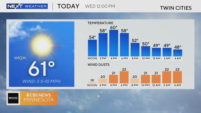
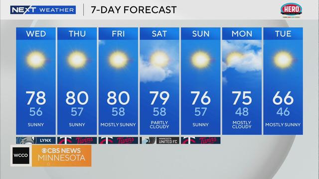
A big chill is in the air early Wednesday, but temperatures will return to average by the afternoon in the Twin Cities as conditions remain sunny and dry.
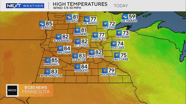
We're ahead of another dry cold front which will help warm the Twin Cities into the low 80s on Thursday afternoon — about 20 degrees above average.
A wind shift will occur on Wednesday as high pressure shifts eastward, helping to usher in warmer air.
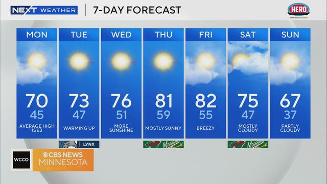
Some parts of Minnesota will wake up to chilly temperatures and even frost on Monday, but this week will bring rising temperatures.
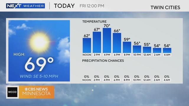
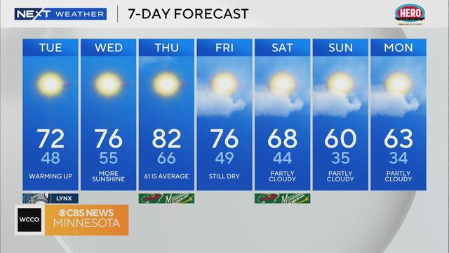
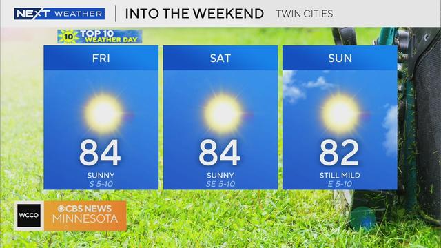
High pressure continues to build back on Friday, making for a beautiful end to the week with sunshine and highs closer to 70 degrees.
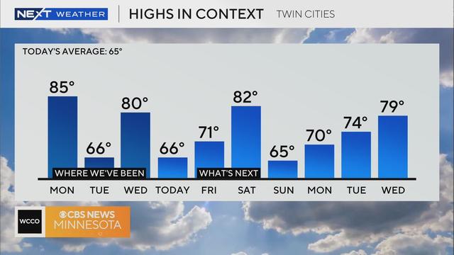
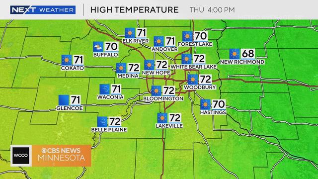
Highs will drop into the mid-to-upper 60s in the Twin Cities on Thursday as this week's temperature rollercoaster continues.
A temperature seesaw is in full effect this week in Minnesota, with Wednesday on the warm side with sunshine and elevated fire concerns.
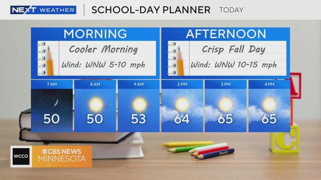
The first day of October will bring a noticeable fall feel to the Twin Cities.
The Twin Cities will enjoy one more day in the 80s on Monday, with the winds picking up and fire conditions increasing in western Minnesota.
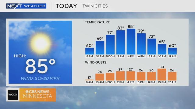
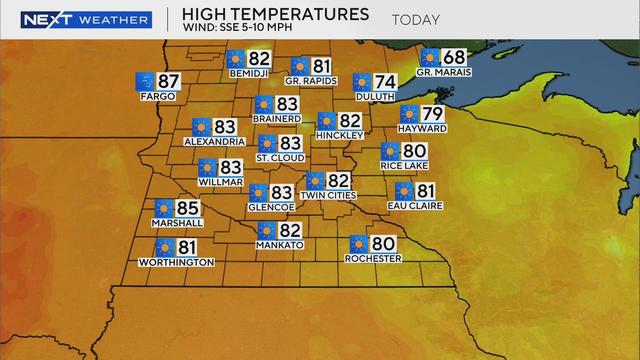
The Twin Cities will enjoy summery weather for the final Friday of September, with a forecast high of 84 degrees, which is about 15 degrees above average.
High pressure over the Great Lakes continues to dominate our forecast, bringing clear skies and a light southerly wind to the Twin Cities on Thursday.
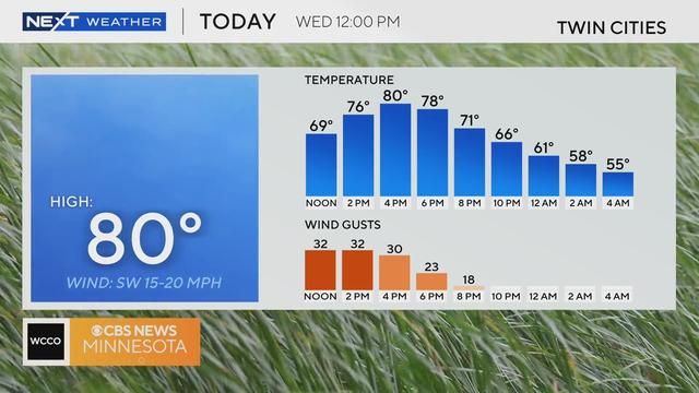
Wednesday will bring a boost in temperatures, bright sunshine and blue skies.
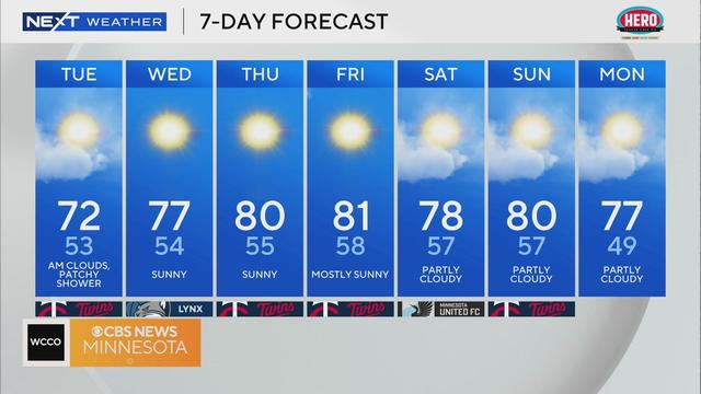
A mild week continues Tuesday with highs right around average.
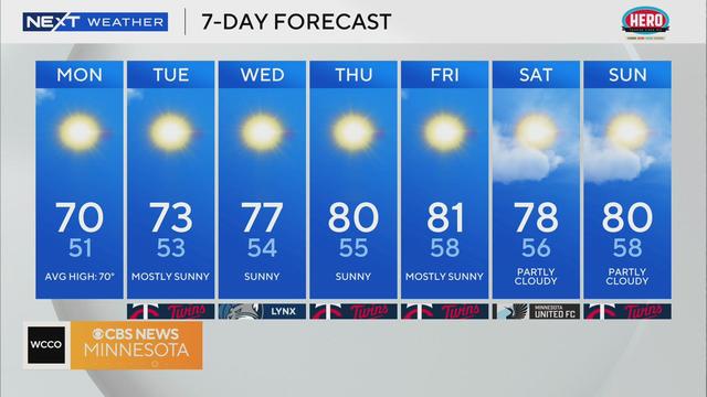
Monday will kick off a quiet weather week in Minnesota that will see above average temperatures make a return.