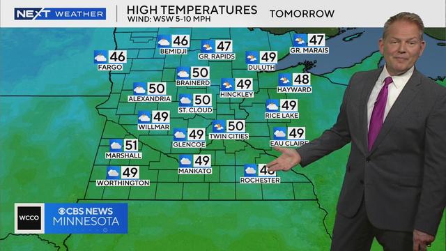
Twin Cities to dry out, warm up ahead of pleasant fall weekend
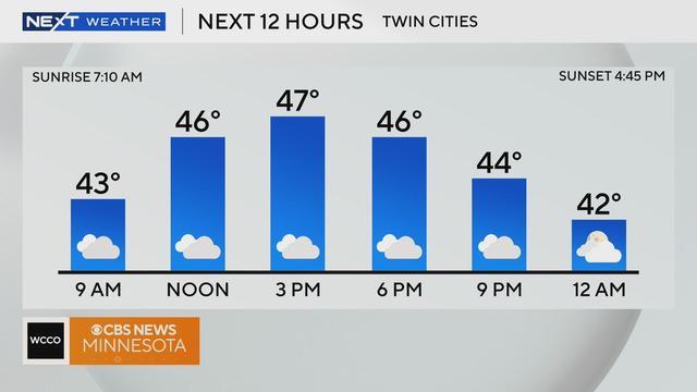
Patchy fog and mist early Thursday will give way to clouds as the Twin Cities dry out and warm up ahead of a pleasant fall weekend.
Watch CBS News

Patchy fog and mist early Thursday will give way to clouds as the Twin Cities dry out and warm up ahead of a pleasant fall weekend.
Tuesday will start out cold, then the Twin Cities will get more wind and sunshine before the next rain event arrives.
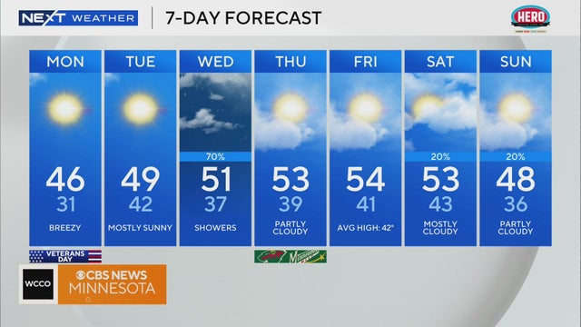
Things will dry out and clear up to start the week as cold winds bring temperatures down.
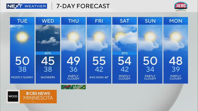
Expect the rest of the work week to stay dry before showers return this weekend.
After an Election Day featuring widespread showers, Minnesota will start to dry out and warm up on Wednesday.
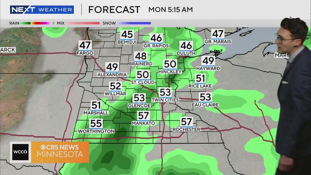
Morning rain and fog will give way to a mild, cloudy afternoon on Monday in the Twin Cities.
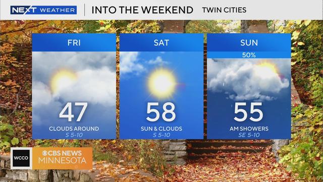
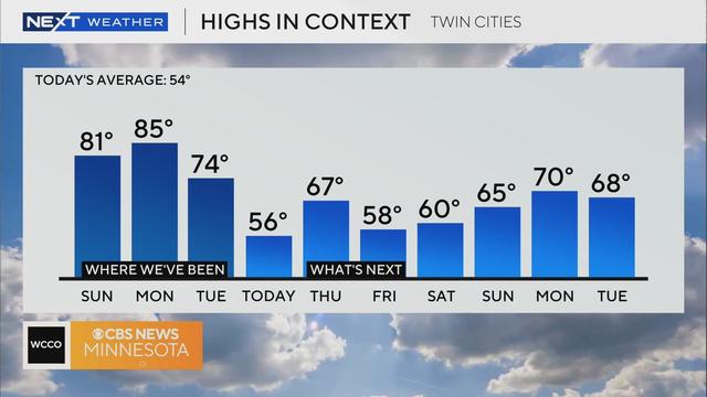
Temperatures will rise to the 50s and 60s over the weekend.
A NEXT Weather Alert is in effect for a very wet Halloween, with morning rain eventually transitioning to snow.
Wednesday will start out mild, but temperatures will drop throughout the day. Our Halloween forecast looks unideal for trick-or-treating.
The Twin Cities shattered a 102-year-old record for warmth on Tuesday afternoon, but things will feel much more autumnal come Wednesday.
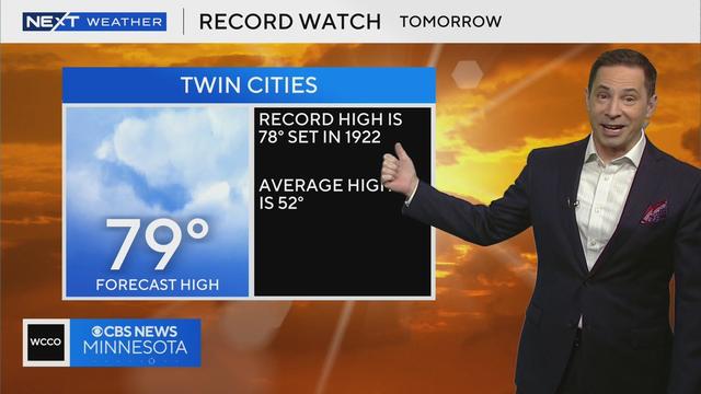
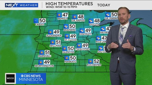
Highs will approach 80 on Tuesday as the next system positions itself far enough north to pull in some warm air.
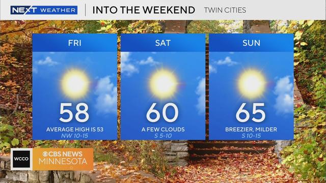
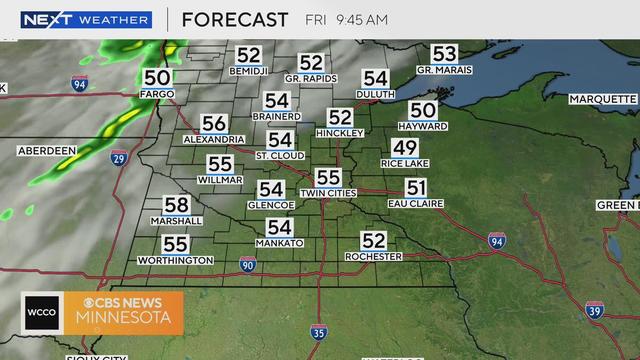
The Twin Cities will enjoy a typical fall day on Friday, with a pleasant weekend to follow.
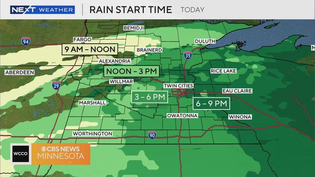
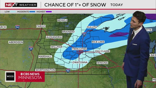
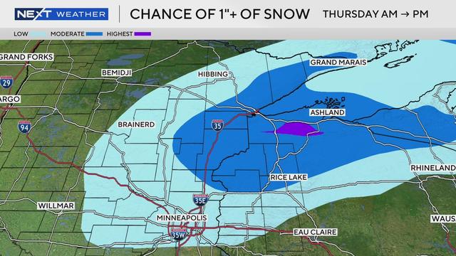
It's not much, but a system will move through Minnesota on Thursday producing rain around the region.
Cooler air is moving in Wednesday, making it feel more like October in Minnesota.
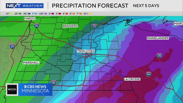
The metro could see some drops overnight into Saturday, though the rain will not be significant.