Colorado to see rain and snow later in the week
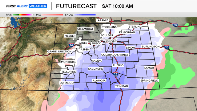
April storms are messy, and the bulk of the upcoming storm is expected during the day on Friday. Two weather factors are at play.
Watch CBS News

April storms are messy, and the bulk of the upcoming storm is expected during the day on Friday. Two weather factors are at play.
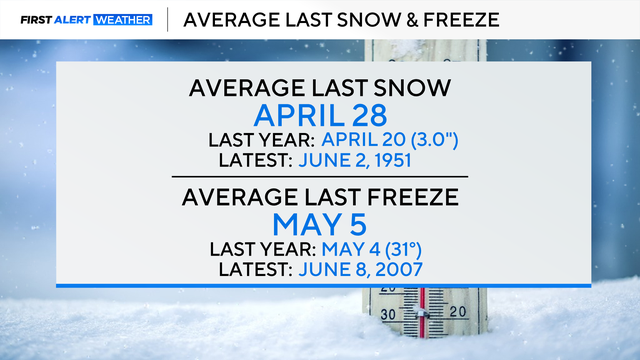
We are still about two weeks away from the average last snow in Denver and about three weeks away from the average last freeze.
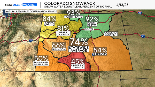
Colorado's snowpack continues to plummet just one week after its peak.
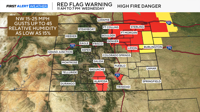
Elevated fire danger will be over portions of Colorado, including Denver, on Wednesday. Red Flag Warnings will go into effect beginning at 11 a.m. on Wednesday through 7 p.m.
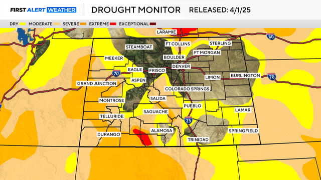
Currently, a significant portion of the high country and the extreme northern parts of the I-25 corridor are experiencing drought. This affects approximately 613,900 Colorado residents, a number that is expected to rise rapidly over the next month or two.
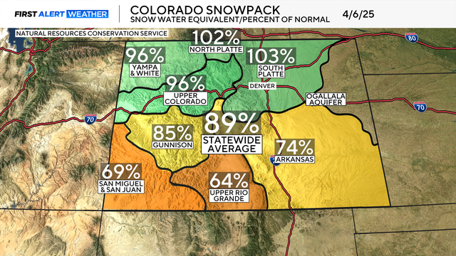
Today, April 7th, marks the historical peak of the snowpack across Colorado.
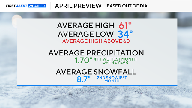
April showers bring May flowers... April has officially arrived!

The snowpack across Colorado is lagging below average.
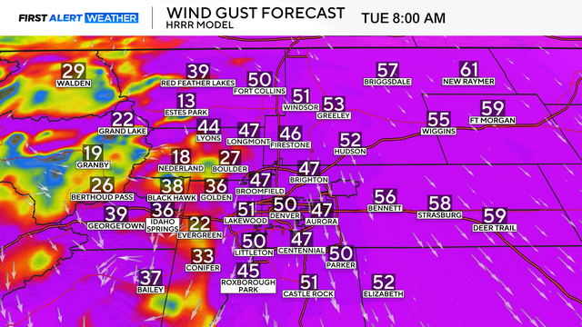
A mixed bag of weather will continue Tuesday night and affect the Wednesday morning commute across the Denver metro area and the Eastern Plains.

A home was destroyed by fire very close to the Hertha Lake Fire burn area.

A buffet of varying active weather conditions is expected across Colorado for the rest of this week.
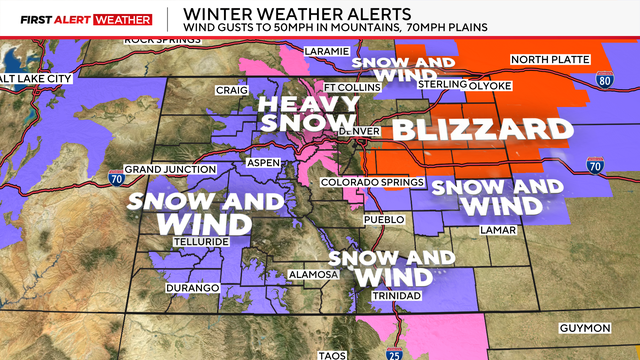
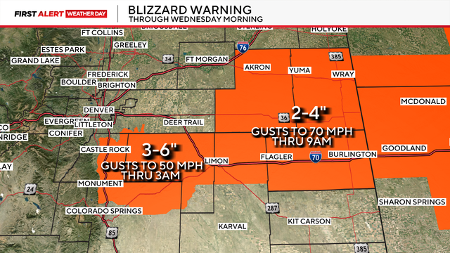
Blizzard Warnings have been issued for portions of Douglas, El Paso, Arapahoe, Adams, Elbert, Lincoln, Washington, Sedgwick, Phillips, Yuma, and Kit Carson counties. Snow totals will range anywhere from 2 to 10 inches.
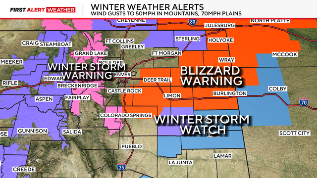
Blizzard warnings have been issued south and east of Denver, treacherous travel is expected overnight Monday into Tuesday afternoon for portions of the Plains.
A mild start to Monday with rain, snow, and wind expected by the evening. Significant accumulations are possible for portions of the high country, Palmer Divide, and Eastern Plains.
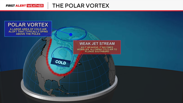
Cold air originating from the Arctic Ocean was dislodged earlier this week and spilled south across the United States. As a result, wind chills across the Eastern Plains bottomed out around 30 degrees below 0.