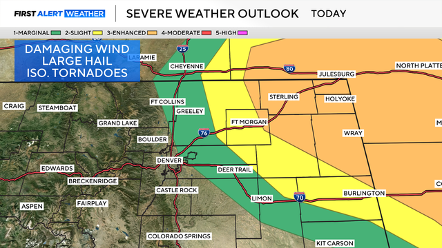
Egg-Sized hail possible across Eastern Colorado Sunday
Strong to severe storms are expected Sunday afternoon and evening, with the potential for large hail, damaging winds, and isolated tornadoes.
Watch CBS News

Strong to severe storms are expected Sunday afternoon and evening, with the potential for large hail, damaging winds, and isolated tornadoes.

Denver is experiencing above-average temperatures to start the week, coming within a few degrees of daily records. The city is still waiting on its first 90-degree day of the year.
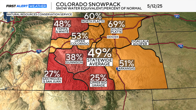
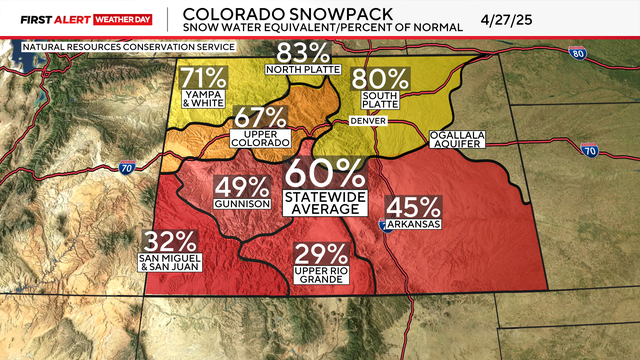
After up to 4 feet of snow fell in the mountains, Colorado's snowpack is still just 49% of normal, and melting two weeks ahead of schedule.

How many times have you heard "We need the moisture!" over the past three days? Well, Coloradans who uttered these words weren't wrong, and many locations finally received the desperately needed rain and snow.
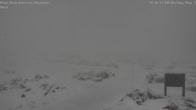
Perhaps the most impressive statistic is the 50 inches of snow expected to fall atop Pikes Peak by Thursday morning.
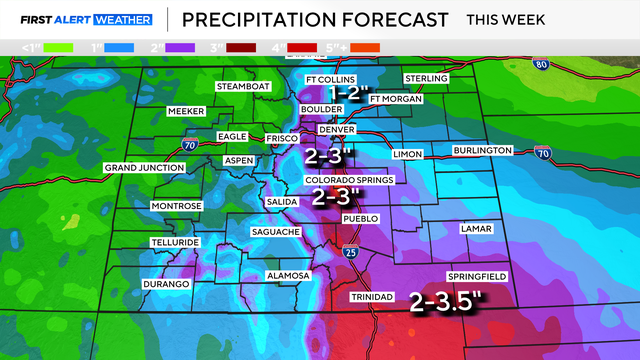
Spring slop is heading to Colorado, bringing snow to the mountains and heavy rain to Denver.
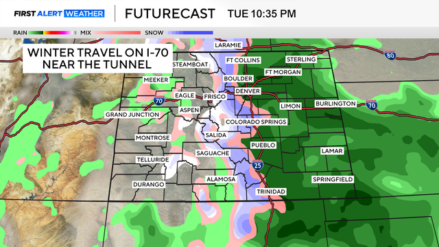
A sloppy May system will bring heavy rain and snow to Colorado for several days.
We will put a Band-Aid on the drought for the next month or so, but the overall dry pattern will return through mid-July with drought conditions expanding.
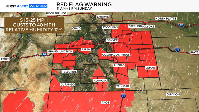
High fire danger is expected Sunday across much of Colorado.

Dr. Jason Persoff has spent more than 15 years chasing storms across Colorado and the Midwest. From tornadoes to tennis ball-sized hail, he's seen it all. Now he helps hospitals prepare for disasters.

A watch means to be ready, while a warning means act now.
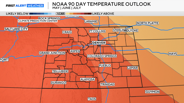
The Climate Prediction Center anticipates a hot and dry remainder of spring and start to summer.
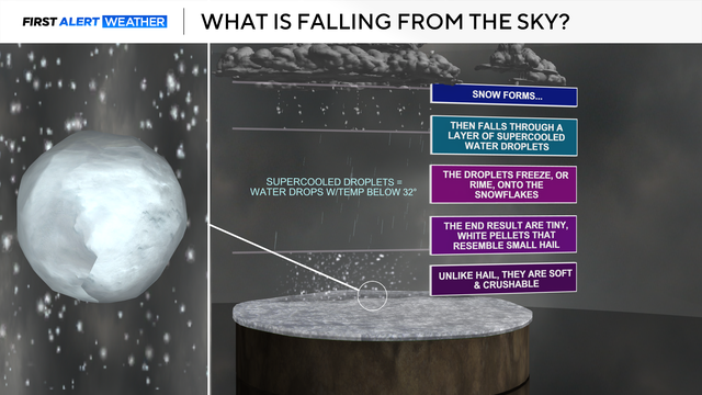
Graupel is a unique type of precipitation, also referred to as soft hail or snow pellets.
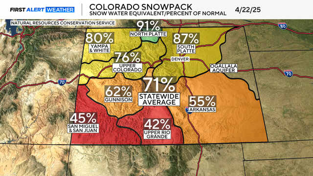
Snowpack woes continue across Colorado. Even with parts of the high country receiving over a foot of snow last weekend, we are still lagging significantly behind.
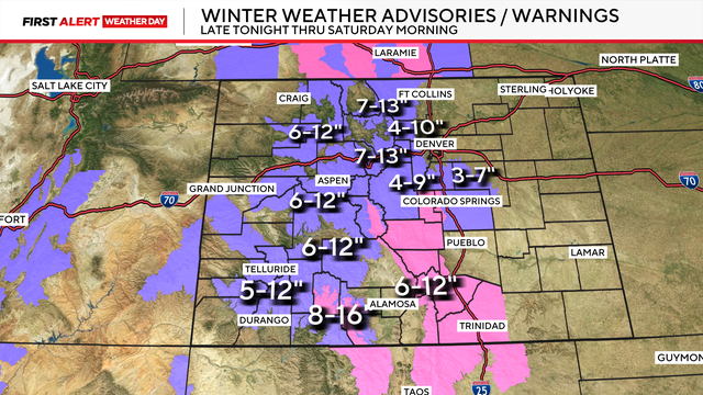
Winter weather is making a comeback! A long stretch of snow and cold continues on the Front Range and in the mountains.