High wind warnings issued for portions of Colorado through Thursday morning
Another day of high winds is expected across portions of Colorado.
Watch CBS News

Another day of high winds is expected across portions of Colorado.
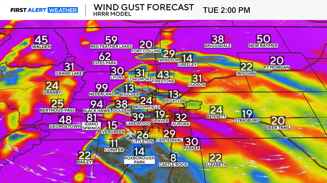
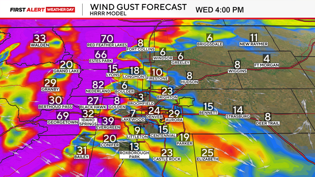
Wind gusts up to 95 mph will be possible across the Front Range mountains and the northern foothills, with the strongest winds north of I-70 and east of the Continental Divide.
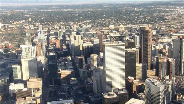
Temperatures will continue to plummet across Denver and all of Colorado on Wednesday night.
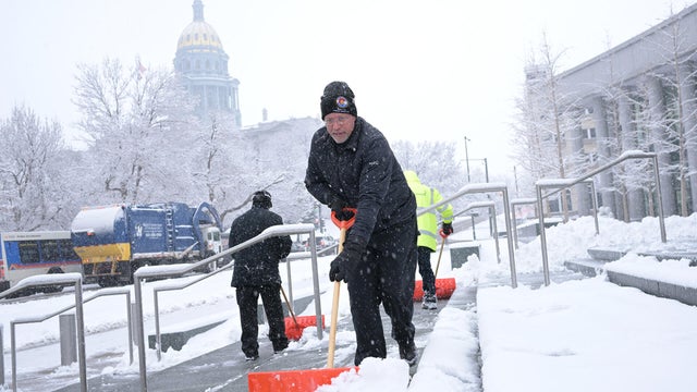
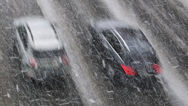
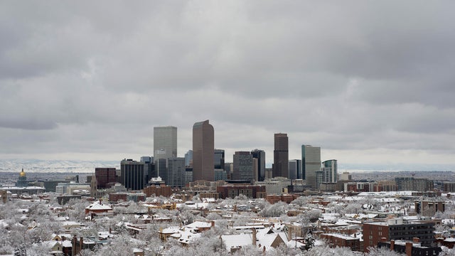
The largest snowstorm so far this season on Colorado's Front Range came to an end on Wednesday night, and some impressive snow total results have come in from many different areas. In the hardest hit areas, snowfall numbers reached near a foot.
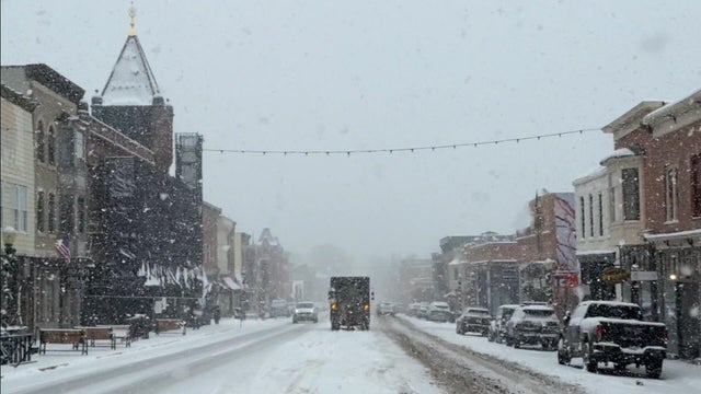
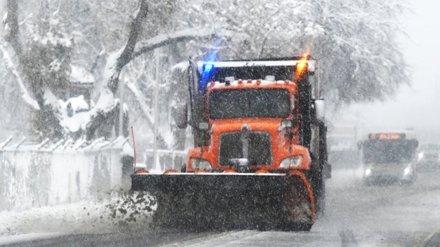
Snow will begin filling in across the I-25 corridor overnight and there's the potential for dangerous driving conditions. Wednesday is a First Alert Weather Day.
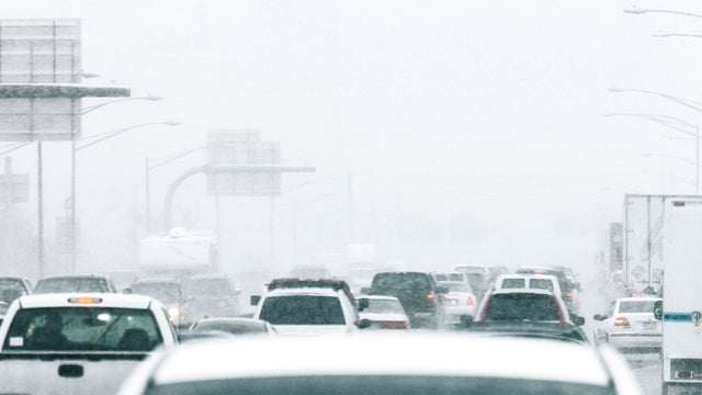
Accumulating snow is expected to blanket Denver and much of the I-25 corridor throughout the day on Wednesday.
Confidence continues to increase that a winter storm will bring the first snow of the season to Denver and many areas across Colorado's Front Range soon.
2025 officially surpassed 1894 for Denver's 4th latest measurable snow on record.
A significant weather pattern change by the middle of the workweek is ahead in Denver and other parts of Colorado.
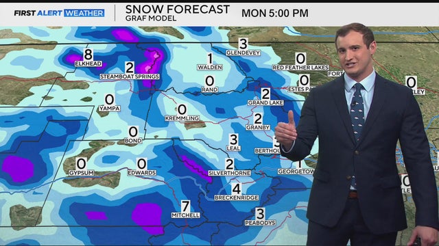
Light snow will continue across Colorado's high country through Monday afternoon, creating slick conditions along the I-70 corridor and several mountain passes early Monday. The bulk of the moisture is expected to arrive just before and during the morning commute.
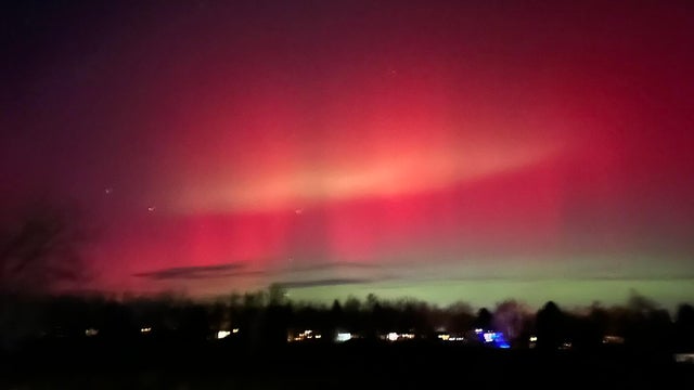
Across the state, Coloradans have been photographing the aurora borealis -- commonly referred to as the northern lights -- and even seeing them with their naked eye, which typically has a harder time seeing them than cameras with the right settings.
From the Front Range to the Palmer Divide and Cheyenne Ridge, elevation and wind direction often determine which parts of Colorado hit the snow jackpot during winter storms.
The Mile High City is now 18 days behind the average first snow and could finish among the 10 latest starts to winter on record.
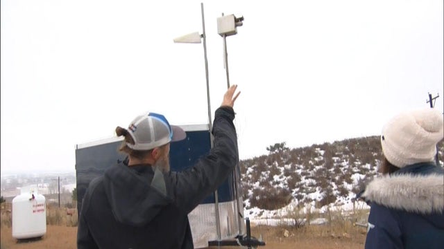
Scientists say cloud seeding can boost snowpack by up to 12% during storms that already form naturally, a small change that can add up for the Colorado River.
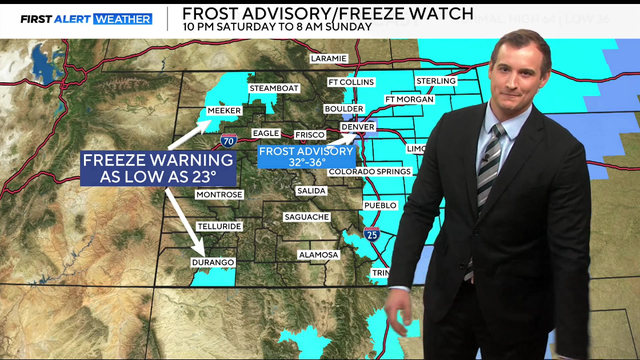
Temperatures will drop into the 20s and 30s overnight, ending the growing season for many parts of the state.