Scattered storms Thursday in Chicago
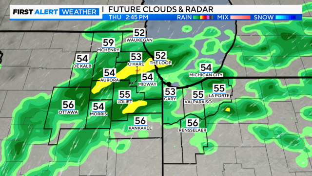
Highs climb to the 70s by midday as clouds move in as rain approaches.
Watch CBS News

Meteorologist David Yeomans joined the First Alert Weather team in 2024. You can see him on CBS News Chicago weekdays at 11 a.m. and 4 p.m., and reporting on the Climate Watch team.
David has been fascinated by the weather for as long as he can remember, becoming a National Weather Service-registered storm spotter at age 9. He went on to earn bachelor's and master's degrees in meteorology from the University of Miami. David holds the Certified Broadcast Meteorologist seal from the American Meteorological Society.
David studied under world-renowned climate change expert Dr. Brian Soden, publishing undergraduate research on the relationship between water vapor in the upper atmosphere and global warming. His graduate studies focused on hurricane rapid intensification and the role of mid-tropospheric humidity. He took a flight aboard the NOAA Hurricane Hunter aircraft as a Guest Scientist.
Prior to working at CBS, David was Chief Meteorologist at the NBC affiliate in Austin, TX, where he worked for 12 years.
David has been awarded four Emmy Awards, including for an investigation on climate change affecting Texas' water supply and for an educational weather series. He was named Best Weather Anchor by the Texas Association of Broadcasters. David appeared on the History Channel's "I Was There" series and GQ's "The Breakdown" as a weather expert, and was a TEDx speaker on climate change.

Highs climb to the 70s by midday as clouds move in as rain approaches.
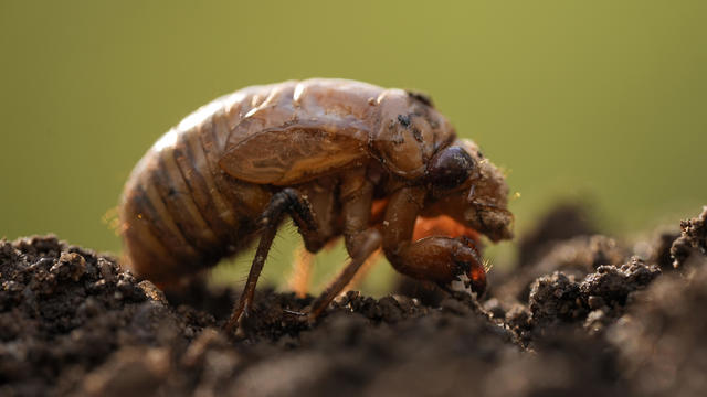
But as Chicago bakes in its third-warmest year on record, is a species directly cued by soil temperatures warming to 64 degrees being affected by the warming climate?
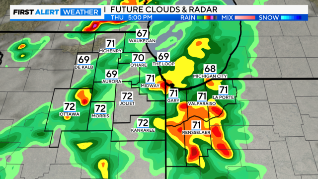
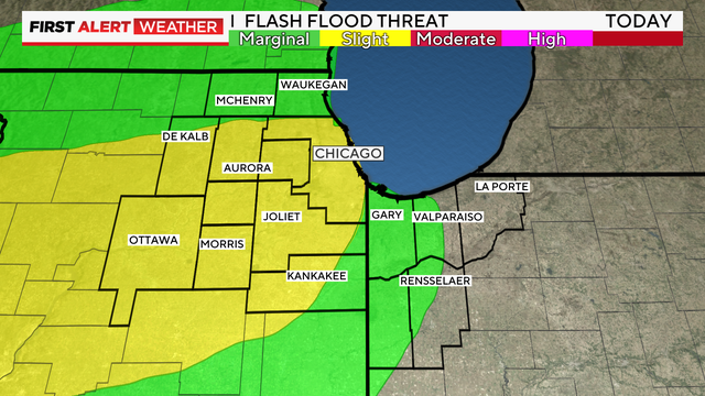
The threat of severe thunderstorms looks quite low, as temperatures are not expected to warm past the mid-70s before rain moves in.
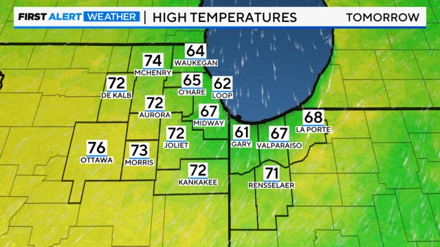
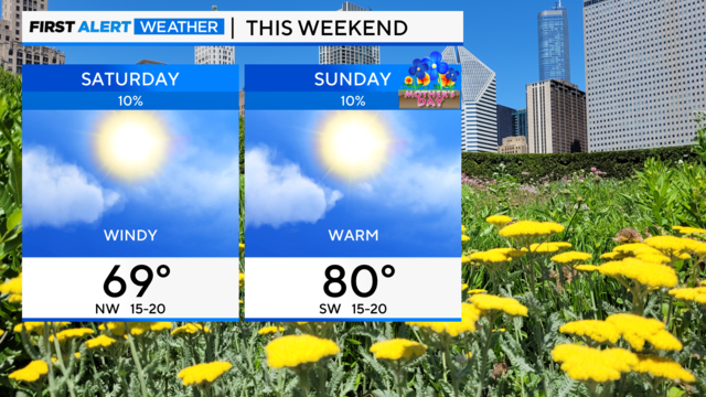
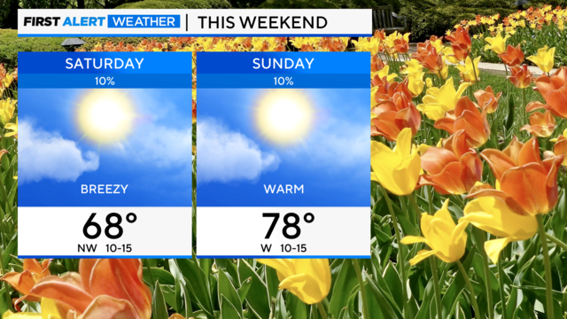
Highs return to the 80s by the weekend.
Showers will taper off Tuesday as temperatures drop to the 50s.
The storms are not expected to be severe but may contain lightning and wind gusts up to 40 miles per hour.
It will be a noticeably cooler day with breezy and wet conditions and highs near 60s.
Following severe storms on Tuesday, Chicagoans are enjoying a nice break in the weather this Wednesday. But the next storm system is approaching quickly from the west.
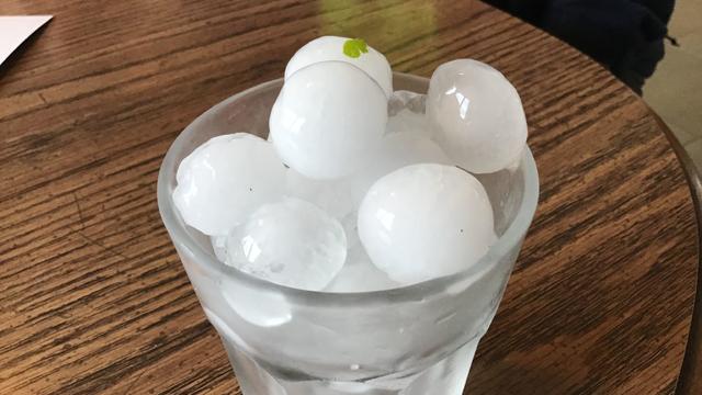
Tinley Park saw golf-ball-sized hail and Orland Park saw ping-pong-sized hail, according to the National Weather Service.
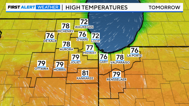
Lovely weather is in store until Tuesday, but two rounds of strong to severe storms could come soon.

Sunday plans look lovely with cooler, dry weather behind a cold front. Periods of rain return much of next week.

While rain will be isolated throughout the day, widespread rain and thunderstorms move in overnight, when a nice soaking of 0.50" to 0.75" is expected.

Following a trace of snow in the first few days of the month, 18 of 30 April days featured above-normal temperatures at O'Hare

The warm front will also lead to thunderstorm development during the afternoon and evening.
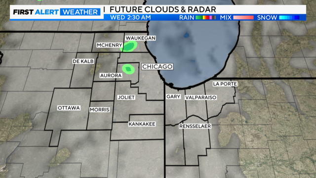
Warm sunshine was a pleasant sight in the Chicago area on Tuesday, and it returns in your forecast on Wednesday.