Goin' to the Lake: Chris Shaffer and Joseph Dames are in Shell Lake
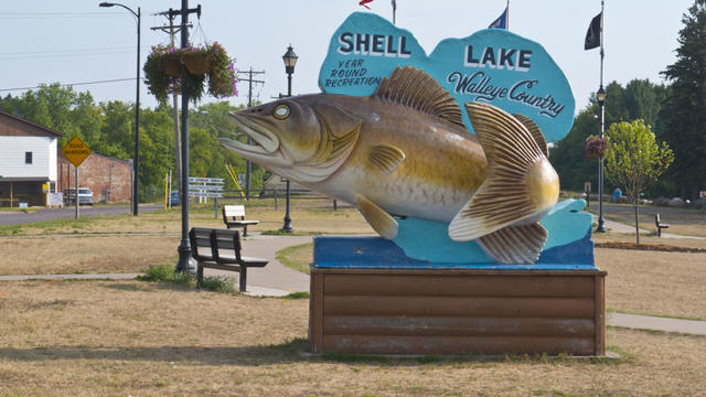
WCCO's next Goin' to the Lake begins Thursday as Chris Shaffer and Joseph Dames head to Shell Lake, Wisconsin.
Watch CBS News

WCCO's next Goin' to the Lake begins Thursday as Chris Shaffer and Joseph Dames head to Shell Lake, Wisconsin.
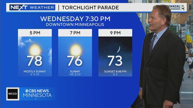
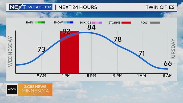
A really nice Wednesday in the works with high pressure and a gentle wind coming in out of the east.
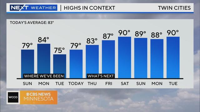
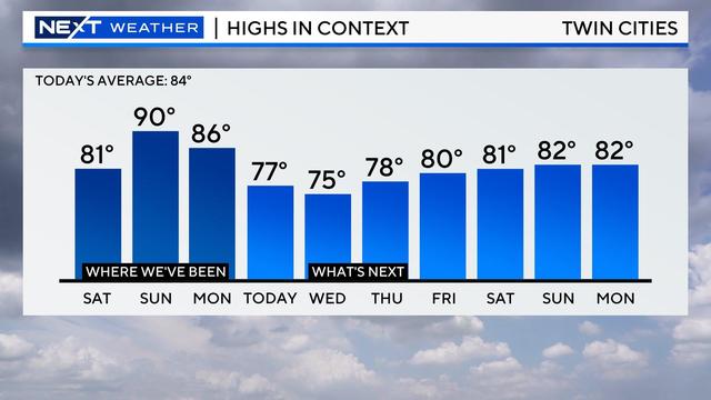
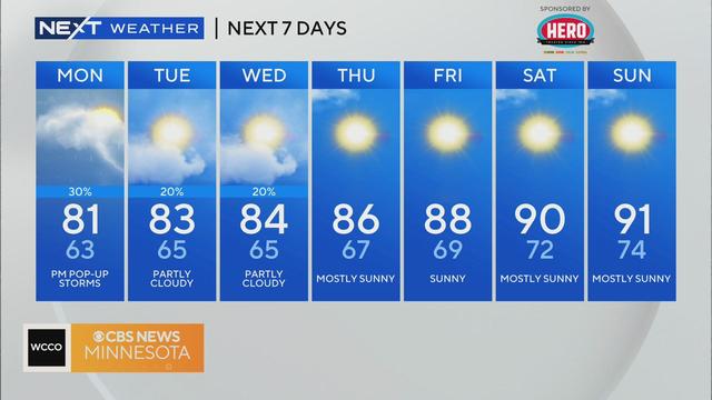
Wednesday will be the most comfortable day of the week with highs around 80 degrees and plenty of sunshine.
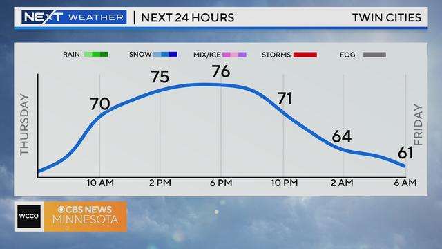
The Twin Cities will soak up the sunshine on Thursday — a #Top10WxDay!
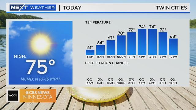
Wednesday kicks off a stretch of lovely summer weather in the Twin Cities.
Aside from a slight chance of isolated showers on Tuesday, the next few days of the forecast look dry.
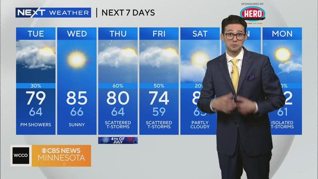
Brace for more rain and storms on Monday in parts of Minnesota, including the Twin Cities.
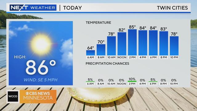
We are starting to crank up the heat in the Twin Cities, with both Thursday and Friday featuring temperatures in the mid-to-high 80s.
Wednesday will be another day of isolated storms in the Twin Cities before we dry out and heat up this weekend.
The Twin Cities will experience a few more days of scattered showers before temperatures head into the 90s at the end of the week.
Overnight storms have cleared the metro and the next round won't begin until around dinnertime.
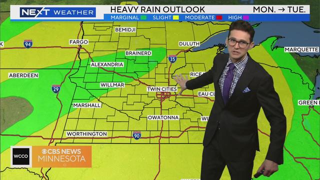
Monday will be mostly dry, though showers and storms will likely arrive in the overnight hours heading into Tuesday.
Our sunny start will fade behind clouds on Thursday as our next disturbance begins to arrive.
After a small chance for some passing showers in the morning, sunshine will arrive and give us a dry Tuesday in the Twin Cities with a high of 85 degrees.
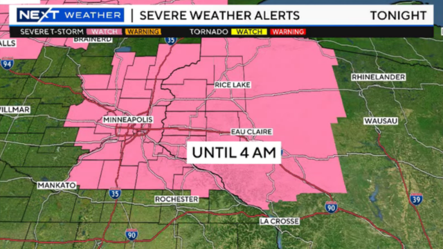
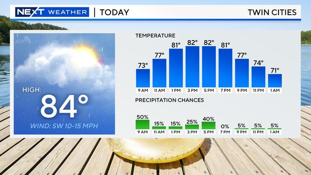
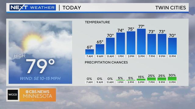
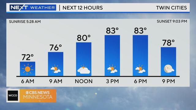
Monday will be hot and humid before potentially damaging severe weather moves in during the evening hours.