
Chicago First Alert Weather: Rain and snow on Saturday
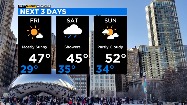
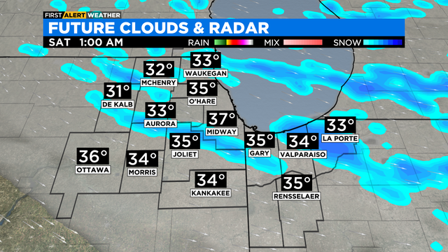
It will be cloudy and dry to start Saturday, then numerous showers move in from the west by midmorning.
Watch CBS News

It will be cloudy and dry to start Saturday, then numerous showers move in from the west by midmorning.

Wet snow mixed with rain is possible, but mainly for areas north and northwest of Chicago.
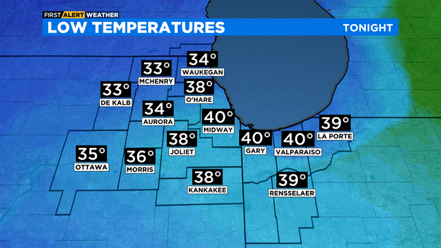
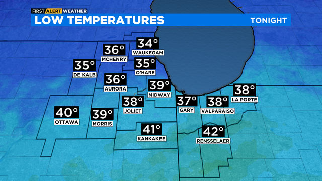
Lows Thursday night will range from mid 20s to low 30s across the area.
CBS 2 Chief Meteorologist Albert Ramon says a rain and wet snow mix is in the forecast for Thursday morning.
Showers increase Tuesday night with a few isolated thunderstorms possible.
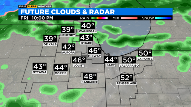
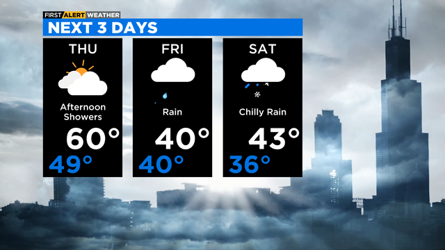
Scattered showers for Friday, but mainly in the afternoon. Light snow showers will be possible Friday night. No accumulation of snow is expected.
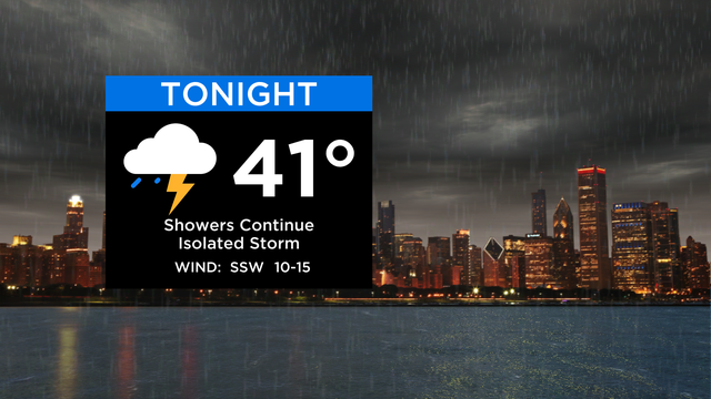
A soggy night ahead with numerous showers and isolated storms in the forecast.
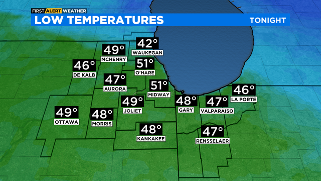
According to CBS 2 Chief Meteorologist Albert Ramon, lows Tuesday night will be in the upper 40s and low 50s.
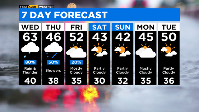
A big shift in the weather pattern is coming after an afternoon in the 70s on Monday.
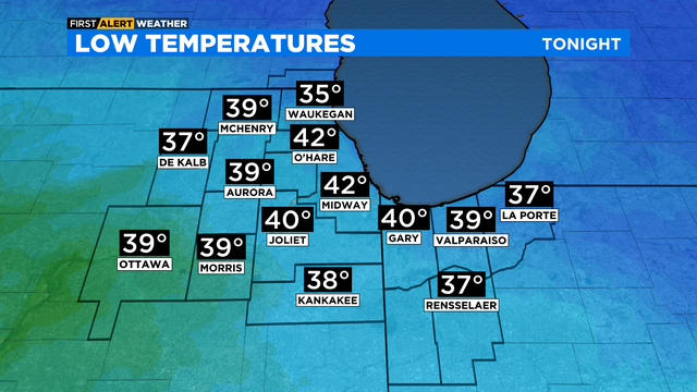
Scattered showers continue tonight, along with a strong north wind gusting to 30 miles per hour at times. Lows will be in the upper 30s and low 40s.
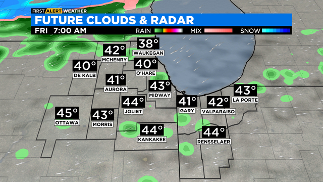
Patchy areas of rain are possible overnight into Friday morning.
A front will pass through the area on Thursday allowing for a chance for light rain in the afternoon and evening.
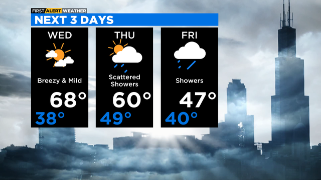
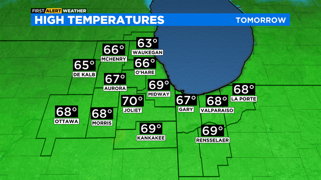
Partly cloudy and much warmer for Wednesday. A strong south wind will boost highs into the upper 60s to near 70 degrees. That's more than 20 degrees above average for this time of year.
A breezy south wind returns on Wednesday bringing temperatures back to the mid to upper 60s for highs.
It will be mostly cloudy with temperatures holding steady overnight through Saturday morning in the upper 30s and low 40s.