Chicago First Alert Weather: showers and thunder possible tonight, clearing and warmer tomorrow
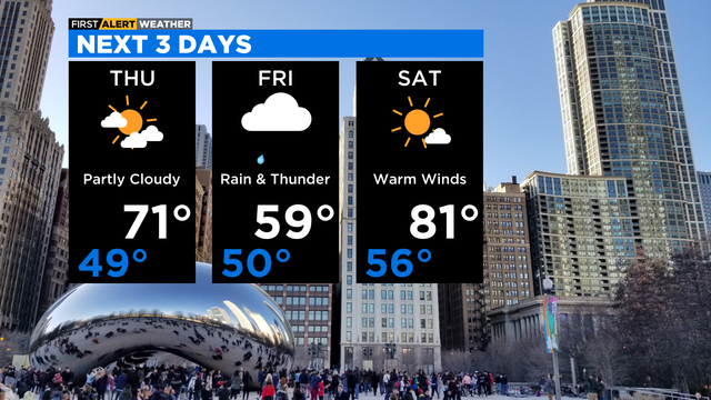
Highs will be warmer in the upper 60s and low 70s on Thursday.
Watch CBS News

Highs will be warmer in the upper 60s and low 70s on Thursday.

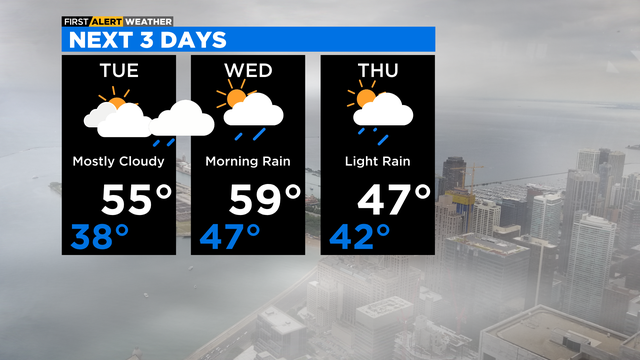
Rain chances decrease by Thursday morning. Then it'll be partly cloudy and much warmer on Thursday with highs around 70 degrees. Showers likely on Friday with highs back in the low 60s.
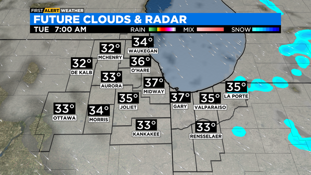
Scattered areas of light rain and snow flurries are expected Monday evening with temperatures in the mid- to upper 30s.
Lighter winds for Easter Sunday with highs in the upper 40s. An east wind will keep temperatures in the low 40s along the lake. Showers possible Sunday evening.
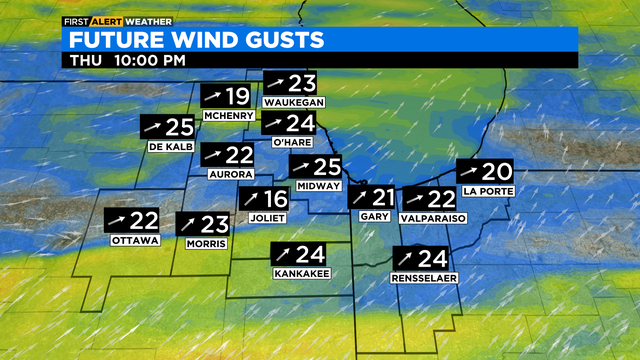
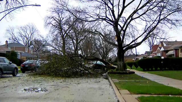
A High Wind Warning was in effect Thursday for the entire Chicago area and beyond.
Scattered showers will persist through the evening.
There is chance for scattered showers and isolated thunderstorms Tuesday evening.
Damaging winds are the primary threat, but isolated tornadoes cannot be ruled out.
Isolated areas of a light snow are possible overnight. Lows will be in the low 30s.
Some accumulating snow is possible, but mainly on elevated surfaces and grassy areas. Rainfall amounts will be generally under a quarter of an inch. Highs on Friday will be in the low 40s.
Patchy rain this evening, then a slight chance for a rain and snow mix overnight. Lows in the mid 30s.
Breezy tonight with patchy showers possible. Lows in the mid to upper 30s in most locations.
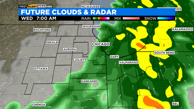
Rain showers for Wednesday morning, then partly cloudy and windy in the afternoon. An isolated shower is possible in the afternoon with highs in the upper 50s.
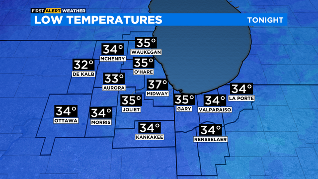
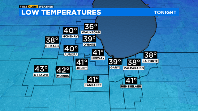
It will be mostly cloudy tonight with lows in the mid to upper 30s.
Increasing clouds late today, then rain increases by mid to late evening. Showers are likely overnight through early Monday morning