Chicago First Alert Weather: Mild temperatures ahead
Passing clouds overnight, but we'll be mostly clear by Daybreak Tuesday.
Watch CBS News

Passing clouds overnight, but we'll be mostly clear by Daybreak Tuesday.
According to CBS 2 Chief Meteorologist Albert Ramon, temperatures will be steady through the late afternoon, in the low to mid 20s. Wind chills will be in the single digits and teens.
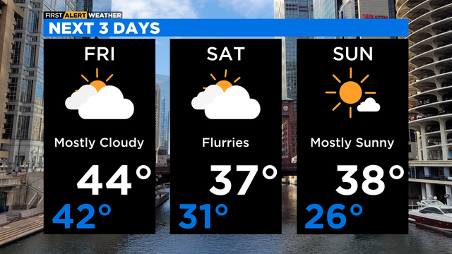
Highs on Friday will only be in the mid 20s, but wind chills will be in the teens all day.
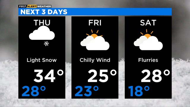
A reinforcing cold front moves into the area on Thursday, pushing in even colder air for the days ahead.
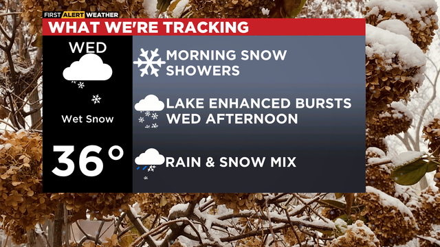
According to CBS 2 Chief Meteorologist Albert Ramon, a Winter Storm Warning is in effect for La Porte County, Indiana from 4:00 a.m. Wednesday to 10:00 a.m. Thursday for the threat of lake effect snow adding up to over five inches.
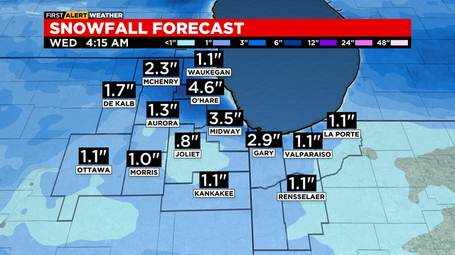
Snowfall amounts will range from little to no accumulation near the lake to as high as 5 inches in some spots.
The strongest cold front so far this season moves into the area after midnight.
A strong cold front arrives Thursday night and will make for a much colder Friday.
Highs this weekend will be very cold, with temperatures in the mid 30s during the day and mid 20s at night.
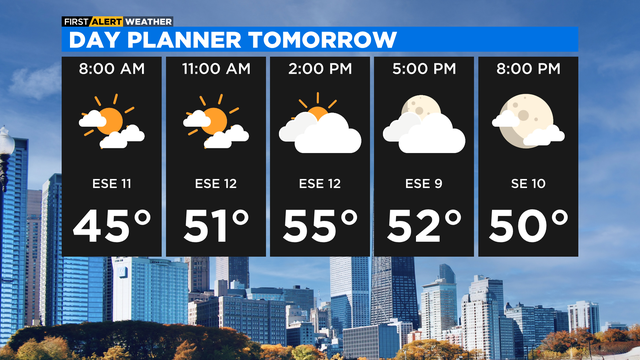
After a mostly clear morning, we'll have increasing clouds in the afternoon on Tuesday with highs in the mid to upper 50s.
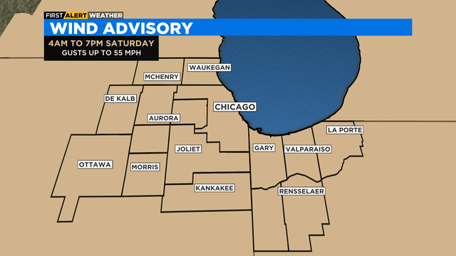
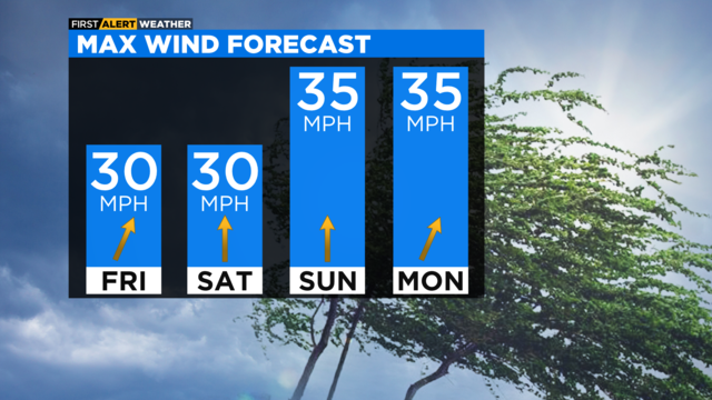
Gusts could be as high as 55 miles per hour.
Saturday will also be very windy, with wind gusts at times around 50 mph in the morning and early afternoon.
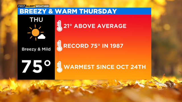
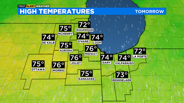
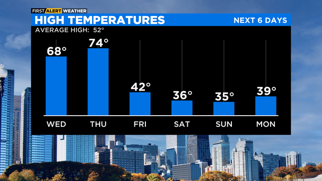
High temperatures Thursday will be running 20 degrees above average in the mid-70s.
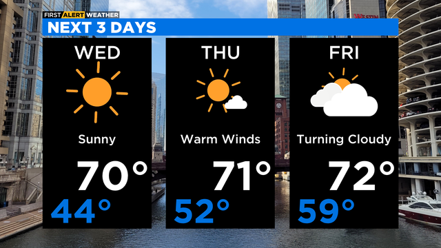
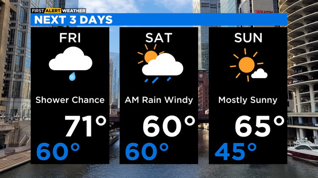
Lots of sunshine for Wednesday afternoon with highs around 70 degrees.
Average highs this time of the year are around 60 degrees, so we're tracking nearly 20 degrees above average in some areas.