Chicago area escapes severe weather Thursday night, skies clearing for Friday
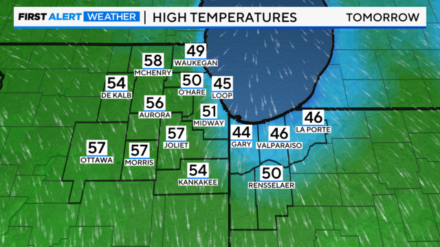
Skies will clear by Friday, leaving cloudy skies and temperatures in the 50s inland and the 40s lakeside. Skies will turn cloudy by Sunday.
Watch CBS News

Skies will clear by Friday, leaving cloudy skies and temperatures in the 50s inland and the 40s lakeside. Skies will turn cloudy by Sunday.
A weather pattern change arrives Tuesday night with a chance for showers into early Wednesday.
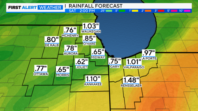
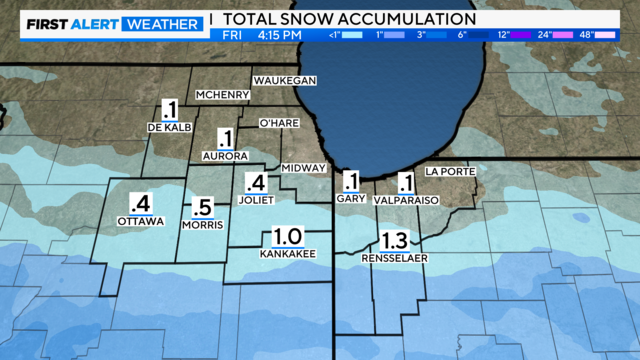
Rainfall totals are forecast to be over one inch in some spots, especially south of I-88.
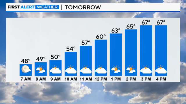
Friday will be very wet with a 90% chance of rain.

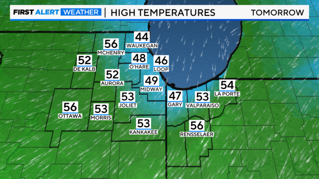
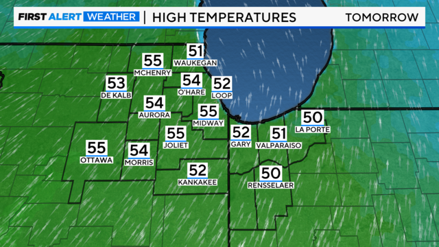
Behind the front, drier and cooler weather arrives Tuesday through Thursday with highs in the 40s and 50s.

Record-breaking warmth is here and high temperatures will be near 30 degrees above average.
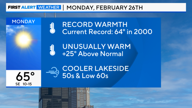
After a brief cold snap this weekend, temperatures will soar to record warmth early this week ahead of an approaching cold front.

Clearing for Saturday and colder with highs in the mid-30s but on Sunday we jump 20 degrees warmer!

Take a look inside everything from academics to school spirit.

High pressure builds Saturday with dry and cool conditions with highs in the upper 30s.
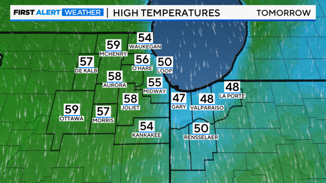
Much colder air will arrive behind this system, with highs only in the low 40s on Friday and upper 30s on Saturday.

The emergence of greenery and blossoms is underway soon as El Niño fades away, and we transition to a neutral weather pattern.

The weather pattern will bring very warm conditions at times over the next several days.
Behind the front, temperatures will briefly cool down on Friday and Saturday.
Lows Saturday morning are in the teens with highs only in the low 30s. Gusty northwest winds will create wind chills Saturday morning in the single digits.