Unsettled pattern continues through the weekend, bringing afternoon rain
Spotty showers on Friday morning will taper off, but there's still the threat of an isolated storm in the afternoon.
Watch CBS News

Spotty showers on Friday morning will taper off, but there's still the threat of an isolated storm in the afternoon.

A team at Brigham Young University looked at particulate matter for two years and found higher concentrations of metals like copper and barium left following fireworks displays.

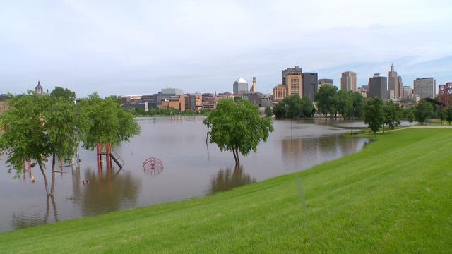
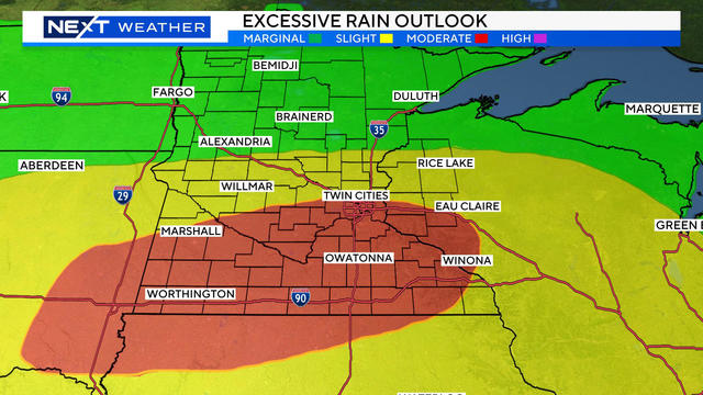
It's been a wet summer in Minnesota with residents seeing more than five inches above average of rain for this time of year.
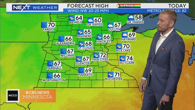
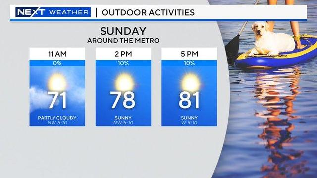
The sun is making its return in what will be the first dry weekend since early May.
Even though some of the smaller rivers like the Cannon and Cottonwood have already crested, that isn't the case everywhere.
Our sunny start will fade behind clouds on Thursday as our next disturbance begins to arrive.
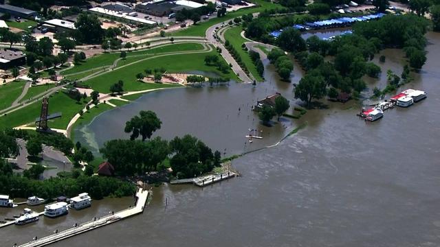
With the ground waterlogged, our most recent weather pattern was a recipe for disaster.
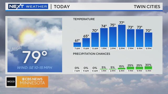
High pressure will keep the Twin Cities dry on Wednesday, with a mix of sun and clouds in the afternoon.
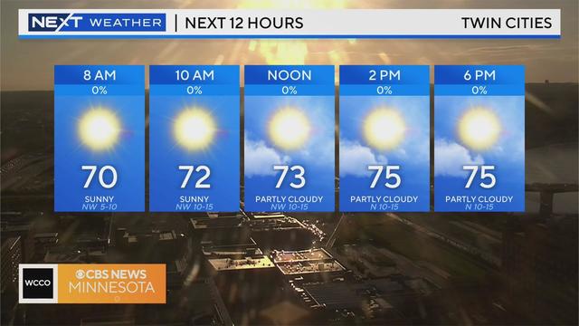
For the first time since June 14, we have no rain to worry about in the Twin Cities and most of Minnesota.
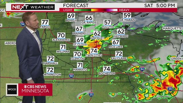
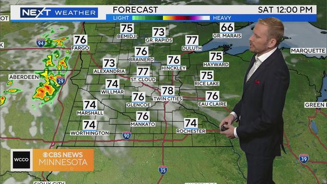
The last push of steady rain and stronger storms is exiting east across southern Minnesota on Saturday morning.
More scattered showers are on tap Thursday afternoon and evening, mainly across southern Minnesota.
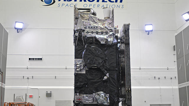
The National Oceanic and Atmospheric Administration, or NOAA, is getting ready to launch a new weather satellite into space.
Sunday is a NEXT Weather Alert day due to excessive heat and humidity in the Twin Cities.
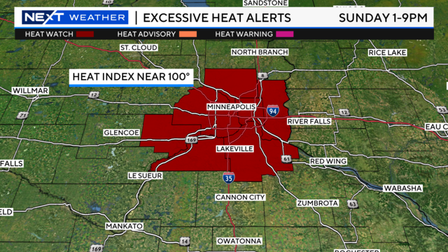
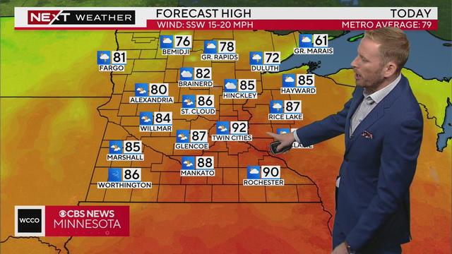
You can expect a scorcher of a Father's Day weekend, followed by more storms late next week.
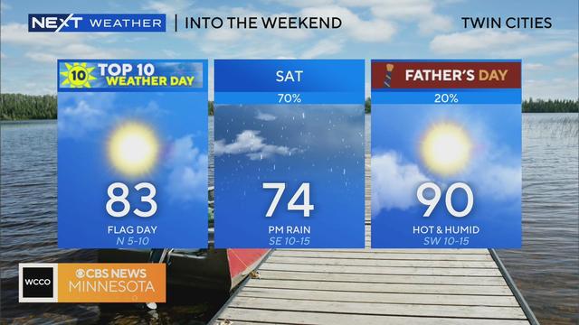
A great day of weather is on tap for Minnesota Friday, but there is some rain expected over the weekend. Plus, Father's Day is looking like a bit of a scorcher.