
Warmest weekend in two weeks on tap this weekend, temps expected to drop on Monday
This weekend will be the warmest in two weeks, however the warm-up will be short lived.
Watch CBS News

This weekend will be the warmest in two weeks, however the warm-up will be short lived.
Minnesota will start to warm up on Friday, with temperatures pushing into the 40s this weekend.

For decades, families flocked to the eighth-floor auditorium of Dayton's in downtown Minneapolis for its famous holiday displays. The tradition ended nearly a decade ago when the department store closed, but now some of the Dayton's elves have a new home.
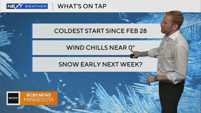
The Twin Cities are still dealing with dangerously cold wind chills on Thursday.

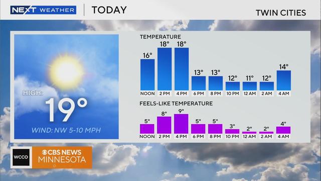
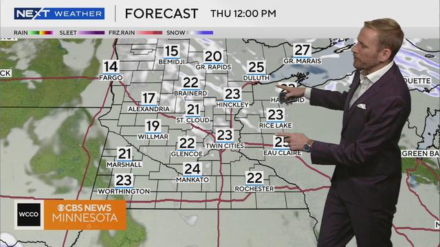
Highs try to warm a little more but only reach the lower 20s with wind chills closer to 10.
Expect a fairly quiet, but cold weekend as Canadian high pressure nudges in.
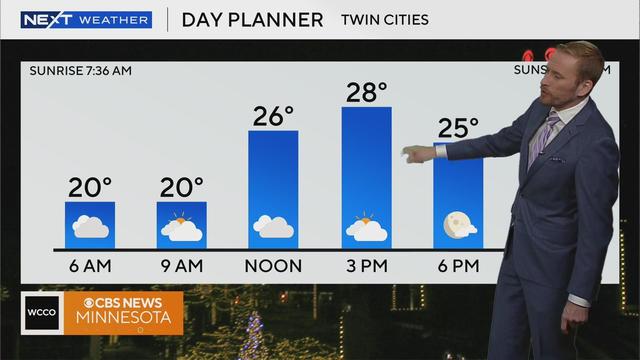
Despite forecasted sunshine, Black Friday shoppers should bundle up with high temperatures in the teens across Minnesota.
The cold is settling in over the holiday, and with the gusty winds, it'll feel especially chilly.
More of the same for Saturday, until snow moves in for some on Sunday night.
Friday will be another cool and cloudy day, with Saturday following suit.
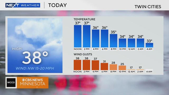
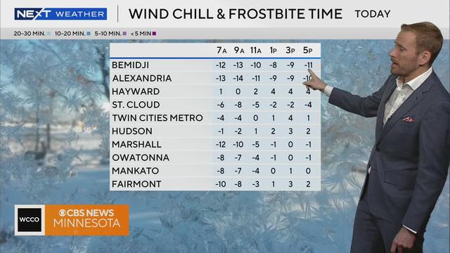
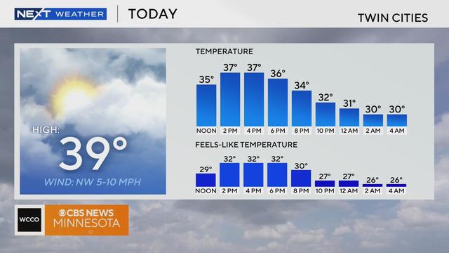
Overcast skies and northwest winds with gusts up to 35 mph will make the Twin Cities feel chilly on Thursday.
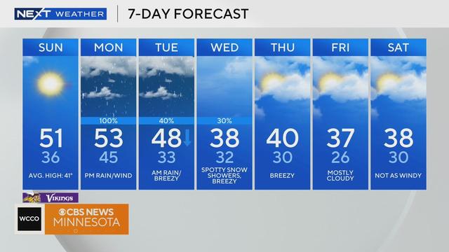
Sunday will be full of sunshine with high temperatures near 50 before things go downhill for the start of the work week.
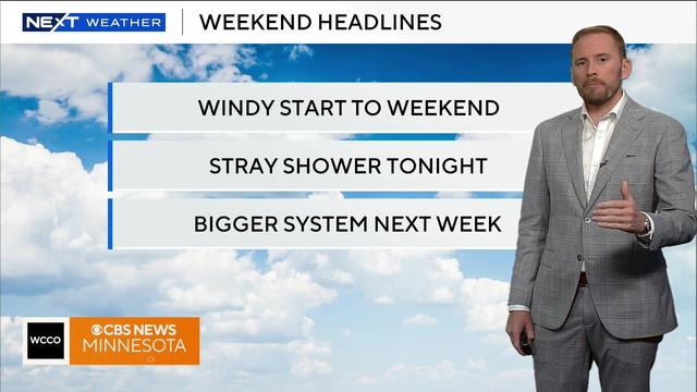
A weak storm system will pass to through the north this weekend, bringing some changes to the region.
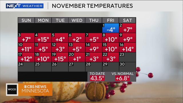
We're nearly midway through November and scant snowflakes have reached the ground in Minnesota, which has many of the state's residents wondering when they'll need to break out the shovel or snowblower.
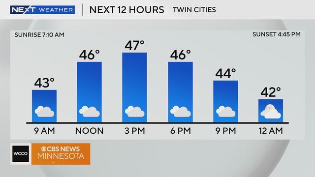
Patchy fog and mist early Thursday will give way to clouds as the Twin Cities dry out and warm up ahead of a pleasant fall weekend.