La Niña is officially here. Here's how it may Minnesota's winter.
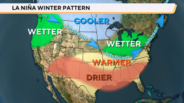
After a long wait, NOAA says La Nina is officially here. That's when the sea surface temperatures along the equator in the Pacific Ocean drop below average.
Watch CBS News

After a long wait, NOAA says La Nina is officially here. That's when the sea surface temperatures along the equator in the Pacific Ocean drop below average.

Aside from some flurries on Friday morning, it's a fairly quiet end to the week in the Twin Cities with a mostly cloudy sky.
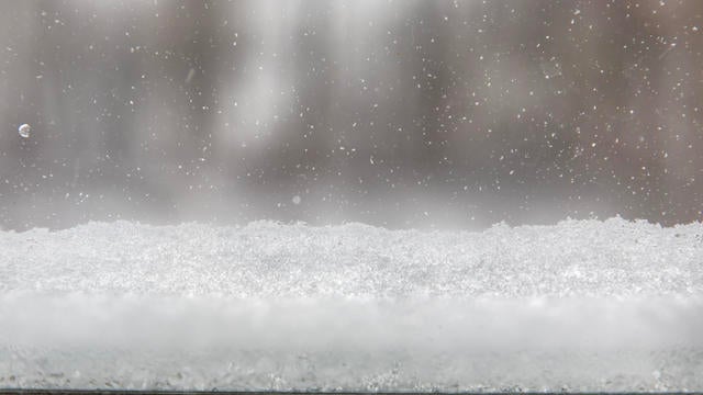
Light snow is coming to the Twin Cities on Thursday, with a weekend clipper bringing accumulating snow and an arctic chill early next week.

The John Beargrease Sled Dog Marathon stretches from Duluth to Grand Portage.

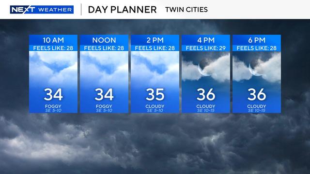
Clouds will dominate the day with the hopes of any sun later very low.

After a soggy Friday, the rain has wrapped up for the Twin Cities and will continue to lift northeast through the morning.
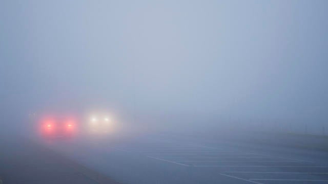
A dense fog advisory is in effect across Minnesota through noon on Friday, and early isolated showers are possible ahead of widespread rain later in the afternoon and evening.

2024 was indeed the warmest year on record in the Twin Cities, including warmth records set in the fall and winter.

Thursday will be a mild one in the Twin Cities ahead of some December rain and even warmer temperatures.

A foggy Christmas Day could lead to slick spots on the roads.
High temperatures will stay in the 30s through Monday — an improvement after last week's deep freeze.
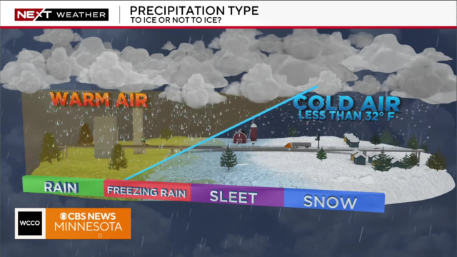
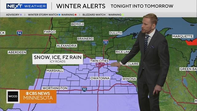
Saturday will start off dry but a light snow (and potentially icy mix) will move into the metro as the morning progresses.
Friday kicks off with more frigid conditions in Minnesota, but temperatures, clouds and wind pick up through the afternoon before our next storm.
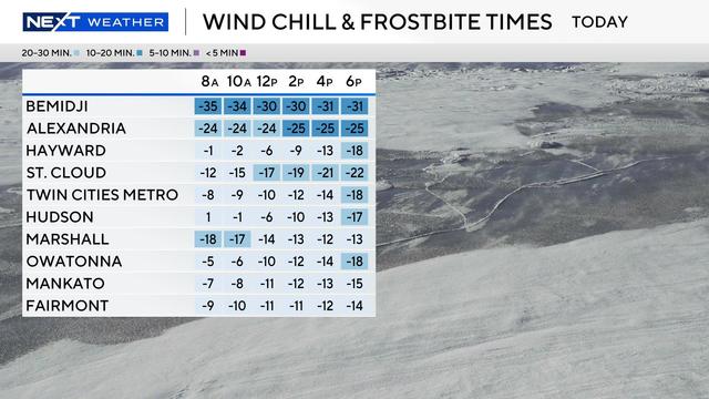
Cold weather advisories are in effect for northern Minnesota from Wednesday evening through Thursday morning for dangerous wind chills around minus 35 degrees.

In the Twin Cities on Sunday, temperatures will get up into the 40s in the afternoon before gusty winds move into the area.