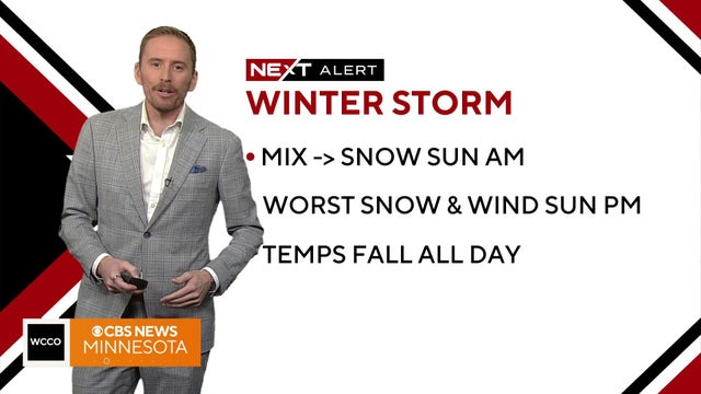
Icy mix of sleet, freezing rain and snow possible Sunday
It will be a messy forecast today as an icy mix of sleet, freezing rain, and snow will move through the metro starting around noon.
Watch CBS News

It will be a messy forecast today as an icy mix of sleet, freezing rain, and snow will move through the metro starting around noon.
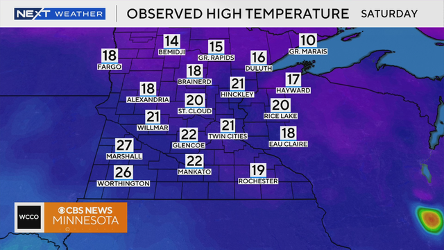
Saturday will be warmer than the past few days with highs in the low 20s, much closer to average for this time of year.

Not only did we witness some big storms on Earth in 2025, but the sun also put on a show for the country, fuelling a number of solar storms throughout the year.
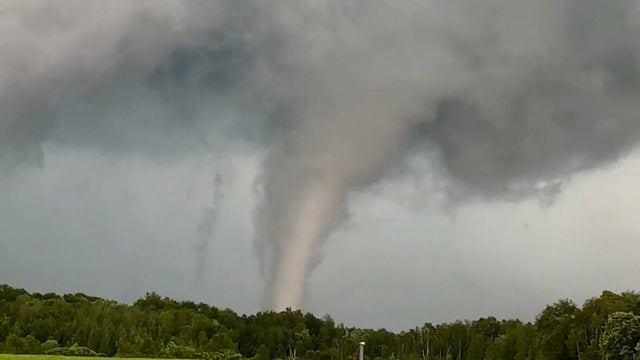
From severe weather to extreme heat and everything in between, 2025 was a year full of big swings and big storms across Minnesota.
Saturday will see temperatures in the 40s before a major drop off comes on Sunday.

Temperatures on Saturday will be in the low 40s.

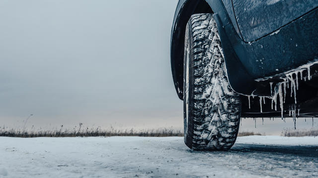
A NEXT Drive Alert is in effect due to the potential for icy roads with possible freezing drizzle in northern and central Minnesota.
Christmas Eve will be mild with mostly cloudy skies, with afternoon temperatures reaching the upper 30s.
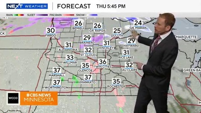
A NEXT Weather Alert is in effect Thursday for a little snow but a lot of wind and cold that could cause roads to freeze up across the Twin Cities.
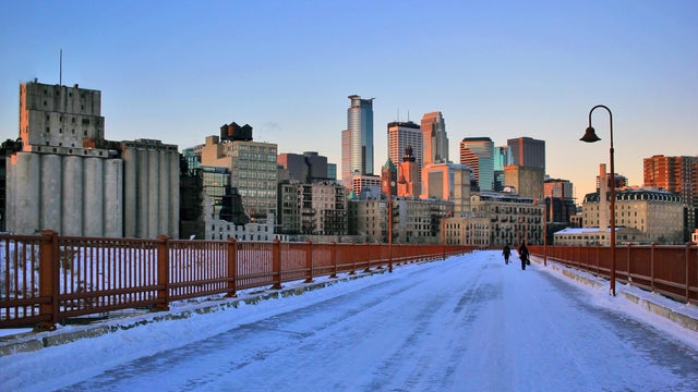
Minnesotans are waking up to the coldest air of the season so far on Sunday.

"Panettone is sweet, sweet bread with fruits. It's very popular for Christmas in Italy and everywhere," said Jaime Martinez, executive pastry chef at Cossetta's.
Dangerous cold is the big story all weekend as the Twin Cities as temperatures are expected to plummet overnight Saturday.
If temperatures remain below zero all day Saturday, it will be the coldest day in the metro since Feb. 17, the earliest zero-or-lower high since Dec. 12, 2000 and the 15th earliest zero-or-lower high on record.

A clipper will throw some light snow to southwestern Minnesota into Thursday afternoon, with 1 to 3 inches of accumulation possible. A winter weather advisory is in effect in that region until 6 p.m. Thursday.
Tuesday's storm is gone, but some lingering flurries will slide through the Twin Cities on Wednesday.