Isolated showers, line of storms move into Philadelphia area Sunday night. Here's the weather forecast.
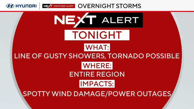
Showers and even a couple of stronger storms arrive in the Philadelphia area Sunday night. The entire area is under a NEXT Weather Alert because of these storms.
Showers are expected to hold off until late Sunday night as the front moves closer. The cold front will sweep through overnight into Monday morning, bringing a period of rain and a few gusty showers or isolated storms.
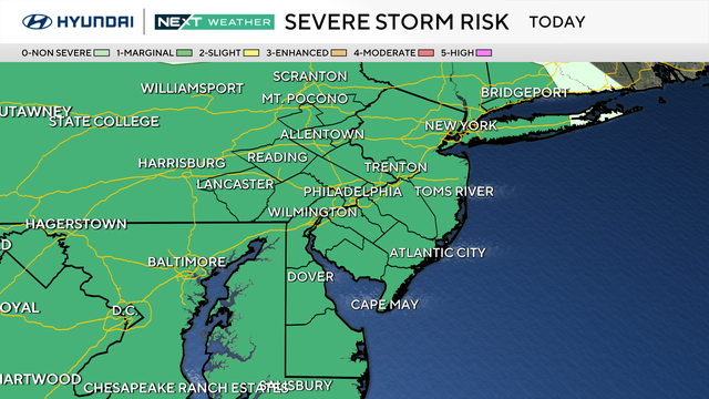
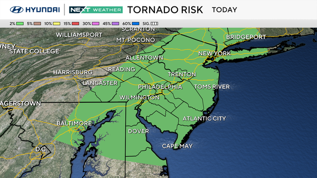
Instability looks limited, but a high amount of spin in the atmosphere could allow for a stronger wind gust to mix down with the heavier showers. The spin in the atmosphere will also produce a small threat for an isolated tornado.
While the threat is low, the timing of this threat for storms will be while most people are sleeping, which is why the NEXT Weather Team has issued a NEXT Weather Alert for Sunday night. Make sure that you have a way to receive severe weather alerts for your area in case a warning is issued overnight.
Otherwise, rainfall totals between a quarter inch and just over 1 inch are possible, but flooding is not expected.
Rough timeline for Sunday's showers, storms
Until around 8 p.m.: Dry, warm and breezy conditions
From around 8 p.m. to 12 a.m.: Isolated showers move into the region
From around 12 a.m. to 2 a.m.: Line of storms, isolated embedded gusty/severe storms with small tornado risk
From around 2 a.m. to 6 a.m.: Rain exits, skies partially clear, still breezy
Cool air comes back to town
Behind the front, temperatures drop sharply with highs Monday in the mid-50s to mid-60s and lingering clouds. While most of the region will be dry on Monday, there could be a few stray showers to the north on Monday afternoon.
A second, weaker cold front arrives Tuesday night into Wednesday with only scattered showers. Behind it, colder and drier air settles in, setting up potential frost or freeze conditions in some inland areas by Thursday night. High temperatures look to only peak in the low 60s for the second half of the week into the weekend.
Here's your 7-day forecast:
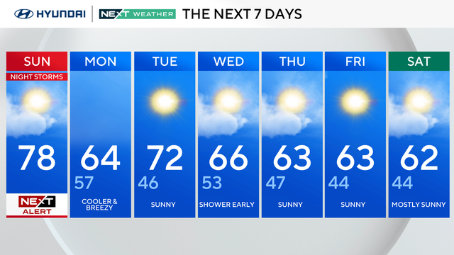
Sunday: NEXT Weather Alert for isolated/gusty storms at night. High 78, Low 57.
Monday: Cooler and breezy. High 64, Low 57.
Tuesday: Sunny. High 72, Low 46.
Wednesday: Showers early. High 66, Low of 53.
Thursday: Sunny. High 63, Low 47.
Friday: Sunny. High 63, Low 44.
Saturday: Mostly sunny. High 62, Low 44.