Humidity rises, rain returns to Tri-State Area on Thursday. Get the First Alert Forecast.
Our prolonged stretch of gorgeous weather is finally coming to an end.
The changes will start Wednesday night, as humidity levels will slowly rise and temperatures won't be as cool. Lows will mainly be in the upper 50s to low 60s. Some development of fog is possible once again, especially for interior sections of New Jersey.
Elevated risk of wildfires Thursday for Hudson Valley
Then it's back to a summery feel on Thursday.
High temperatures will return to the low and mid 80s, something many locations have not seen since Aug. 25, while humidity levels continue to rise. Despite those rising humidity levels, a persistent breeze, with gusts between 25-35 mph, combined with very dry vegetation and soils, will lead to an elevated risk of wildfires.
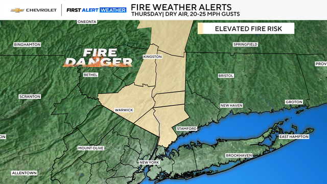
The Hudson Valley is where the fire development has the greatest chance of occurring, however, all areas are at risk, as seen Wednesday with the Buckabear fire in New Jersey.
When is it going to rain in the Tri-State Area?
Most of Thursday will feature sunny skies, but by the evening hours, showers and some embedded thunderstorms are likely to move into the region.
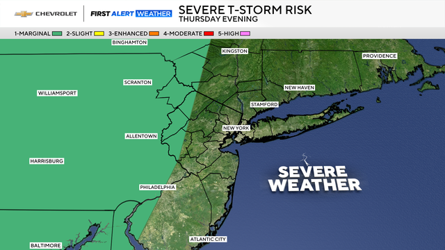
The severe threat is not high, though, and will be mainly confined to our northwestern suburbs. If severe storms do occur, heavy rain and gusty winds would be the greatest concerns.
As Thursday night progresses, the severe threat decreases, as a few more rounds of showers pivot through.
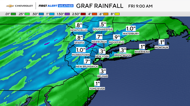
Rain showers come to an end by Friday morning, and temps will climb even further. Inland areas of New Jersey could see highs in the upper 80s. A 90-degree reading or two is not out of the realm of possibility either.