Rain, storms return to Tri-State Area this week. Get the First Alert Forecast.
The Tri-State Area's extended stretch of dry weather is likely to come to an end this week.
Another gorgeous day Wednesday
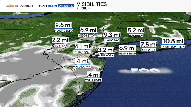
A cool night is in store Tuesday, with temps dropping to around 60 in the city, while many of the suburbs will be in the 50s. Under clear skies and light winds, some development of fog is possible as well, especially for inland sections of New Jersey.
Once the fog and morning chill wear off, a gorgeous Wednesday takes shape, with lots of sunshine, low humidity, and highs ranging from 75-80.
Rain, warmer temps return Thursday
While most of Thursday is dry, by the evening hours, a few showers and embedded thunderstorms are anticipated to move into the region.
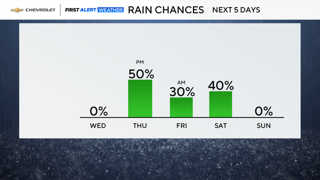
Widespread heavy rain and severe weather are not expected, however, locations north and west of the city may pick up some heavier bouts of rainfall, which could last into the early portions of Friday.
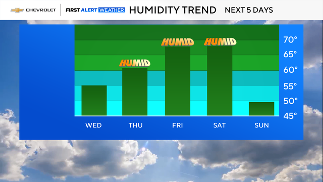
As rain chances go up, so too will humidity levels, making it feel more like summer again.
High temperatures will also climb, going from the upper 70s on Thursday to the low and mid 80s by Friday.