Here's how Hurricane Erin could impact the NYC area
Hurricane Erin, the first of the 2025 Atlantic hurricane season, strengthened into a major Category 5 storm over the weekend. It has since been downgraded to a Category 2 as it continues to churn.
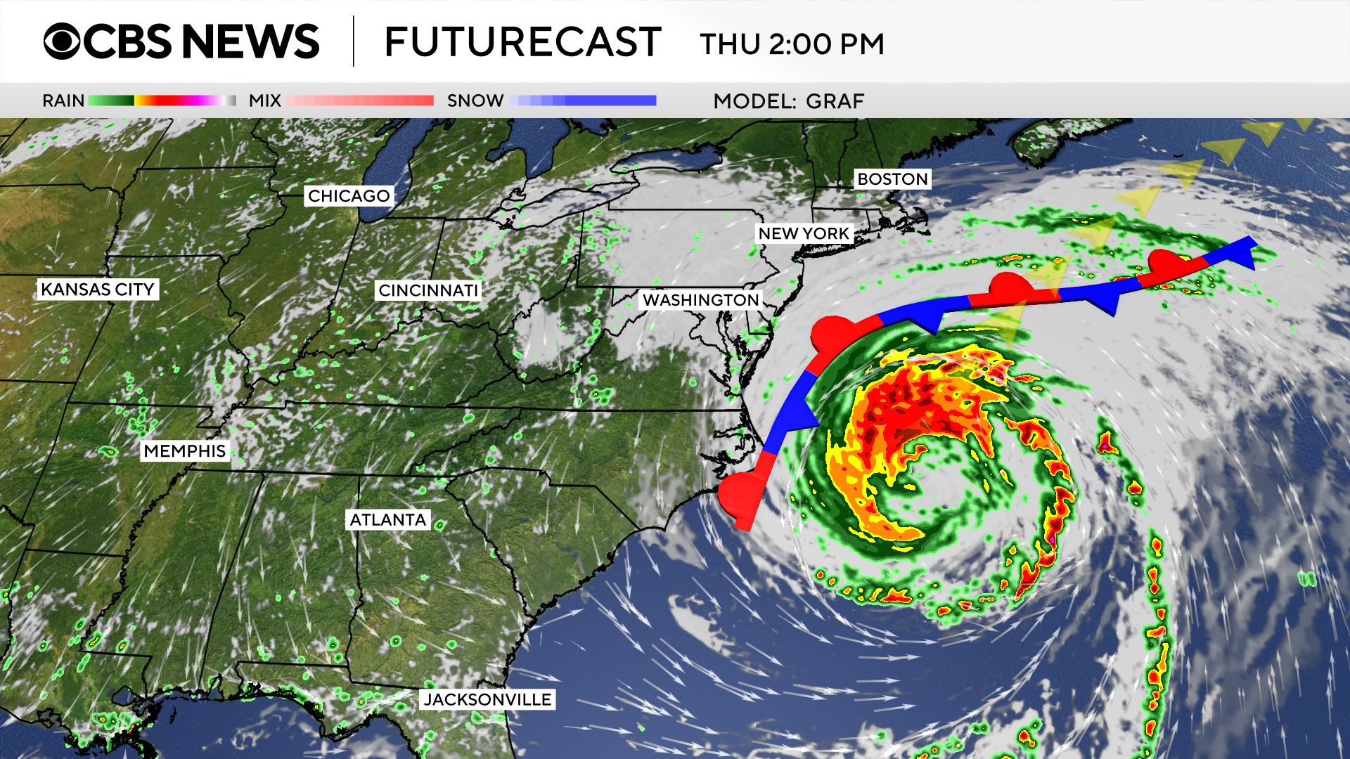
While the storm is forecast to stay hundreds of miles offshore, the New York City area -- including the Jersey Shore and parts of Long Island -- is feeling its effects as it moves along the East Coast over the coming days.
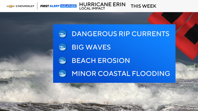
New York City beaches are closed, and New Jersey Gov. Phil Murphy is urging people to avoid the water due to dangerous rip currents.
Hurricane Erin impacting NYC, Jersey Shore and Long Island beaches
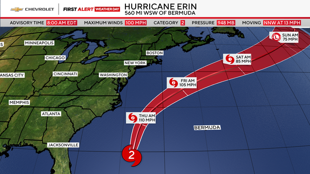
As Erin moves away from the Bahamas and turns north, the jet stream will push it away from the East Coast, while also causing the storm to expand in size.
It will still be about 350 to 450 miles offshore, however.
The main timeframe of Erin's local impacts will be throughout the day on Thursday and could linger into Friday.
Coastal areas, including New York City beaches, will see dangerous rip currents, along with high surf and the chance of coastal flooding.
Strong winds will also be an issue at the coast, gusting between 35 to 50 mph. The winds, in conjunction with saturated ground from the heavy rain, may lead to downed trees or power lines.
New York's Hudson Valley, Northern and Central New Jersey and Connecticut are unlikely to see much from Erin, other than clouds and some breezy conditions.
Dangerous rip currents and high surf
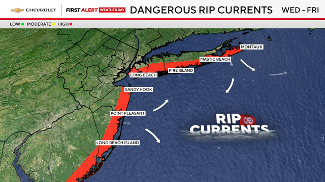
Erin is already bringing dangerous rip currents down the Shore and to Long Island's south-facing beaches. Visitors should not swim, regardless of skill level, as conditions continue to deteriorate throughout the week.
A high surf advisory has also been issued for Wednesday into Friday, as waves are expected to reach 15 feet in some areas. New York City and Jersey Shore beaches could see waves from 8 to 13 feet, while Long Island could see 10 to 15 feet.
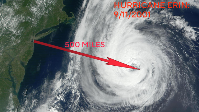
Not the 1st Hurricane Erin this close to NYC
The 2025 hurricane would not be the first one named Erin to come within several hundred miles of the New York metropolitan area.
The most notable Hurricane Erin formed in 2001. The Category 3 storm was located around 500 miles southeast of New York City as the September 11th attacks were unfolding.
This year is the seventh time the name Erin has been used since the late 1980s, since none of the previous storms caused enough damage for it to be retired.
The roster of hurricane names rotates every six years and some names are reused. Names are only retired when a storm causes catastrophic destruction, like Ida and Sandy.