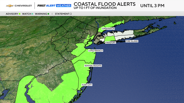
Map shows coastal flood advisory for parts of Tri-State Area today

A coastal flood advisory is in effect Wednesday for parts of New York, New Jersey and Connecticut.
The advisory was issued from 8 p.m. Tuesday through 3 p.m. Wednesday for Staten Island, southern Nassau and southern Westchester counties in New York, Middlesex, Monmouth and Ocean counties along the Jersey Shore and Fairfield County in Connecticut.
The rip current risk is also high at south-facing beaches and down the Shore.
Much of the area woke up to damp, dreary conditions Wednesday, and it's expected to feel more like October.
Coastal areas have the highest chance of showers, while areas to the northwest may not see much at all.
How much rain to expect today
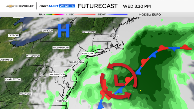
Showers started to become more numerous after sunrise. While the morning hours look to be the wettest, the chance of showers lingers through the day.
For the most part, the showers will be on the light side, however, they may be moderate at times in isolated spots. Rainfall totals are expected to average .50" or less.
Along with the dreary conditions, a persistent breeze, with gusts between 20-30 mph, will make it feel quite chilly. Highs are not anticipated to get out of the 60s.
Once the low pulls away by Wednesday night, clearing skies and warmer temperatures, back to around 80, will follow for Thursday.