Strong storms pose active flash flood threat in Miami and Broward through Saturday

The NEXT Weather team has declared a NEXT Weather Alert Day for Friday afternoon as strong storms bring the potential for flash flooding across South Florida.
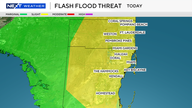
The Weather Prediction Center has issued a Level 2 flash flooding advisory for both Broward and Miami-Dade counties, warning residents of heavy rain and flooding risks.
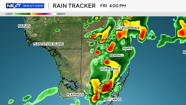
Storms are expected to begin around 2 p.m. and continue through the early evening hours.
The frontal boundary that has been parked over Central Florida throughout most of the week will begin a slow push through South Florida today before stalling over the Straits on Saturday. As this front moves, deep tropical moisture will continue to pool over the region, fueling numerous showers and thunderstorms this afternoon and evening.
Some storms may produce very high rainfall rates. Combined with already saturated ground, this will result in a continued flood threat. Officials warn that a Flood Advisory can quickly escalate into a Flash Flood Warning if storms repeatedly pass over the same areas.
South Florida Saturday forecast: storms continue with flood risk
The unsettled pattern extends into Saturday, when another NEXT Weather Alert Day is in effect.
While the frontal boundary will finally push south and east of the area later in the day, residual tropical moisture will still spark afternoon and evening storms. The coverage of storms should be less widespread than in recent days, but heavy rainfall on already soaked ground could still bring localized flooding.
Rain chances are expected to taper off on Sunday as drier air moves in, signaling the beginning of a quieter weather pattern for late weekend and early next week.