Will Tropical Storm Imelda impact South Florida? See its projected path.
Tropical Depression 9 strengthened into Tropical Storm Imelda on Sunday afternoon, making it the ninth named storm of the 2025 Atlantic hurricane season.
It is now forecast to remain off the coast of the Carolinas as a hurricane on Tuesday and Wednesday.
Where is Imelda?
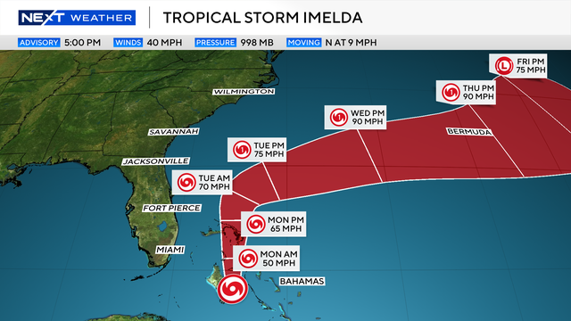
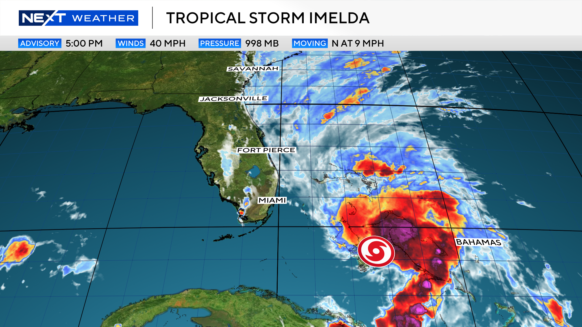
As of 5 p.m. Sept. 28, Tropical Storm Imelda is located about 55 miles south-southwest of the Northwest Bahamas and 355 miles southeast of Cape Canaveral, moving northwestward at 9 mph with maximum sustained winds of 40 mph.
Imelda is closely monitored for U.S. threats
Tropical Storm Imelda will continue to move north at around 10 mph, which will keep the storm's center well east of the area. Tropical storm warnings remain in effect for the Bahamas, with a tropical storm watch in effect for the waters off the coast.
Favorable conditions are expected early this week as Imelda moves north away from the Bahamas. Imelda is expected to become a hurricane on Tuesday with winds over 75 mph.
Even though the storm will be moving north away from us here in South Florida, wind gusts over 30 mph are possible, especially in northern Broward. The wind will be turning to the northwest, which will be blowing offshore.
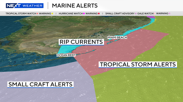
Coastal flooding is not expected; however, due to the increased swells traveling south from the storm, a high risk of rip currents is in effect for Monday. Rough seas and surf will likely continue as the storm slowly turns east and moves away from the coast later this week.
We will remain on the fringe of the outer rain bands on Monday and early Tuesday. Most of the squalls remain north of Broward County and stay off the coast, but a brief gusty downpour is still possible.
Humberto rapidly strengthens but has no impact on South Florida
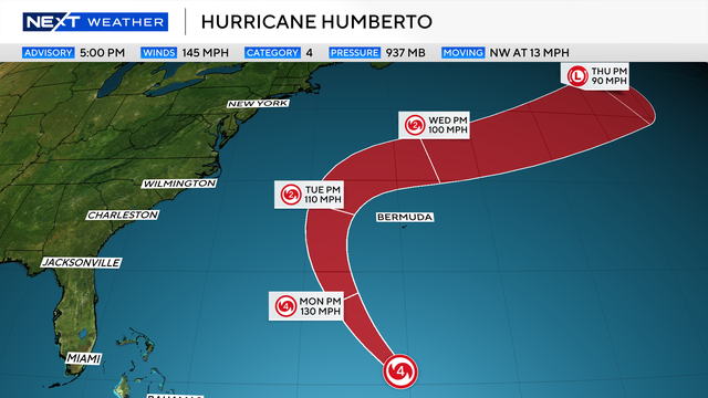
Humberto, the eighth named storm of the 2025 Atlantic hurricane season, quickly strengthened into a Category 5 hurricane on Saturday afternoon before weakening to a Category 4 on Sunday. However, it is not expected to impact South Florida, meteorologists say.
As of 11 a.m. Sept. 28, Humberto is located about 450 miles north of the Northern Leeward Islands and about 535 miles south of Bermuda, moving west-northwestward at 13 mph with maximum sustained winds of 150 mph.
Humberto, like the other two hurricanes of the season, rapidly intensified Saturday as it began a turn to the north, where Bermuda remained on alert.
The storm is due south of Bermuda and will make a turn to the north and eventually the northeast well before the Eastern U.S. or Canada. It is forecast to move north of Bermuda early this week and then increase speed moving into the North Atlantic.
2025 Atlantic hurricane season
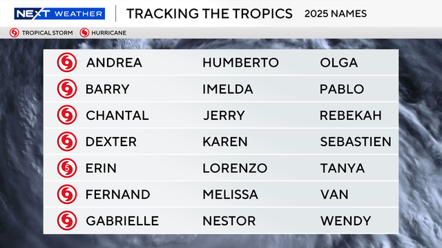
The National Oceanic and Atmospheric Administration, or NOAA, forecast an above-normal hurricane season this year, predicting there will be between 13 and 18 named storms. Five to nine of those are expected to become hurricanes.
Erin was the first, and so far only, storm to become a hurricane this season. Erin didn't make landfall, but at its peak grew to a ferocious Category 5, and it caused strong winds, dangerous rip currents and flooding along parts of the East Coast.
Historically, on average, hurricane and tropical storm activity peaks on Sept. 10, but this year has been quieter than expected when it comes to tropical systems in the Atlantic.