Will Hurricane Humberto impact South Florida? See its projected path.
Humberto, the eighth named storm of the 2025 Atlantic hurricane season, strengthened into a hurricane late Thursday night, but it is not expected to impact South Florida, meteorologists say.
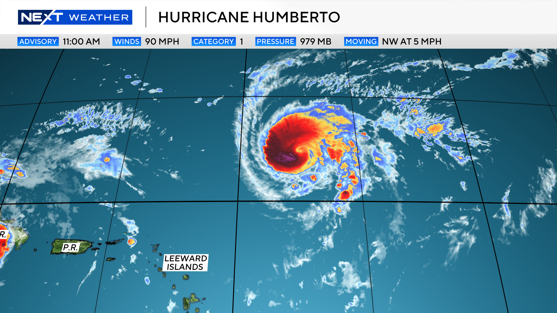
Where is Humberto?
As of 5 p.m. Sept. 26, Humberto is located about 430 miles northeast of the Northern Leeward Islands, moving northwestward at 5 mph with maximum sustained winds of 115 mph.
Humberto becomes a hurricane
Hurricane Gabrielle broke a near-month drought in the Tropics. Now, Humberto, like its predecessor, is the next hurricane of the season, making it only the third to gain that intensity.
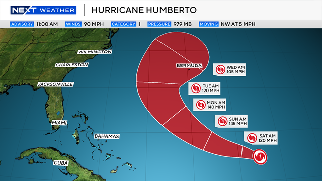
Hurricane Humberto continues to strengthen just northeast of the Lesser Antilles on Friday as it slowly moves to the northwest. The latest forecast from the National Hurricane Center shows it will stay well east of South Florida and the United States East Coast with no direct impacts expected at this time.
There is high confidence that Humberto will rapidly strengthen over the next 24 hours and could potentially become a major Category 3 hurricane by late Friday night or early Saturday. Additional strengthening is expected over the weekend, with it potentially reaching Category 4 status by Sunday morning. If this were to occur, it would mark the third consecutive hurricane to rapidly intensify this season.
Humberto is expected to make a turn to the north around the beginning of next week and is then expected to turn back to the east. While impacts aren't forecast for the U.S. East Coast at this time, there is the potential for impacts to Bermuda.
Tropical wave over Hispaniola
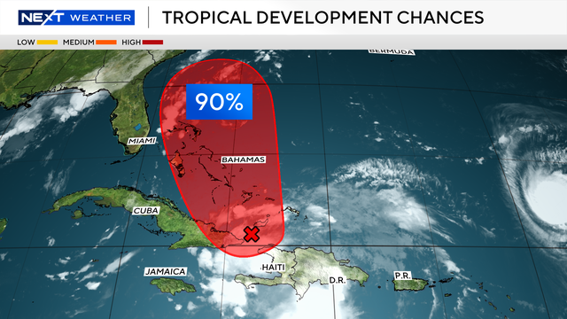
In addition to Humberto, the NEXT Weather Team is monitoring a tropical wave near Hispaniola, which has a 90% chance of tropical development.
A tropical depression is expected to develop later today as it moves closer to the Bahamas. If this were to become a tropical storm, it would be called Imelda.
While there is still a lot of uncertainty around this forecast, direct impacts are not expected for South Florida at this time. Updates on this particular wave are expected around 2 p.m. Friday.
Models show limited South Florida threat for what could become Tropical Storm Imelda
Models are in good agreement that the system will also turn north before any significant impacts across South Florida.
After that, it is uncertain what will happen as steering currents become erratic.
The U.S. GFS model shows a sheared system from strong upper-level winds over Florida, while the European model has it getting trapped with no steering and then making an unusual turn back to the U.S.
2025 Atlantic hurricane season
The National Oceanic and Atmospheric Administration, or NOAA, forecast an above-normal hurricane season this year, predicting there will be between 13 and 18 named storms. Five to nine of those are expected to become hurricanes.
Erin was the first, and so far only, storm to become a hurricane this season. Erin didn't make landfall, but at its peak grew to a ferocious Category 5, and it caused strong winds, dangerous rip currents and flooding along parts of the East Coast.
Historically, on average, hurricane and tropical storm activity peaks on Sept. 10, but this year has been quieter than expected when it comes to tropical systems in the Atlantic.