
From St. Croix Roots, Linval Joseph's Super Sunday Dream Now A Reality
Watch CBS News

The Giants are taking Tom Coughlin's mantra, "Talk is cheap, play the game," and throwing it out the window.

Mark Herzlich took the radiation. He took the chemo. He had the tumor removed, replaced with a steel rod that runs down the inside of his femur. And he kept his chin up.

Al's original did the trick for the Jets against New England last January. And it's so nice, it might just work twice.

The Giants defense will do everything it can to pressure Tom Brady. And it's more a matter of what happens when the pass rush closes in on the Patriots quarterback.


Thankfully, Wednesday and Thursday's media sessions will be back to normal. Football questions only!

Given the seemingly impossible road one team must traverse in order to scale the mountain that is the Super Bowl, let's take a look back at what the Giants and Patriots endured to reach the Super Bowl.

Bill Belichick and Tom Coughlin are long-time friends who share the same old-school philosophy when it comes to saying anything about the opposition. Zip it. Tight. Or else.

Matthew Broderick's role in Ferris Bueller's Day Off has been revived in the form of a commercial.

If the Giants win, one New York City family will be chosen to get a super tour of Boston.

Even the usually dour Bill Belichick was joking around as the Patriots arrived in Indy for Super Bowl week.

Quite simply, Giants coach Tom Coughlin belongs in the Hall of Fame whether he wins a second Lombardi Trophy or not.

Laugh if you like. Eli won't tell you to stop. He'll just show you why you should.

Will the Patriots manage to exact revenge in Super Bowl XLVI? Let's try to surmise by taking a position-by-position look at the game's participants.

Bright sunshine for Sunday with weak high pressure. Breezy west winds have been supplying cooler air this morning behind a departing front which moved through last night. This will make highs today a bit cooler from Saturday with temps this afternoon able to climb into the Lwr 40's. Still very nice for this time of year with temps running about 5-8 degrees above normal
A gorgeous Saturday morning will see increasing cloudiness by afternoon. Temps have started in the 30's and will be climbing into the mid-upper 40's by this afternoon with a mild west wind. Weak high pressure over us this morning will give way to an approaching front for the evening hours.

Despite the substantial turnover in lineups for this Super Bowl, the quarterbacks for both teams remain the same. I'll rephrase. The quarterbacks are the same, yet, Eli Manning is in no way the same quarterback.


Cold high pressure sits over this morning with clear skies and frigid early morning temperatures Below zero in the northern valleys, single digits in the suburbs, and teens and 20's at the coast. Ocean effect clouds remain in place across SE MA. High pressure sits over us today providing calm conditions, but as it pulls off shore this afternoon, light east winds at the surface may begin to direct some of this low cloudiness in land. These low clouds may deposit a few flurries in spots this afternoon
So far this winter most of our snow has been light or has occurred overnight, but this next round of snow will likely be our most substantial plowable snowfall we have seen since the October Nor'easter. Still, this will be no Nor'easter. Not even close.
Big blue high pressure sitting over us is providing a calmer day with less of a wind chill factor. This high will be pulling off the coast and begin to wrap in warmer SW during the afternoon. This will allow temps to continue to rise through the day...but it will be a slow warming. In fact it will take the entire day of warming just to reach 32 degrees. But this will feel a whole lot better than yesterday! High clouds will continue to increase making for filtered sunshine this afternoon

Maybe it is time that you explored new winter activities.
The rest of us are seeing a brilliant, blustery and very cold day with the heart of the Arctic air settling over us today. Highs will only be able to climb into the teens today. Winds will start to die down this afternoon, but wind chills will remain in the single digits...despite near 100% of the sun.
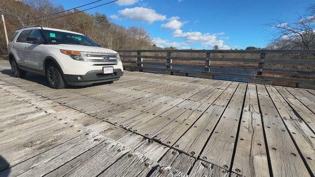
The Sherman Bridge linking Wayland and Sudbury is showing its age and stirring up debate over its future.

Demolition crews ripped down what was left of the Turtle Tavern in Milford after a fire.

A shelter-in-place has been issued after a UPS plane crashed near the Louisville International Airport in Kentucky, officials said.
Tom Brady's dog is a clone of a "beloved" pet that died, the seven-time Super Bowl champion revealed on Tuesday.
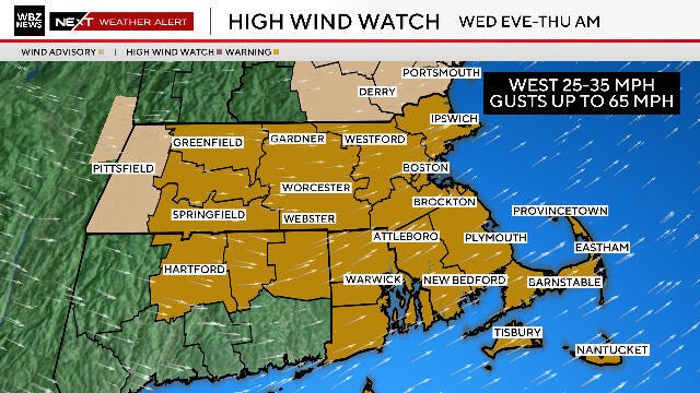
Boston could see strong, damaging winds as a storm brings some snow to northern New England.

Two Massachusetts men accused of setting off an explosion at Harvard Medical School are now facing federal charges.
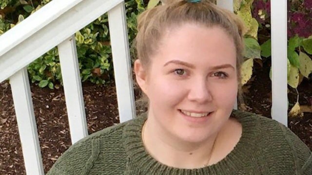
Joanna Brown, a woman who had been reported missing last weekend, was found dead in a car in Worcester.
Boston could see strong, damaging winds as a storm brings some snow to northern New England.
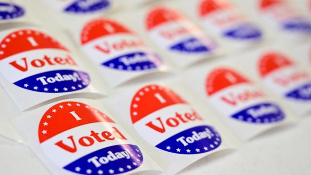
Tuesday, Nov. 4 is Election Day for 55 cities and towns across Massachusetts.
There were stunning moves ahead of the NFL trade deadline, but the Patriots stayed quiet.
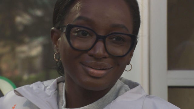
Amy Cohen is running the New York City Marathon despite living with the painful effects of sickle cell disease.
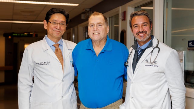
Surgeons at Massachusetts General Hospital have removed a pig kidney from a New Hampshire man 271 days after the innovative transplant.

With two-year waiting lists for a primary care physician, Mass General Brigham is using AI to bridge the gap.

A new study finds that simply having a HEPA air purifier in the classroom may not be enough to keep students safe from respiratory illnesses.
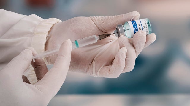
Health officials in Massachusetts are recommending that all adults in the state receive the COVID vaccine.

I-Team sources say the allegations of misconduct involving Canton Police Sgt. Sean Goode stem from an investigation into former State Police Trooper Michael Proctor.
Customers have been telling the I-Team that the service has not been as advertised with delays and equipment problems.

Advocates for Pappas Rehabilitation Hospital in Canton say the state is failing to keep its promise to keep the facility open.
Michael Proctor, the disgraced lead investigator in Karen Read's high-profile case, has dropped his appeal to the Civil Service Commission and is no longer seeking to get his job back with Massachusetts State Police.
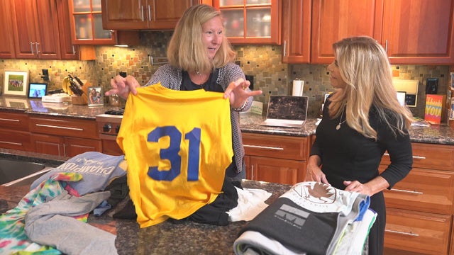
A Mansfield woman reached out to the I-Team's Call for Action after a package of meaningful T-shirts from her daughter's younger years ended up in limbo.

Both the Trump and Healey administrations are using government websites to blame each other for the shutdown.

Which party stands to take more of the blame from voters for the government shutdown? Here's what a new poll says.

A UNH Survey Center/Granite State poll shows John Sununu crushing Scott Brown by 23 points among likely primary voters in New Hampshire.

Seth Moulton said he's running against Sen. Ed Markey because "our party leaders are clinging to that old playbook."

Maine Governor Janet Mills' run for Senate comes with an unusual promise - she will only serve one six-year term.
The "Spirit Christmas" chain is moving into some closed big box stores in New England.

Boston-based brewer Sam Adams has released a new beer that's so strong it can't be sold in 15 states, including New Hampshire.
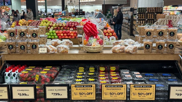
The Fresh Market on Route 9 in Framingham is set to close less than a year after it opened.

Big changes are envisioned for the 75-year-old Kowloon restaurant property off Route 1 in Saugus.

An expert points to three main factors and explains why the Black women unemployment rate is a warning sign.

Just steps from the water's edge along Lake Winnipesaukee, a spectacular estate mixes modern architecture with breathtaking views.

An innovative craft winery located in downtown Meredith, New Hampshire, Hermit Woods is taking a different approach to winemaking.

Located on the water's edge along New Hampshire's Lake Winnipesaukee, Mill Falls blends elegant luxury with spectacular vistas.

Kohler Store by Supply New England and an interior designer showcases how beauty and functionality can breathe new life into a project.

James Beard-nominated pastry chef and co-founder of Bakey in Boston gives insight on how to make his world-famous babka.
The Patriots sit at 7-2 on the day of the NFL trade deadline, but they didn't make any moves before 4 p.m.
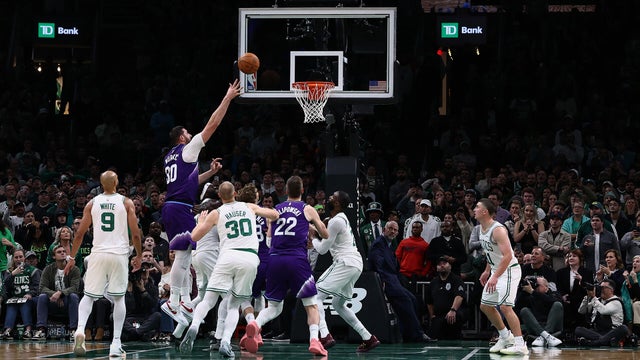
The Utah Jazz overcame a double-digit, second-half deficit to beat the Boston Celtics 105-103 on Monday night.
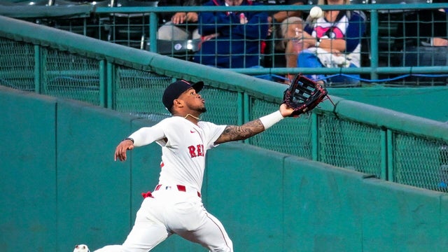
A pair of Red Sox outfielders took home Gold Glove Awards for their defensive efforts this season.

Drake Maye threw two touchdown passes and had a pair of turnovers, and the Patriots held on for their sixth straight victory.

Kevin Durant scored 26 points in three quarters before resting the fourth, Amen Thompson added 17 points and nine rebounds, and the Houston Rockets beat the Boston Celtics 128-101 on Saturday night.
Tom Brady's dog is a clone of a "beloved" pet that died, the seven-time Super Bowl champion revealed on Tuesday.

New England Aquarium researchers spotted three True's beaked whales, which are rarely seen on the surface.

A Massachusetts lottery winner is sharing the wealth with his son.

The roughtail stingray can grow up to 8 feet wide and weigh close to 800 pounds.

A special type of camera captured clear video of a great white shark looking for food off the coast of New England.